Home
Browse
Ask Us
Chat
Harmful Language Statement
Log in
Photo Archives
Advanced Search
About
Over 70,000 photos covering a variety of topics from Marriott Library Special Collections
Year
1973
TO
1973
Type
Image
24
Format
image/jpeg
24
Collection Name
Wayne Owens
24
Filters:
Collection Name:
"Wayne Owens"
Collection:
"uum_map"
1
-
25
of
24
Gallery view
Number of results to display per page
10
25
50
100
200
Sort by Relevance
Sort by Title A-Z
Sort by Title Z-A
Sort by Date Ascending
Sort by Date Descending
Sort by Last Modified Ascending
Sort by Last Modified Descending
Sort by Photo Number
Title
Setname
Type
1
Wayne Owens with the student body officers of Clayton Jr. High School, Salt Lake City, Utah
uum_map
Image
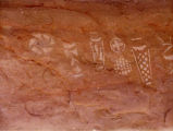
2
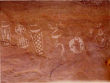
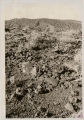
Petroglyphs in Davis Gulch, Southern Utah [1]
uum_map
Image
3
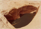
Northwest pillar of Rainbow Bridge.
uum_map
Image
4
Cathedral in the Desert after Lake Powell was created
uum_map
Image
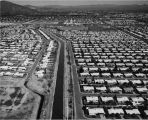
5
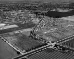
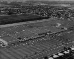
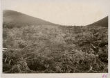
Salt River Project, Arizona [1]
uum_map
Image
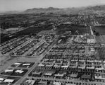
6
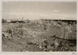
Salt River Project, Arizona [2]
uum_map
Image
7
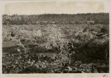
Salt River Project, Arizona [3]
uum_map
Image
8
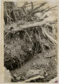
Salt River Project, Arizona [4]
uum_map
Image
9
Salt River Project, Arizona [5]
uum_map
Image
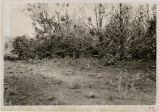
10
From folder on water pollution under topic of environment. From particular correspondence pertaining to Mr. John Morgan, March 12, 1973.
uum_map
Image
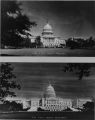
11
United States Capitol Building
uum_map
Image
12
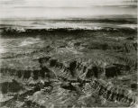
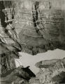
Bridge Canyon on the northern boundary of the Hualapai Indian Reservation where the Hualapai Hydroelectric Dam is to be built [01]
uum_map
Image
13
Bridge Canyon on the northern boundary of the Hualapai Indian Reservation where the Hualapai Hydroelectric Dam is to be built [02]
uum_map
Image
14
Bridge Canyon on the northern boundary of the Hualapai Indian Reservation where the Hualapai Hydroelectric Dam is to be built [03]
uum_map
Image
15
Bridge Canyon on the northern boundary of the Hualapai Indian Reservation where the Hualapai Hydroelectric Dam is to be built [04]
uum_map
Image
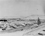
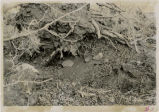
16
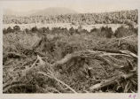
Desert scenes from the Grand Canyon Bill folder. Photographs sent by Dr. Richard Thomson of Southern Utah State College, Ceder City, Utah.
uum_map
Image
17
Bridge Canyon on the northern boundary of the Hualapai Indian Reservation where the Hualapai Hydroelectric Dam is to be built [05]
uum_map
Image
18
Bridge Canyon on the northern boundary of the Hualapai Indian Reservation where the Hualapai Hydroelectric Dam is to be built [06]
uum_map
Image
19
Bridge Canyon on the northern boundary of the Hualapai Indian Reservation where the Hualapai Hydroelectric Dam is to be built [07]
uum_map
Image
20
Bridge Canyon on the northern boundary of the Hualapai Indian Reservation where the Hualapai Hydroelectric Dam is to be built [08]
uum_map
Image
21
Bridge Canyon on the northern boundary of the Hualapai Indian Reservation where the Hualapai Hydroelectric Dam is to be built [09]
uum_map
Image
22
Bridge Canyon on the northern boundary of the Hualapai Indian Reservation where the Hualapai Hydroelectric Dam is to be built [10]
uum_map
Image
23
Bridge Canyon on the northern boundary of the Hualapai Indian Reservation where the Hualapai Hydroelectric Dam is to be built [11]
uum_map
Image
24
Petroglyphs in Davis Gulch, Southern Utah [2]
uum_map
Image
1
-
25
of
24