Over 70,000 photos covering a variety of topics from Marriott Library Special Collections
TO
| Title | Date | Type | ||
|---|---|---|---|---|
| 1 |
 |
Aerial view of red rock landscape with sandstone canyon | 1962; 1963; 1964; 1965; 1966; 1967; 1968 | Image/StillImage |
| 2 |
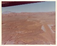 |
Aerial view of a Southern Utah red rock landscape | 1962; 1963; 1964; 1965; 1966; 1967; 1968 | Image/StillImage |
| 3 |
 |
Aerial view of a Southern Utah red rock landscape showing buttes | 1962; 1963; 1964; 1965; 1966; 1967; 1968 | Image/StillImage |
| 4 |
 |
Aerial view of a Southern Utah red rock landscape with buildings and parked vehicles and boats | 1962; 1963; 1964; 1965; 1966; 1967; 1968 | Image/StillImage |
| 5 |
 |
Aerial view of a Southern Utah red rock landscape with multiple mobile homes | 1962; 1963; 1964; 1965; 1966; 1967; 1968 | Image/StillImage |
| 6 |
 |
Aerial view of a Southern Utah red rock landscape with parking area | 1962; 1963; 1964; 1965; 1966; 1967; 1968 | Image/StillImage |
| 7 |
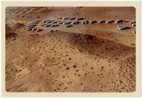 |
Aerial view of a Southern Utah red rock landscape with parking area and cars | 1962; 1963; 1964; 1965; 1966; 1967; 1968 | Image/StillImage |
| 8 |
 |
Aerial view of a Southern Utah red rock landscape with river [1] | 1962; 1963; 1964; 1965; 1966; 1967; 1968 | Image/StillImage |
| 9 |
 |
Aerial view of a Southern Utah red rock landscape with river [2] | 1962; 1963; 1964; 1965; 1966; 1967; 1968 | Image/StillImage |
| 10 |
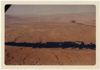 |
Aerial view of a Southern Utah red rock landscape with river [3] | 1962; 1963; 1964; 1965; 1966; 1967; 1968 | Image/StillImage |
| 11 |
 |
Aerial view of a Southern Utah red rock landscape with several buildings and mobile homes | 1962; 1963; 1964; 1965; 1966; 1967; 1968 | Image/StillImage |
| 12 |
 |
Aerial view of a Southern Utah red rock landscape with structures | 1962; 1963; 1964; 1965; 1966; 1967; 1968 | Image/StillImage |
| 13 |
 |
Aerial view of a Southern Utah red rock landscape with water | 1962; 1963; 1964; 1965; 1966; 1967; 1968 | Image/StillImage |
| 14 |
 |
Aerial view of desert-like landscape [1] | 1964; 1965; 1966; 1967; 1968; 1969; 1970; 1971; 1972; 1973; 1974; 1975 | Image/StillImage |
| 15 |
 |
Aerial view of desert-like landscape [2] | 1964; 1965; 1966; 1967; 1968; 1969; 1970; 1971; 1972; 1973; 1974; 1975 | Image/StillImage |
| 16 |
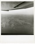 |
Aerial view of Lake Powell | 1964; 1965; 1966; 1967; 1968; 1969; 1970; 1971; 1972; 1973; 1974; 1975 | Image/StillImage |
| 17 |
 |
Aerial view of landscape with two recreational vehicles | 1964; 1965; 1966; 1967; 1968; 1969; 1970; 1971; 1972; 1973; 1974; 1975 | Image/StillImage |
| 18 |
 |
Boating on Lake Powell amid red rock cliffs | 1964; 1965; 1966; 1967; 1968; 1969; 1970; 1971; 1972; 1973; 1974; 1975 | Image/StillImage |
| 19 |
 |
Canyon showing handmade stone structure | 1962; 1963; 1964; 1965; 1966; 1967; 1968 | Image/StillImage |
| 20 |
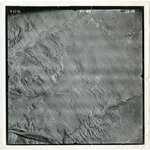 |
High-altitude aerial photo of Lake Powell | 1964; 1965; 1966; 1967; 1968; 1969; 1970; 1971; 1972; 1973; 1974; 1975 | Image/StillImage |
| 21 |
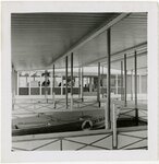 |
Inside covered marina with multiple slips in front of building | 1964; 1965; 1966; 1967; 1968; 1969; 1970; 1971; 1972; 1973; 1974; 1975 | Image/StillImage |
| 22 |
 |
Logo design showing blue-green frog in circle | 1964; 1965; 1966; 1967; 1968; 1969; 1970; 1971; 1972; 1973; 1974; 1975 | Image/StillImage |
| 23 |
 |
Map of Bullfrog Basin Development by Young & Fowler Associates | 1963; 1964; 1965; 1966; 1967 | Image/StillImage |
| 24 |
 |
Map of Bullfrog Basin with "Lake Powell" hand-lettered at upper left and colored legend identifying service station, marina, and motel and an inset of map showing Southern Utah | 1964 | Image/StillImage |
| 25 |
 |
Older jeep-style vehicle on dirt road | 1964; 1965; 1966; 1967; 1968; 1969; 1970; 1971; 1972; 1973; 1974; 1975 | Image/StillImage |
