The Utah River Running Photo Archives is part of the S. J. Quinney Ski and Outdoor Recreation Archives at the University of Utah. The river running photo collection includes photos of Glen Canyon, Hatch River Expeditions, the Colorado River, and a variety of historic expeditions.
| Title | Collection Number And Name | Photo Number | ||
|---|---|---|---|---|
| 1 |
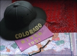 |
Map of the Colorado River. | P0867 Marjorie G. Paul Photograph Collection | P0867n001 |
| 2 |
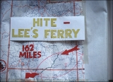 |
Hite at Lee's Ferry, 162 miles. | P0867 Marjorie G. Paul Photograph Collection | P0867n002 |
| 3 |
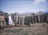 |
Mrs. Wright and Frank airing sleeping bags in Blanding, Utah. | P0867 Marjorie G. Paul Photograph Collection | P0867n003 |
| 4 |
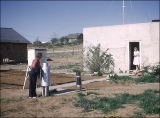 |
Barbara using a weather apparatus in Blanding. | P0867 Marjorie G. Paul Photograph Collection | P0867n004 |
| 5 |
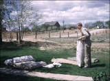 |
Don Smith stacking up sleeping bags in Blanding. | P0867 Marjorie G. Paul Photograph Collection | P0867n005 |
| 6 |
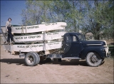 |
"Marjorie G. Paul looking over our boats prior to departure for Hite." | P0867 Marjorie G. Paul Photograph Collection | P0867n006 |
| 7 |
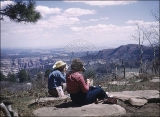 |
Frank and Barbara at lunch time at Arch Canyon. | P0867 Marjorie G. Paul Photograph Collection | P0867n007 |
| 8 |
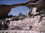 |
"Owachamo Bridge, 108 ft high, 200 ft span." | P0867 Marjorie G. Paul Photograph Collection | P0867n008 |
| 9 |
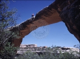 |
"Frank and Barbara on top of Owachomo." | P0867 Marjorie G. Paul Photograph Collection | P0867n009 |
| 10 |
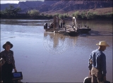 |
"Arth Chaffin and his ferry coming to take us to other side of river." | P0867 Marjorie G. Paul Photograph Collection | P0867n010 |
| 11 |
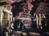 |
"Marjorie, Barbara, Frank, and Art crossing the Colorado late eve 5-10-51." | P0867 Marjorie G. Paul Photograph Collection | P0867n011 |
| 12 |
 |
"On ferry watching boats being unloaded from truck." | P0867 Marjorie G. Paul Photograph Collection | P0867n012 |
| 13 |
 |
"Marjorie at Hite, UT before leaving Chaffin's. Where B and I spent the night." | P0867 Marjorie G. Paul Photograph Collection | P0867n013 |
| 14 |
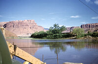 |
"Crossing Colorado River again to start our river trip, 5-11-51." | P0867 Marjorie G. Paul Photograph Collection | P0867n014 |
| 15 |
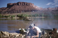 |
"Jack preparing campfire breakfast." | P0867 Marjorie G. Paul Photograph Collection | P0867n015 |
| 16 |
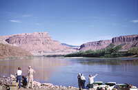 |
"Waiting impatiently for the launching." | P0867 Marjorie G. Paul Photograph Collection | P0867n016 |
| 17 |
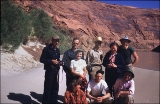 |
"Our group of River Rats. First trip on Colorado." | P0867 Marjorie G. Paul Photograph Collection | P0867n017 |
| 18 |
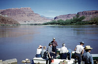 |
"Climbing on board at Hite." | P0867 Marjorie G. Paul Photograph Collection | P0867n018 |
| 19 |
 |
"Sailing along completely relaxed." | P0867 Marjorie G. Paul Photograph Collection | P0867n019 |
| 20 |
 |
"First lap and Verona's friends." | P0867 Marjorie G. Paul Photograph Collection | P0867n020 |
| 21 |
 |
"First Rapids." | P0867 Marjorie G. Paul Photograph Collection | P0867n021 |
| 22 |
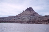 |
"Castle Butte on our way to plane which landed on sand bar." | P0867 Marjorie G. Paul Photograph Collection | P0867n022 |
| 23 |
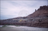 |
"Pilot Jim Rigg taking off in 100 ft." | P0867 Marjorie G. Paul Photograph Collection | P0867n023 |
| 24 |
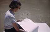 |
"Marjorie and map of river pad prepared for me." | P0867 Marjorie G. Paul Photograph Collection | P0867n024 |
| 25 |
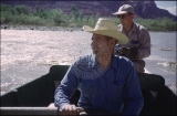 |
"Ticaboo Rapids, Mile 148." [Frank Wright at oars] | P0867 Marjorie G. Paul Photograph Collection | P0867n025 |
| 26 |
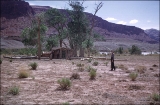 |
"Bert Loper's Cabin, Mile 150." | P0867 Marjorie G. Paul Photograph Collection | P0867n026 |
| 27 |
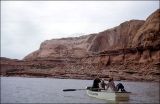 |
Boating on the Colorado River. | P0867 Marjorie G. Paul Photograph Collection | P0867n027 |
| 28 |
 |
"After first night camp, breakfast cleanup 2 miles below Good Hope." | P0867 Marjorie G. Paul Photograph Collection | P0867n028 |
| 29 |
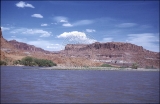 |
"Knowles Canyon mile 134. East side of river." | P0867 Marjorie G. Paul Photograph Collection | P0867n029 |
| 30 |
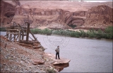 |
"Marjorie. on ledge of old mine site. Mile134." [Olympia Bar] | P0867 Marjorie G. Paul Photograph Collection | P0867n030 |
| 31 |
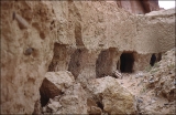 |
"Old Gerhart Mine site mile 131.5." | P0867 Marjorie G. Paul Photograph Collection | P0867n031 |
| 32 |
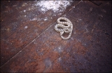 |
"Snake in dump car at Gerhart mine." | P0867 Marjorie G. Paul Photograph Collection | P0867n032 |
| 33 |
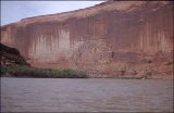 |
"Sheer wall on right." [Tapestry Wall] | P0867 Marjorie G. Paul Photograph Collection | P0867n033 |
| 34 |
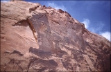 |
"400 ft wall blue sky above." | P0867 Marjorie G. Paul Photograph Collection | P0867n034 |
| 35 |
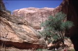 |
"Walking up Moki (Moqui) Canyon, mile 145." | P0867 Marjorie G. Paul Photograph Collection | P0867n035 |
| 36 |
 |
Moki Canyon. | P0867 Marjorie G. Paul Photograph Collection | P0867n036 |
| 37 |
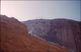 |
"Moki Canyon looking up to Verona on ledge." | P0867 Marjorie G. Paul Photograph Collection | P0867n037 |
| 38 |
 |
"Looking down to Barbara and Joe below." | P0867 Marjorie G. Paul Photograph Collection | P0867n038 |
| 39 |
 |
"Walking out Moki canyon to boats." | P0867 Marjorie G. Paul Photograph Collection | P0867n039 |
| 40 |
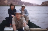 |
"Joe and Barbara passengers with Jack in Hidden Passage." | P0867 Marjorie G. Paul Photograph Collection | P0867n040 |
| 41 |
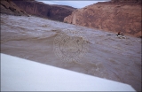 |
"Bullfrog Rapid, Mile 120.5" | P0867 Marjorie G. Paul Photograph Collection | P0867n041 |
| 42 |
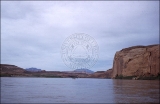 |
"2 of 3 Henry Mountains to North from mile 119." | P0867 Marjorie G. Paul Photograph Collection | P0867n042 |
| 43 |
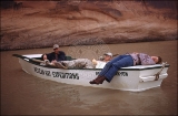 |
"Verona, Don, and Bill relaxing in Rosebud Canyon." | P0867 Marjorie G. Paul Photograph Collection | P0867n043 |
| 44 |
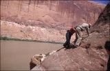 |
Traversing precarious trail to fake Moki ruins | P0867 Marjorie G. Paul Photograph Collection | P0867n044 |
| 45 |
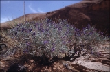 |
"Purple Sage Mile 118." | P0867 Marjorie G. Paul Photograph Collection | P0867n045 |
| 46 |
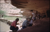 |
"Lunch at Annie's Canyon, mile 108." | P0867 Marjorie G. Paul Photograph Collection | P0867n046 |
| 47 |
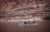 |
"Olive, Don and Upman after swim about 103 miles above Lee's Ferry." | P0867 Marjorie G. Paul Photograph Collection | P0867n047 |
| 48 |
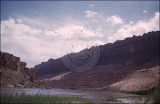 |
"West from mile 101." | P0867 Marjorie G. Paul Photograph Collection | P0867n048 |
| 49 |
 |
"Escalante River entering Colorado River." | P0867 Marjorie G. Paul Photograph Collection | P0867n049 |
| 50 |
 |
"Escalante on left mile 87.75. 7 A.M. May 14, 1951." | P0867 Marjorie G. Paul Photograph Collection | P0867n050 |
| 51 |
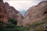 |
"Hole in the Rock, mile 84.5." | P0867 Marjorie G. Paul Photograph Collection | P0867n051 |
| 52 |
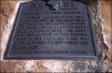 |
"Commemorative plaque erected Aug 13, 1939. Hole in the Rock." | P0867 Marjorie G. Paul Photograph Collection | P0867n052 |
| 53 |
 |
"View back to Hole in the Rock as we continued down Colorado River." | P0867 Marjorie G. Paul Photograph Collection | P0867n053 |
| 54 |
 |
"Marjorie at Hole in the Rock." | P0867 Marjorie G. Paul Photograph Collection | P0867n054 |
| 55 |
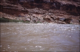 |
"Rapid near Music Temple." | P0867 Marjorie G. Paul Photograph Collection | P0867n055 |
| 56 |
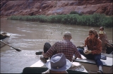 |
"Midmorning candy call exchange between Bill and Verona." | P0867 Marjorie G. Paul Photograph Collection | P0867n056 |
| 57 |
 |
"San Juan entering Colorado River. Joe and I high looking down on River." | P0867 Marjorie G. Paul Photograph Collection | P0867n057 |
| 58 |
 |
"Looking down from cliffs to boats at edge of San Juan River. Mile 78" | P0867 Marjorie G. Paul Photograph Collection | P0867n058 |
| 59 |
 |
"Leaving Hidden Passage." | P0867 Marjorie G. Paul Photograph Collection | P0867n060 |
| 60 |
 |
"Walking into Hidden Passage." | P0867 Marjorie G. Paul Photograph Collection | P0867n061 |
| 61 |
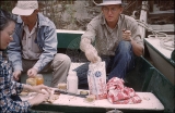 |
"Marjorie, Joe, and Jack, lunch time." | P0867 Marjorie G. Paul Photograph Collection | P0867n062 |
| 62 |
 |
"Barbara photographing petroglyphs in Twilight Canyon mile 71." | P0867 Marjorie G. Paul Photograph Collection | P0867n063 |
| 63 |
 |
"Petroglyphs in Twilight Canyon." | P0867 Marjorie G. Paul Photograph Collection | P0867n064 |
| 64 |
 |
"Marjorie and petroglyphs above Twilight Canyon." | P0867 Marjorie G. Paul Photograph Collection | P0867n065 |
| 65 |
 |
"Tapestry Wall in Mystery Canyon." | P0867 Marjorie G. Paul Photograph Collection | P0867n066 |
| 66 |
 |
"Mystery Canyon." | P0867 Marjorie G. Paul Photograph Collection | P0867n067 |
| 67 |
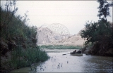 |
"Redbud Canyon leaving Mystery Creek." | P0867 Marjorie G. Paul Photograph Collection | P0867n068 |
| 68 |
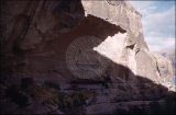 |
"Mite camp x 2 Aztec Creek old Native American Site." | P0867 Marjorie G. Paul Photograph Collection | P0867n069 |
| 69 |
 |
"On the trail to Rainbow, Sunday " | P0867 Marjorie G. Paul Photograph Collection | P0867n070 |
| 70 |
 |
"Barbara drinking. 1.5 miles up stream on 6 mile hike to Rainbow Bridge." | P0867 Marjorie G. Paul Photograph Collection | P0867n071 |
| 71 |
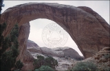 |
"Rainbow Bridge" | P0867 Marjorie G. Paul Photograph Collection | P0867n072 |
| 72 |
 |
"Rainbow Bridge" | P0867 Marjorie G. Paul Photograph Collection | P0867n073 |
| 73 |
 |
"Plaque to commemorate Pauite Nisjah Begay who first led white men to near Goshi." | P0867 Marjorie G. Paul Photograph Collection | P0867n074 |
| 74 |
 |
"Rainbow Bridge register #7301" | P0867 Marjorie G. Paul Photograph Collection | P0867n075 |
| 75 |
 |
"Rainbow Bridge." | P0867 Marjorie G. Paul Photograph Collection | P0867n076 |
| 76 |
 |
"Joe photographing bridge from south side." | P0867 Marjorie G. Paul Photograph Collection | P0867n077 |
| 77 |
 |
"Rainbow Bridge." | P0867 Marjorie G. Paul Photograph Collection | P0867n078 |
| 78 |
 |
Rainbow Bridge | P0867 Marjorie G. Paul Photograph Collection | P0867n079 |
| 79 |
 |
"Wyman, Joe and Frank descending." | P0867 Marjorie G. Paul Photograph Collection | P0867n080 |
| 80 |
 |
"Our first views from above as we prepared to descend from the top of Rainbow Bridge." | P0867 Marjorie G. Paul Photograph Collection | P0867n081 |
| 81 |
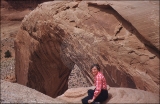 |
"After traversing Moki steps." | P0867 Marjorie G. Paul Photograph Collection | P0867n082 |
| 82 |
 |
Marjorie, tiny depression in rock for toes and fingers on climb up and down from Rainbow | P0867 Marjorie G. Paul Photograph Collection | P0867n083 |
| 83 |
 |
"Looking down N. W. from top of Rainbow Bridge our companions 300 ft below." | P0867 Marjorie G. Paul Photograph Collection | P0867n084 |
| 84 |
 |
Downstream view of Bridge Canyon from Rainbow Bridge looking toward Kaiparowitz. | P0867 Marjorie G. Paul Photograph Collection | P0867n085 |
| 85 |
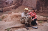 |
"Frank and Marjorie at register on top of Rainbow Bridge, 5-15-51." | P0867 Marjorie G. Paul Photograph Collection | P0867n086 |
| 86 |
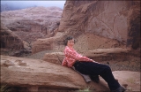 |
"Marjorie in a relaxed pose on top of rainbow Bridge- Navajo Mt and clouds to East. 5-15-51." | P0867 Marjorie G. Paul Photograph Collection | P0867n087 |
| 87 |
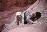 |
Descending tiny toe hold steps to reach top of Rainbow | P0867 Marjorie G. Paul Photograph Collection | P0867n088 |
| 88 |
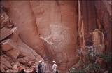 |
"Lunch time beneath Rainbow Bridge. 5-15-51" | P0867 Marjorie G. Paul Photograph Collection | P0867n089 |
| 89 |
 |
"Rainbow Bridge from East side yucca in bloom in foreground. 5-15-51" | P0867 Marjorie G. Paul Photograph Collection | P0867n090 |
| 90 |
 |
"Goodbye to Rainbow Bridge as we turn for a final view and clouds close in on Navajo Mt." | P0867 Marjorie G. Paul Photograph Collection | P0867n091 |
| 91 |
 |
"Stepping Stone, Mini Bath Tubs down Rainbow Creek." | P0867 Marjorie G. Paul Photograph Collection | P0867n092 |
| 92 |
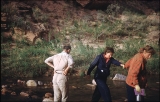 |
"One of the last of 32 crossings we made of Aztec Creek, more difficult by sudden rise of water coming from Navajo Mt." | P0867 Marjorie G. Paul Photograph Collection | P0867n093 |
| 93 |
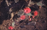 |
"Prickly Pear Cactus blooming above Aztec Creek as we neared our camp site. 5-15-51" | P0867 Marjorie G. Paul Photograph Collection | P0867n094 |
| 94 |
 |
"Breakfast Tues am above Aztec Creek miles above Lee's Ferry 68.5" | P0867 Marjorie G. Paul Photograph Collection | P0867n095 |
| 95 |
 |
"A 3 second view of a peak of Kaiparowitz Plateau at mile 66.5" | P0867 Marjorie G. Paul Photograph Collection | P0867n096 |
| 96 |
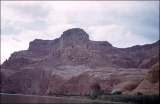 |
"Eastward from Mile 61 to Wild Horse Mesa." | P0867 Marjorie G. Paul Photograph Collection | P0867n097 |
| 97 |
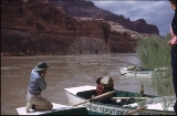 |
"Olive drinking from canteen, Joe photographing the event. Rock Creek Bar mile 55." | P0867 Marjorie G. Paul Photograph Collection | P0867n098 |
| 98 |
 |
"Lunch at Kane Creek. 5-16-51." | P0867 Marjorie G. Paul Photograph Collection | P0867n099 |
| 99 |
 |
"M. by tamarisk looking East from Kane Creek above crossing of the Fathers." | P0867 Marjorie G. Paul Photograph Collection | P0867n100 |
| 100 |
 |
"Looking down onto the boats at mouth of Kane Creek. Wyman, Verona, M." | P0867 Marjorie G. Paul Photograph Collection | P0867n101 |
