Home
Browse
Ask Us
Chat
Harmful Language Statement
Log in
Photo Archives
Advanced Search
About
Over 70,000 photos covering a variety of topics from Marriott Library Special Collections
Year
1959
1960
1961
1962
1963
1964
1965
1966
1967
1968
1969
1970
1971
1972
1973
TO
1959
1960
1961
1962
1963
1964
1965
1966
1967
1968
1969
1970
1971
1972
1973
Type
Image
372
Format
image/jpeg
372
Collection
Photo Archives
372
Filters:
Collection Name:
"John Stockert"
326
-
350
of
372
<
6
7
8
9
10
11
12
13
14
15
>
Gallery view
Number of results to display per page
10
25
50
100
200
Sort by Relevance
Sort by Title A-Z
Sort by Title Z-A
Sort by Date Ascending
Sort by Date Descending
Sort by Last Modified Ascending
Sort by Last Modified Descending
Title
Date
Type
326
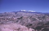
Henry Mountains
1960-11-01
Image
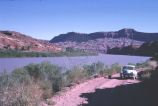
327
Just north of Hite, Utah, along Colorado River
1963-06-26
Image
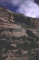
328
Looking down into Cliff Canyon
1960-06-12
Image
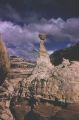
329
Natural Bridges National Monument, Utah
1960-10-11
Image
330
Natural Bridges National Monument, Utah
1960-10-11
Image
331
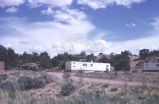
New housing for Island in the Sky, Canyonlands
1965-08-10
Image
332
Old road just west of where Hite used to be
1965-09-22
Image
333
Potash Wells, Grand County, Utah
1960-10-25
Image
334
Rainbow Bridge
1960-06-12
Image
335
Road between Hanksville and Hite, bladed through a wash
1965-09-22
Image
336
Southern Utah scenery
1960-06-12
Image
337
Southern Utah scenery
1960-06-12
Image
338
"Atomic Cloud," Natural Bridges National Monument [1]
1963-06-26
Image
339
"Atomic Cloud," Natural Bridges National Monument [2]
1963-06-26
Image
340
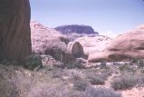
Bridge Canyon and Rainbow Bridge [1]
1960-06-12
Image
341
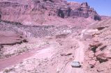
Car in stream bed along old Hanksville-Hite road
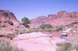
1965-09-22
Image
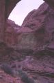
342
The church arch in Cliff Canyon
1960-06-12
Image
343
Double rim arch, the sign for turning
1960-06-12
Image
344
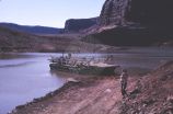
Hite Ferry
1963-06-26
Image
345
Hite Ferry, approaching point for unloading
1963-06-26
Image
346
Hite Ferry, Utah, midway point
1963-06-26
Image
347
Hite Ferry, Utah, unloading point for car
1963-06-26
Image
348
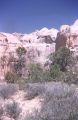
Natural Bridges National Monument landscape
1960-10-11
Image
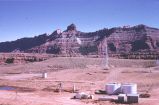
349
Natural Bridges National Monument, present headquarters (1963)
1963-06-26
Image
350
Posey Lake near Escalante, Utah
1963-06-27
Image
326
-
350
of
372
<
6
7
8
9
10
11
12
13
14
15
>