Home
Browse
Ask Us
Chat
Harmful Language Statement
Log in
Advanced Search
Year
1900
1901
1902
1903
1904
1905
1906
1907
1908
1909
1910
1911
1912
1913
1914
1915
1916
1917
1918
1919
1920
1921
1922
1923
1924
1925
1926
1927
1928
1929
1930
1931
1932
1933
1934
1935
1936
1937
1938
1939
1940
1941
1942
1943
1944
TO
1900
1901
1902
1903
1904
1905
1906
1907
1908
1909
1910
1911
1912
1913
1914
1915
1916
1917
1918
1919
1920
1921
1922
1923
1924
1925
1926
1927
1928
1929
1930
1931
1932
1933
1934
1935
1936
1937
1938
1939
1940
1941
1942
1943
1944
Type
Image
56
Image/StillImage
3
Format
image/jpeg
59
Collection
Photo Archives
56
UAIDA Main Collection
3
Filters:
Collection Name:
"Herbert E. Gregory"
26
-
50
of
59
<
1
2
3
>
Gallery view
Number of results to display per page
10
25
50
100
200
Sort by Relevance
Sort by Title A-Z
Sort by Title Z-A
Sort by Date Ascending
Sort by Date Descending
Sort by Last Modified Ascending
Sort by Last Modified Descending
Title
Date
Type
Setname
26
Water Pocket Fold near foot of Burr Trail. General view Cretaceous strata. Garfield County, UT. June 1918
1918
Image
uum_map
27
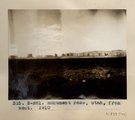
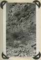
Wind erosion, 3± miles southwest of Oljato, Utah, 1910 (Photo G140)
1910
Image
uum_map
28
Cedar mesa looking north from edge of Johns Canyon. Coconino(?) on Supai(?). San Juan County, UT, 1928
1928
Image
uum_map
29
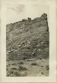
Cuzco Valley, Lava columns NE bank of Vilcanata at Sierra Bella.
1912; 1913; 1914; 1915
Image
uum_map
30
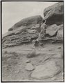
Cuzco Valley. North-flowing, subsequent tributary to Huatanay, entering south side of valley at West (upper) end of Narrows.
1912; 1913; 1914; 1915
Image
uum_map
31
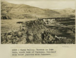
Cuzco Valley. Terrace in lake beds, south bank of Huatanay. One-half mile below junction with Huancaro
1912; 1913; 1914; 1915
Image
uum_map
32
Detail, Dolores section, as in No. 742 (Photo G425)
1913
Image
uum_map
33
Details of middle Moenkopi. Head of Comb Wash. San Juan County, UT, 1927
1927
Image
uum_map
34
Fault at Mt. Carmel Junction, looking southeast. Carmel limestone on upthrown side (middle); Entrada (foreground). Kane County, UT, 1939
1939
Image
uum_map
35
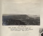
From west base of Baigaiche looking S-SE toward Fort Defiance. Bar. 8700' (Photo G381)
1913
Image
uum_map
36
Group at the Calca Sunday market.
1912; 1913; 1914; 1915
Image
uum_map
37
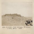
Hopi village. Mi-shong-i-nivi, Ariz. 1909
1909
Image
uum_map
38
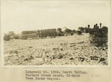
Longwell 12, Death Valley. Furnace Creek Ranch. 20-Mule Team Borax wagons
1924
Image
uum_map
39
Monument Pass. Utah, from west, 1910 (Photo N-M81)
1910
Image
uum_map
40
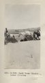
Pack team (Heald)., Lower Chinlee (Photo G333)
1913
Image
uum_map
41
Parunuweap formation, Pliocene?, overlying Moenkopi beds (concealed by talus) and capped by basalt. Lower La Verkin Canyon, Washington County, UT, 1943
1943
Image
uum_map
42
Permian-Triassic contact in Goulds Canyon (of little Creek). Kaibab (lowest ledge), conglomerate (second ledge), Moenkopi (third ledge and top). Washington County, UT. 1939
1939
Image
uum_map
43
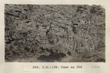
Same as 585 (Sandstone in canyon at Totocong, Photo N-M138)
1913
Image
uum_map
44
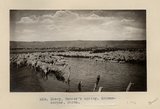
Sheep, Tanner's spring. Schwemberger, photo
1911
Image
uum_map
45
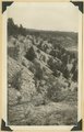
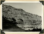
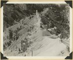
Spur on wall of canyon. Wasatch limestone. Cedar Breaks National Monument
1937; 1938
Image
uum_map
46
Trail over Water Pocket Fold near Smith's Ranch. LaPlata sandstone. Kane County, UT. June 1918
1918
Image
uum_map
47
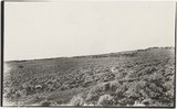
Typical vegetation, elevation 5000-5500 feet, between St. Michaels and Ganado, Ariz., 1909 (photo G-34)
1909
Image
uum_map
48
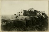
Walpi-the east end of the pueblo. Note deep trail worn into the edge of mesa top
1915
Image
uum_map
49
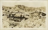
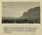
Wilson Ranch, Charleston Mountains, NV. Cliff of Navajo SS. in background. Ranch house is on bench of Shinarump conglomerate. 1922
1922
Image
uum_map
50
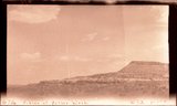
East side of Butler Wash, 77 Miles above its mouth. View taken standing on Navajo sandstone. Carmel (?), Entrada (?), Summerville (?), Salt Wahs (?), Morrison Shales, Dakota, San Juan County, Utah, 1928.
Image
uum_map
26
-
50
of
59
<
1
2
3
>