Home
Browse
Ask Us
Chat
Harmful Language Statement
Log in
Photo Archives
Advanced Search
About
Over 70,000 photos covering a variety of topics from Marriott Library Special Collections
Year
1872
1873
1874
1875
1876
1877
1878
1879
1880
1881
1882
1883
1884
1885
1886
1887
1888
1889
1890
1891
1892
1893
1894
1895
1896
1897
1898
1899
1900
1901
1902
1903
1904
1905
1906
1907
1908
1909
1910
1911
1912
1913
1914
1915
1916
1917
1918
1919
1920
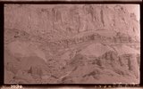
1921
1922
1923
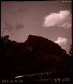
1924
1925
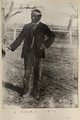
1926
1927
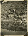
1928
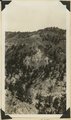
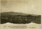
1929
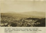
1930
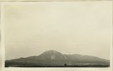
1931
1932
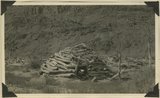
1933
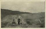
1934
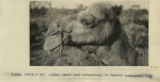
1935
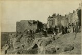
1936
1937
1938
1939
1940
1941
1942
1943
1944
1945
1946
1947
1948
1949
1950
1951
1952
1953
1954
1955
1956
1957
1958
1959
1960
1961
1962
1963
1964
1965
1966
1967
1968
1969
1970
1971
1972
1973
1974
1975
1976
1977
1978
1979
1980
1981
1982
1983
1984
1985
1986
1987
1988
1989
1990
1991
1992
1993
TO
1872
1873
1874
1875
1876
1877
1878
1879
1880
1881
1882
1883
1884
1885
1886
1887
1888
1889
1890
1891
1892
1893
1894
1895
1896
1897
1898
1899
1900
1901
1902
1903
1904
1905
1906
1907
1908
1909
1910
1911
1912
1913
1914
1915
1916
1917
1918
1919
1920
1921
1922
1923
1924
1925
1926
1927
1928
1929
1930
1931
1932
1933
1934
1935
1936
1937
1938
1939
1940
1941
1942
1943
1944
1945
1946
1947
1948
1949
1950
1951
1952
1953
1954
1955
1956
1957
1958
1959
1960
1961
1962
1963
1964
1965
1966
1967
1968
1969
1970
1971
1972
1973
1974
1975
1976
1977
1978
1979
1980
1981
1982
1983
1984
1985
1986
1987
1988
1989
1990
1991
1992
1993
Type
Image
3,521
Format
image/jpeg
3,451
application/pdf
70
Collection
Photo Archives
3,521
Filters:
Collection Name:
"Herbert E. Gregory"
Type:
"Image"
51
-
75
of
3,521
<
1
2
3
4
5
6
7
8
9
10
>
Gallery view
Number of results to display per page
10
25
50
100
200
Sort by Relevance
Sort by Title A-Z
Sort by Title Z-A
Sort by Date Ascending
Sort by Date Descending
Sort by Last Modified Ascending
Sort by Last Modified Descending
Title
Date
Type
51
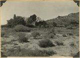
'Winsor Castle', old fort at Pipe Springs, looking south over Unikaret Plateau, Kanab Canyon upper right
1939
Image
52
'Winsor Castle,' old stone fort at Pipe Springs, Mohave County, AZ. Sevier fault passes between Navajo sandstone." (upper right) and lower Moenkopi (foreground). 1939
1939
Image
53
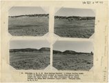
(Panorama A, B, C, D) Blue Springs Meadows. A stream leading south (left) to Mammoth Creek blocked by basalts from Miller Knoll (right sky line) became a lake that eventuallly cut an outlet through the Brian Head formation (upper left).
1944
Image
54
1, Navajo sandstone (at base); 2, shales; 3, sandstone bed that forms "entablatures" on "Temples" of Zion National Park; 4, Carmel and above. Zion-Mount Carmel highway, Kane County, Utah, 1931.
1931
Image
55
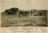
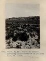
15 Miles NE Little Colorado at Tanners Crossing 1900
1900
Image
56
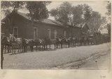
20 mules in a train
1909
Image
57
3± mi. north of Ganado, Ariz. Tertiary in angular unconformity with Dolores (Triassic), 1909 (photo G-37)
1909
Image
58
3± mi. north of Ganado. Tertiary unconformable on Dolores. VII, 19. 1911 (Photo G218)
1911
Image
59
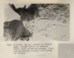
3± mi. north of Tucker Spgs. Green bands in Permian shale just below Shinarump, showing secondary origin. Shinarump in blocks (Photo N-M170)
1913
Image
60
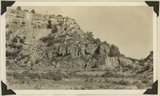
[Faulting in rock layers, probably Kanab Creek Canyon, Arizona, 1922]
1922
Image
61
[Grand Gulch, Wayne Co., Ut.]
1935
Image
62
[Upper wall of Big Meadow Canyon (on Zion-Mt. Carmel road). Morrison strata, unconsolidated Dakota ? (black band), and coal-bearing Cretaceous. Kane County, Utah, 1930]
1930
Image
63
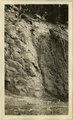
[Whiskey Creek palisades] (Photo N-M130)
1911
Image
64
A basin range, Toquerville region, 190
1900
Image
65
A Navajo 1910
1909
Image
66
A nearer view of G-48 (volcanic neck between Sunrise Springs and Biddehoche), 1909 (photo G-49)
1909
Image
67
A. M. Thompson, Kanab Creek, 1872.
1872
Image
68
Abajo Mountains from southwest, [Probably from southern end of Elk Ridge]
1915
Image
69
Abajo Mountains looking east from Elk Ridge across Cottonwood Canyon, San Juan County, Utah. June, 1915.
1915
Image
70
Abajo Mountains looking northwest from Blanding. Monticello Road. San Juan County, UT, 1928
1928
Image
71
Abancay to La Estrella. Concacha. Nearer view of the same.
1911; 1912; 1915
Image
72
Abandoned hogan on east side of the San Juan some 3 miles above the mouth of Pinte Creek. San Juan County, UT. 1921
1921
Image
73
Abandoned Logan, San Juan River, 10 miles above mouth
1920; 1921; 1922; 1923; 1924; 1925; 1926; 1927; 1928; 1929; 1930
Image
74
Afghan camel used extensively in central Australia, 1916
1916
Image
75
After the dance, Walpi, AZ
1915
Image
51
-
75
of
3,521
<
1
2
3
4
5
6
7
8
9
10
>