Home
Browse
Ask Us
Chat
Harmful Language Statement
Log in
Photo Archives
Advanced Search
About
Over 70,000 photos covering a variety of topics from Marriott Library Special Collections
Year
1872
1873
1874
1875
1876
1877
1878
1879
1880
1881
1882
1883
1884
1885
1886
1887
1888
1889
1890
1891
1892
1893
1894
1895
1896
1897
1898
1899
1900
1901
1902
1903
1904
1905
1906
1907
1908
1909
1910
1911
1912
1913
1914
1915
1916
1917
1918
1919
1920
1921
1922
1923
1924
1925
1926
1927
1928
1929
1930
1931
1932
1933
1934
1935
1936
1937
1938
1939
1940
1941
1942
1943
1944
1945
1946
1947
1948
1949
1950
1951
1952
1953
1954
1955
1956
1957
1958
1959
1960
1961
1962
1963
1964
1965
1966
1967
1968
1969
1970
1971
1972
1973
1974
1975
1976
1977
1978
1979
1980
1981
1982
1983
1984
1985
1986
1987
1988
1989
1990
1991
1992
1993
TO
1872
1873
1874
1875
1876
1877
1878
1879
1880
1881
1882
1883
1884
1885
1886
1887
1888
1889
1890
1891
1892
1893
1894
1895
1896
1897
1898
1899
1900
1901
1902
1903
1904
1905
1906
1907
1908
1909
1910
1911
1912
1913
1914
1915
1916
1917
1918
1919
1920
1921
1922
1923
1924
1925
1926
1927
1928
1929
1930
1931
1932
1933
1934
1935
1936
1937
1938
1939
1940
1941
1942
1943
1944
1945
1946
1947
1948
1949
1950
1951
1952
1953
1954
1955
1956
1957
1958
1959
1960
1961
1962
1963
1964
1965
1966
1967
1968
1969
1970
1971
1972
1973
1974
1975
1976
1977
1978
1979
1980
1981
1982
1983
1984
1985
1986
1987
1988
1989
1990
1991
1992
1993
Type
Image
3,521
Format
image/jpeg
3,451
application/pdf
70
Collection
Photo Archives
3,521
Filters:
Collection Name:
"Herbert E. Gregory"
Type:
"Image"
676
-
700
of
3,521
<
23
24
25
26
27
28
29
30
31
32
>
Gallery view
Number of results to display per page
10
25
50
100
200
Sort by Relevance
Sort by Title A-Z
Sort by Title Z-A
Sort by Date Ascending
Sort by Date Descending
Sort by Last Modified Ascending
Sort by Last Modified Descending
Title
Date
Type
676
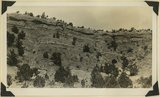
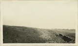
Contact Entrada (?) bottom and Summerville (?) Paria River 6± miles south of Cannonville, Garfield County, Utah, 1932.
1932
Image
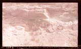
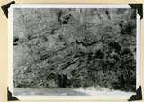
677
Contact Jurassic and consolidated valley fill (Pleistocene?) in gulch east of Mt. Carmel Junction. Kane County, Utah, 1932.
1934
Image
678
Contact Jurassic and consolidated valley fill (Pleistocene?) in gulch east of Mt. Carmel Junction. Kane County, Utah, 1932.
1934
Image
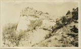
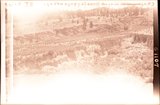
679
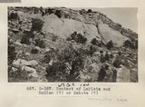
Contact McElmo and Dakota, Henrieville Wash. Garfield County, UT, 1924
1924
Image
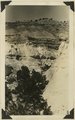
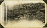
680
Contact Morrison (?) and Dakota (?) 2 miles north of Henrieville, Garfield County, Utah, 1932.
1932
Image
681
Contact Navajo and McElmo, Dry Wash, San Juan County, UT, 1925
1925
Image
682
Contact Navajo sandstone and McElmo, Blue Canyon, 1914
1914
Image
683
Contact of "Frey" (Organ Rock) and De Chelly formations south side White Canyon below Star Springs, San Juan County, Utah, 1932.
1932
Image
684
Contact of fossiliferous Kaibab (base) and fossiliferous Moenkopi (top), Isom Wash, Washington Co., UT, 1939. Exact contact not placed
1939
Image
685
Contact of Kayenta formation (foreground) and Navajo sandstone Park Wash above the mouth of Five Pines Wash. Kane County, UT. 1943
1943
Image
686
Contact of LaPlata and McElmo (?) or Dakokta (?) (Photo G357)
1913
Image
687
Contact of Moenkopi (right) with shales occupying the position of the Coconino (left). San Juan County, UT, 1928
1928
Image
688
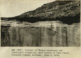
Contact of Navajo sandstone and "Sentinal" formation, east branch of Warm Creek, Coconino County, Arizona.. June, 1915.
1915
Image
689
Contact of old and recent basalt flows near head of Gould Canyon, Washington County, UT, 1939
1939
Image
690
Contact of Supai (left) and shales occupying the position of the Coconino. Comb Wash in background. San Juan County, UT, 1928
Image
691
Contact of Supai (left) and shales occupying the position of the Coconino. Comb Wash in background. San Juan County, UT, 1928
1928
Image
692
Contact of Triassic and Permian (beds in wall wrinkled at base). Cherty limestone lower left. Camp Creek. Iron County, UT. 1941
1941
Image
693
Contact Wingate and Kayenta formation, branch of Kitchen Canyon east of White Cone, Kane County, Utah, 1938.
1938
Image
694
Contact, Carboniferous and Permian, Wolf's Crossing (Photo N-M173)
1913
Image
695
Contact, Carmel & Navajo Skutumpah
1936
Image
696
Contact, Carmel and Navajo Skutumpah, 1936.
1936
Image
697
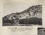
Contact, McElmo and Dakota, northeast of upper corner of Todilto (Photo G394)
1913
Image
698
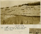
Contact, McElmo and Mancos, 3 mi. NE of Blue Canyon store, 1914
1914
Image
699
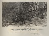
Contact, Moencopie-Shinarump, Mouth of Moencopie (Photo G428)
1913
Image
700
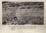
Contact, Tertiary and McElmo, 2± mi. north of Sunrise Spgs. (Photo N-M166)
1913
Image
676
-
700
of
3,521
<
23
24
25
26
27
28
29
30
31
32
>