Home
Browse
Ask Us
Chat
Harmful Language Statement
Log in
Photo Archives
Advanced Search
About
Over 70,000 photos covering a variety of topics from Marriott Library Special Collections
Year
1872
1873
1874
1875
1876
1877
1878
1879
1880
1881
1882
1883
1884
1885
1886
1887
1888
1889
1890
1891
1892
1893
1894
1895
1896
1897
1898
1899
1900
1901
1902
1903
1904
1905
1906
1907
1908
1909
1910
1911
1912
1913
1914
1915
1916
1917
1918
1919
1920
1921
1922
1923
1924
1925
1926
1927
1928
1929
1930
1931
1932
1933
1934
1935
1936
1937
1938
1939
1940
1941
1942
1943
1944
1945
1946
1947
1948
1949
1950
1951
1952
1953
1954
1955
1956
1957
1958
1959
1960
1961
1962
1963
1964
1965
1966
1967
1968
1969
1970
1971
1972
1973
1974
1975
1976
1977
1978
1979
1980
1981
1982
1983
1984
1985
1986
1987
1988
1989
1990
1991
1992
1993
TO
1872
1873
1874
1875
1876
1877
1878
1879
1880
1881
1882
1883
1884
1885
1886
1887
1888
1889
1890
1891
1892
1893
1894
1895
1896
1897
1898
1899
1900
1901
1902
1903
1904
1905
1906
1907
1908
1909
1910
1911
1912
1913
1914
1915
1916
1917
1918
1919
1920
1921
1922
1923
1924
1925
1926
1927
1928
1929
1930
1931
1932
1933
1934
1935
1936
1937
1938
1939
1940
1941
1942
1943
1944
1945
1946
1947
1948
1949
1950
1951
1952
1953
1954
1955
1956
1957
1958
1959
1960
1961
1962
1963
1964
1965
1966
1967
1968
1969
1970
1971
1972
1973
1974
1975
1976
1977
1978
1979
1980
1981
1982
1983
1984
1985
1986
1987
1988
1989
1990
1991
1992
1993
Type
Image
3,521
Format
image/jpeg
3,451
application/pdf
70
Collection
Photo Archives
3,521
Filters:
Collection Name:
"Herbert E. Gregory"
Type:
"Image"
601
-
625
of
3,521
<
20
21
22
23
24
25
26
27
28
29
>
Gallery view
Number of results to display per page
10
25
50
100
200
Sort by Relevance
Sort by Title A-Z
Sort by Title Z-A
Sort by Date Ascending
Sort by Date Descending
Sort by Last Modified Ascending
Sort by Last Modified Descending
Title
Date
Type
601
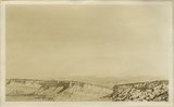
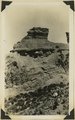
Cliffs of Tertiary limestone under rim of Paunsaugunt Plateau at a point about 7 miles NE of Alton, Kane County, Utah, in 1922.
1922
Image
602
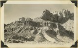
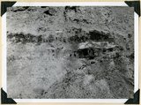
Cliffs of Waweap capped with Dakota. East side Dry Valley looking North. Top of Kaiparowits Plateau in distance. Kane County, UT. 1924
1924
Image
603
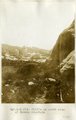
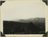
Cliffs on north side of Navaho Mountain
1913
Image
604
Cliffs west of Cornfields, south of Ganado; on west side of Pueblo Colorado Wash. Heald, 1911 (Photo N-M123)
1911
Image
605
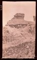
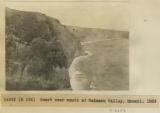
Cliffs, mouth of Parunuweap, Utah, 1936.
1936
Image
606
Coal beds just above Morrison Dakota contact (in shadow) 2± miles north of Cannonville, Utah, 1932.
1932
Image
607
Coal beds just above Morrison Dakota contact (in shadow) 2± miles north of Cannonville, Utah, 1932.
1932
Image
608
Coal in the Dakota or basal Tropic; Coal hill east side Meadow Brook. Kane County, UT
1937
Image
609
Coalpits volcano north of Grafton.
1930; 1931; 1932; 1933; 1934; 1935; 1936; 1937
Image
610
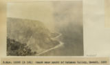
Coast near mouth of Waimanu Valley, Hawaii, 1926 [1]
1926
Image
611
Coast near mouth of Waimanu Valley, Hawaii, 1926 [2]
1926
Image
612
Coast of Tahiti showing reef. Moorea in distance, 1915
1915
Image
613
Coast of Tahiti, 1915
1915
Image
614
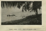
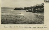
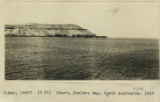
Coast, Fowlers Bay, South Australia, 1916
1916
Image
615
Coast, Fowlers Bay, South Australia, 1916
1916
Image
616
Coconino (?) sandstone near head of Hammond Canyon. San Juan County, UT, 1927
1927
Image
617
Coconino (?) sandstone near head of Hammond Canyon. San Juan County, UT, 1927
1927
Image
618
Coconino (?) sandstone overlaid by Moenkopi and underlaid by Supai (?). Dark Canyon near mouth of Kigalia Canyon, Elk Ridge. San Juan County, UT, 1927
1927
Image
619
Coconino (?) sandstone overlaid by Moenkopi and underlaid by Supai (?). Dark Canyon near mouth of Kigalia Canyon, Elk Ridge. San Juan County, UT, 1927
1927
Image
620
Coconino Forest
1900
Image
621
Coconino Forest
1900
Image
622
Coconino Forest Between Flagstaff & Grand Canyon, 1900 [1]
1900
Image
623
Coconino Forest Between Flagstaff & Grand Canyon, 1900 [2]
1900
Image
624
Coconino marls overlying Supai red beds. West side of Comb Wash near mouth. San Juan County, Utah, 1929.
1929
Image
625
Coconino on rim of Grand Gulch near Dripping Springs. Recession of cliff along thin bed of red shale. Cliff rim under cliff. San Juan County, UT, 1927
1927
Image
601
-
625
of
3,521
<
20
21
22
23
24
25
26
27
28
29
>