Home
Browse
Ask Us
Chat
Harmful Language Statement
Log in
Photo Archives
Advanced Search
About
Over 70,000 photos covering a variety of topics from Marriott Library Special Collections
Year
1899
1900
1901
1902
1903
1904
1905
1906
1907
1908
1909
1910
1911
1912
1913
1914
1915
1916
1917
1918
1919
1920
1921
1922
1923
1924
1925
1926
1927
1928
1929
1930
1931
1932
1933
1934
1935
1936
1937
1938
1939
1940
1941
1942
1943
1944
TO
1899
1900
1901
1902
1903
1904
1905
1906
1907
1908
1909
1910
1911
1912
1913
1914
1915
1916
1917
1918
1919
1920
1921
1922
1923
1924
1925
1926
1927
1928
1929
1930
1931
1932
1933
1934
1935
1936
1937
1938
1939
1940
1941
1942
1943
1944
Type
Image
400
Format
image/jpeg
398
application/pdf
2
Collection
Photo Archives
400
Filters:
Collection Name:
"Herbert E. Gregory"
Spatial Coverage:
"Coconino County (Ariz.)"
Type:
"Image"
126
-
150
of
400
<
1
2
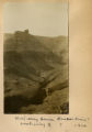
3
4
5
6
7
8
9
10
>
Gallery view
Number of results to display per page
10
25
50
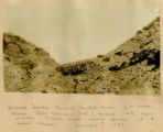
100
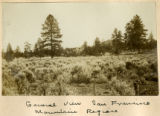
200
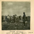
Sort by Relevance
Sort by Title A-Z
Sort by Title Z-A
Sort by Date Ascending
Sort by Date Descending
Sort by Last Modified Ascending
Sort by Last Modified Descending
Title
Date
Type
126
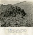
Fossil tree stump standing upright. About 1 mi. east of Tanners Crossing (foot print in foreground). In Dolores.
1913
Image
127
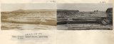
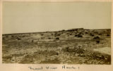
General view near Many Waters Lakes, 16± mi., northeast of Leupp, Arizona (photo G-87)
1909
Image
128
General view near Many Waters Lakes, 16± mi., northeast of Leupp, Arizona (photo G-87)
1909
Image
129
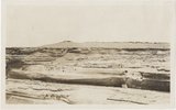
General view, Tuba desert (Photo N-M180)
1913
Image
130
Glen Canyon, 3+ miles above Lees Ferry Coconino County, Arizona. June, 1915.
1915
Image
131
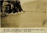
Glen Canyon, 3+ miles above Lees Ferry looking up stream from south bank. June, 1915.
1915
Image
132
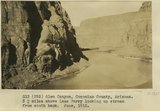
Glen Canyon, Coconino County, Arizona, 3+ miles above Lees Ferry looking up stream from south bank. June 1915.
1915
Image
133
Graded slopes, Vermillion Cliffs, 1900
1900
Image
134
Grand Canyon
1899
Image
135
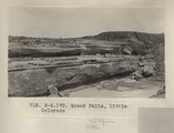
Grand Falls, Little Colorado (Photo N-M175)
1913
Image
136
Grand Falls, Little Colorado (Photo N-M175)
1913
Image
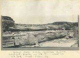
137
Grand Falls, Little Colorado River, photo used in USGS Prof. Paper 96
1909
Image
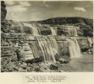
138
Grand Falls, Little Colorado, view from above. W. C. Mendenhall photo, May 1909
1909
Image
139
Grand Falls, Little Colorado, view from below. W. C. Mendenhall photo, May 1909
1909
Image
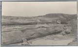
140
Grand Falls, panorama (Photos G415 and G416)
1913
Image
141
Grand Falls, panorama (Photos G415)
1913
Image
142
Grand Falls, panorama (Photos G416)
1913
Image
143
Grand View House?
1900
Image
144
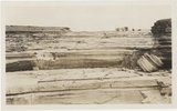
Gravel terrain, Bright Angel Creek, 1/2+ mile above box canyon, top of gravel 100 feet above stream. Photo from lower terrace 15 feet above stream... 1928
1928
Image
145
Greneral view, San Francisco Mountain region
1900
Image
146
Grub wagon near Winslow, Ariz, 1900
1900
Image
147
Halfway House, Hance's trail? Looking East? 1900
1900
Image
148
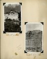
Herbert E. Gregory Book 11: Colorado Plateau, 1938-1942
1938; 1939; 1940; 1941; 1942
Image
149
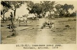
Home-made power pump, Tolchaco, Ariz. (negative for photo G-91)
1909
Image
150
Home-made power pump, Tolchaco, Arizona, 1909 (photo G-91)
1909
Image
126
-
150
of
400
<
1
2
3
4
5
6
7
8
9
10
>