Home
Browse
Ask Us
Chat
Harmful Language Statement
Log in
Photo Archives
Advanced Search
About
Over 70,000 photos covering a variety of topics from Marriott Library Special Collections
Year
1899
1900
1901
1902
1903
1904
1905
1906
1907
1908
1909
1910
1911
1912
1913
1914
1915
1916
1917
1918
1919
1920
1921
1922
1923
1924
1925
1926
1927
1928
1929
1930
1931
1932
1933
1934
1935
1936
1937
1938
1939
1940
1941
1942
1943
1944
TO
1899
1900
1901
1902
1903
1904
1905
1906
1907
1908
1909
1910
1911
1912
1913
1914
1915
1916
1917
1918
1919
1920
1921
1922
1923
1924
1925
1926
1927
1928
1929
1930
1931
1932
1933
1934
1935
1936
1937
1938
1939
1940
1941
1942
1943
1944
Type
Image
400
Format
image/jpeg
398
application/pdf
2
Collection
Photo Archives
400
Filters:
Collection Name:
"Herbert E. Gregory"
Spatial Coverage:
"Coconino County (Ariz.)"
Type:
"Image"
76
-
100
of
400
<
1
2
3
4
5
6
7
8
9
10
>
Gallery view
Number of results to display per page
10
25
50
100
200
Sort by Relevance
Sort by Title A-Z
Sort by Title Z-A
Sort by Date Ascending
Sort by Date Descending
Sort by Last Modified Ascending
Sort by Last Modified Descending
Title
Date
Type
76
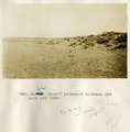
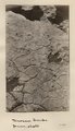
Desert pavement between Red Lake and Tuba
1913
Image
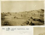
77
Desert vegetation, Red Lake, 1914
1914
Image
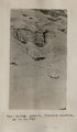
78
Detail, Dolores section, as in No. 742 (Photo G425)
1913
Image
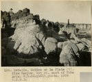
79
Details, McElmo or La Plata (?), Blue Canyon, 18± mi. east of Tuba, Ariz. (M. R. Campbell photo, 1909, U.S.G.S.)
1909
Image
80
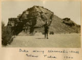
Dike along Moencopie near Tuba, 1900
1900
Image
81
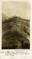
Dike along Moencopie Wash below Tuba 1900
1900
Image
82
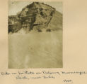
Dike in La Plata or Dolores, Moencopie Wash, near Tuba, 1900
1900
Image
83
Dike,south side of Moenkopi valley, 5 mil SW of Tuba, 1914
1914
Image
84
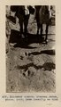
Dinosaur tracks (J. Wetherill photo)
1910
Image
85
Dinosaur tracks (Janus photo)
1909
Image
86
Dinosaur tracks (Stephen Janus photo, 1909. Same locality as G185)
1909
Image
87
Dinosaur tracks (Stephen Janus photo, 1909. Same locality as G185)
1909
Image
88
Dinosaur tracks, Navajo Canyon (Photo Hopkins, Salt Lake City)
1910
Image
89
Dinosaur tracks, Navajo Canyon, Ariz., 1910 (Photo G185)
1910
Image
90
Dinosaur tracks, Navajo Canyon, Ariz., 1910 (Photo G185)
1910
Image
91
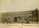
Distant view, W. Kaibab Fault, 1900
1900
Image
92
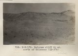
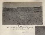
Dolores cliff 8± mi. north of Tolchaco (IX-3-4) (Photo N-M172)
1913
Image
93
Dolores cliff 8± mioles north of Tolchaco (Photo G409)
1913
Image
94
Dolores east of Black Falls
1913
Image
95
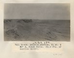
Dolores section, 5± mi. N 80° E, Black Falls (No. 2 etc. of Section IX-13) (Photo G424)
1913
Image
96
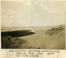
Drifting sand burying canyon, Tuba, Ariz., 1909, La Plata strata (photo G-100)
1909
Image
97
Drifting sand burying canyon, Tuba, Ariz., 1909, La Plata strata (photo G-100)
1909
Image
98
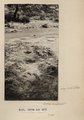
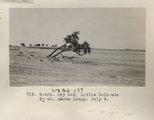
Dry bed, Little Colorado 8± mi. above Leupp. July 9 (Photo G406)
1913
Image
99
Dune occupying cave in Navajo sandstone, Tuba 1914
1914
Image
100
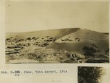
Dune, Tuba desert, 1914
1914
Image
76
-
100
of
400
<
1
2
3
4
5
6
7
8
9
10
>