Home
Browse
Ask Us
Chat
Harmful Language Statement
Log in
Photo Archives
Advanced Search
About
Over 70,000 photos covering a variety of topics from Marriott Library Special Collections
Year
1899
1900
1901
1902
1903
1904
1905
1906
1907
1908
1909
1910
1911
1912
1913
1914
1915
1916
1917
1918
1919
1920
1921
1922
1923
1924
1925
1926
1927
1928
1929
1930
1931
1932
1933
1934
1935
1936
1937
1938
1939
1940
1941
1942
1943
1944
TO
1899
1900
1901
1902
1903
1904
1905
1906
1907
1908
1909
1910
1911
1912
1913
1914
1915
1916
1917
1918
1919
1920
1921
1922
1923
1924
1925
1926
1927
1928
1929
1930
1931
1932
1933
1934
1935
1936
1937
1938
1939
1940
1941
1942
1943
1944
Type
Image
400
Format
image/jpeg
398
application/pdf
2
Collection
Photo Archives
400
Filters:
Collection Name:
"Herbert E. Gregory"
Spatial Coverage:
"Coconino County (Ariz.)"
1
-
25
of
400
<
1
2
3
4
5
6
7
8
9
10
>
Gallery view
Number of results to display per page
10
25
50
100
200
Sort by Relevance
Sort by Title A-Z
Sort by Title Z-A
Sort by Date Ascending
Sort by Date Descending
Sort by Last Modified Ascending
Sort by Last Modified Descending
Title
Date
Type
1
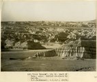
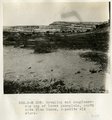
"Blue Canyon" 18± mil east of Tuba, Ariz., McElmo overlain by Dakota (W. C. Mendenhall, U.S.G.S. photo)
1909
Image
2
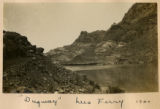
"Dugway," Lees Ferry 1900
1900
Image
3
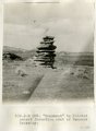
"Monument" in Painted Desert formation east of Tanners Crossing.
1913
Image
4
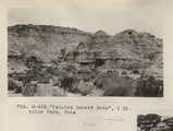
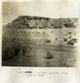
"Painted Desert Bads", 1 mi. below Farm, Tuba (Photo G432)
1913
Image
5
"Painted Desert", 2 mi. west of Tuba
1913
Image
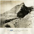
6
"Painted Desert", four miles west of Tuba
1913
Image
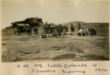
7
15 Miles NE Little Colorado at Tanners Crossing 1900
1900
Image
8
[Faulting in rock layers, probably Kanab Creek Canyon, Arizona, 1922]
1922
Image
9
Ancient irrigation ditch, La Plata sandstone, Moencopie wash, 10± mil east of Tuba, Ariz., 1909 (photo G-101)
1909
Image
10
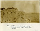
Ancient ruin, rim of Moenkopi Wash below Moenkopi village.
1914
Image
11
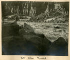
At Grand View
1900
Image
12
At the River
1900
Image
13
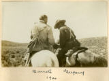
Barrett, Gregory
1900
Image
14
Barrett, Gregory, 1900
1900
Image
15
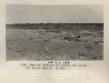
Bed of Little Colorado at crest of Grand Falls (Photo G420)
1913
Image
16
Bed of Little Colorado, Black Falls (negative for photo G-92)
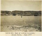
1909
Image
17
Bed of Little Colorado, Black Falls, June 1909 (photo G-92)
1909
Image
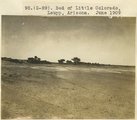
18
Bed of Little Colorado, Leupp, Ariz. (negative for photo G-90)
1909
Image
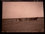
19
Bed of Little Colorado, Leupp, Arizona (negative for photo G-89)
1909
Image
20
Bed of Little Colorado, Leupp, Arizona, June 1909 (photo G-89)
1909
Image
21
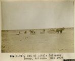
Bed of Little Colorado, Leupp, Arizona, May 1909 (photo G-90)
1909
Image
22
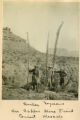
Beecher, Seymour on Copper Mine Trail, Giant Mescals
1900
Image
23
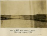
Bekishibito: dunes blocking canyon, 1914
1914
Image
24
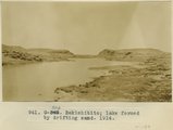
Bekishibito: lake formed by drifting sand, 1914
1914
Image
25
Beveling and conglomerate cap of lower peneplain, north side Blue Canon, opposite old store.
1913
Image
1
-
25
of
400
<
1
2
3
4
5
6
7
8
9
10
>