Home
Browse
Ask Us
Chat
Harmful Language Statement
Log in
Photo Archives
Advanced Search
About
Over 90,000 photos covering a variety of topics from Marriott Library Special Collections.
Year
1872
1873
1874
1875
1876
1877
1878
1879
1880
1881
1882
1883
1884
1885
1886
1887
1888
1889
1890
1891
1892
1893
1894
1895
1896
1897
1898
1899
1900
1901
1902
1903
1904
1905
1906
1907
1908
1909
1910
1911
1912
1913
1914
1915
1916
1917
1918
1919
1920
1921
1922
1923
1924
1925
1926
1927
1928
1929
1930
1931
1932
1933
1934
1935
1936
1937
1938
1939
1940
1941
1942
1943
1944
TO
1872
1873
1874
1875
1876
1877
1878
1879
1880
1881
1882
1883
1884
1885
1886
1887
1888
1889
1890
1891
1892
1893
1894
1895
1896
1897
1898
1899
1900
1901
1902
1903
1904
1905
1906
1907
1908
1909
1910
1911
1912
1913
1914
1915
1916
1917
1918
1919
1920
1921
1922
1923
1924
1925
1926
1927
1928
1929
1930
1931
1932
1933
1934
1935
1936
1937
1938
1939
1940
1941
1942
1943
1944
Type
Image
1,197
Format
image/jpeg
1,186
application/pdf
11
Collection
Photo Archives
1,197
Filters:
Collection Name:
"Herbert E. Gregory"
Spatial Coverage:
"Arizona"
Type:
"Image"
1
-
25
of
1,197
<
1
2
3
4
5
6
7
8
9
10
>
Gallery view
Number of results to display per page
10
25
50
100
200
Sort by Relevance
Sort by Title A-Z
Sort by Title Z-A
Sort by Date Ascending
Sort by Date Descending
Sort by Last Modified Ascending
Sort by Last Modified Descending
Title
Date
Type
1
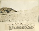
"Beautiful Valley." Fossil forest (Dolores strata), 12± mi. north of Ganado, Ariz. All pebbles in foreground are petrified wood, 1909 (photo G-28)
1909
Image
2
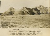
"Beautiful Valley." Fossil forest, Dolores strata, 12± mi. north of Ganado, Ariz., 1909 (photo G-31)
1909
Image
3
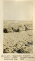
"Beautiful Valley." Fossil forest, Dolores strata, petrified log, 1909 (photo G-29)
1909
Image
4
"Blue Canyon" 18± mil east of Tuba, Ariz., McElmo overlain by Dakota (W. C. Mendenhall, U.S.G.S. photo)
1909
Image
5
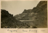
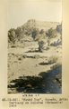
"Dugway," Lees Ferry 1900
1900
Image
6
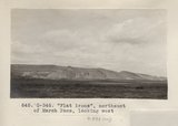
"Flat irons", northeast of Marsh Pass, looking west (Photo G346)
1913
Image
7
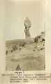
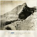
"Kit Carson's Monument," eroded from Moencopie (Permian?_ sandstone near Fort Defiance, Arizona, 1909 (photo G-12)
1909
Image
8
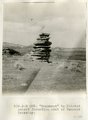
"Monument" in Painted Desert formation east of Tanners Crossing.
1913
Image
9
"North Forest", Carrizo Creek Wash (Photo G447)
1913
Image
10
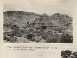
"Painted Desert Bads", 1 mi. below Farm, Tuba (Photo G432)
1913
Image
11
"Painted Desert", 2 mi. west of Tuba
1913
Image
12
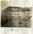
"Painted Desert", four miles west of Tuba
1913
Image
13
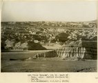
"Round Top," Ganado, Ariz. Tertiary on Dolores (Triassic), 1909 (photo G-36)
1909
Image
14
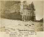
"The Church" (McElmo strata?), 4± mi southeast of Hlohala, Ariz., 1909 (photo G-107)
1909
Image
15
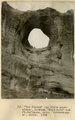
"The Window" (La Plata sandstone), between "Haystacks" and Ft. Defiance, Ariz. (Schwemberger photo), 1906
1906
Image
16
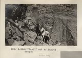
"Trail" out of PahUte canyon (Photo G354)
1913
Image
17
"Windsor Castle," Pipe Springs, 1936.
1936
Image
18
'Winsor Castle', old fort at Pipe Springs, looking south over Unikaret Plateau, Kanab Canyon upper right
1939
Image
19
'Winsor Castle,' old stone fort at Pipe Springs, Mohave County, AZ. Sevier fault passes between Navajo sandstone." (upper right) and lower Moenkopi (foreground). 1939
1939
Image
20
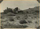
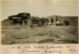
15 Miles NE Little Colorado at Tanners Crossing 1900
1900
Image
21
20 mules in a train
1909
Image
22
3± mi. north of Ganado, Ariz. Tertiary in angular unconformity with Dolores (Triassic), 1909 (photo G-37)
1909
Image
23
3± mi. north of Ganado. Tertiary unconformable on Dolores. VII, 19. 1911 (Photo G218)
1911
Image
24
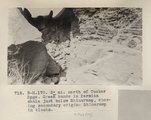
3± mi. north of Tucker Spgs. Green bands in Permian shale just below Shinarump, showing secondary origin. Shinarump in blocks (Photo N-M170)
1913
Image
25
[Faulting in rock layers, probably Kanab Creek Canyon, Arizona, 1922]
1922
Image
1
-
25
of
1,197
<
1
2
3
4
5
6
7
8
9
10
>