Over 70,000 photos covering a variety of topics from Marriott Library Special Collections
TO
| Title | Collection Number And Name | Photo Number | ||
|---|---|---|---|---|
| 176 |
 |
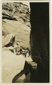
One of the monuments, Monument Pass, Utah. Moencopie strata. 1910 (Photo G138) | P0013 Herbert E. Gregory Photograph Collection | P0013n04_12_0535 |
| 177 |
 |
Same as 627 (LaPlata cross-bedding, Totocong, Photo G332) | P0013 Herbert E. Gregory Photograph Collection | P0013n06_025_0874 |
| 178 |
 |
Same as Photo G254. 1911 (White Cone, Photo G255) | P0013 Herbert E. Gregory Photograph Collection | P0013n05_56verso_0758 |
| 179 |
 |
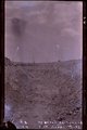
Sevier River formation overlaid by basalt near mouth of Corral Creek on Highway 89, 2 miles east of Panguitch. Garfield County, UT. 1944 | P0013 Herbert E. Gregory Photograph Collection | P0013n12_075_2940A |
| 180 |
 |
Slim Rock or "the Queen," LaPlata outlier on Dolores, near Agathla Needle, Ariz., looking southwest, 1910 (Photo G152) | P0013 Herbert E. Gregory Photograph Collection | P0013n04_29_0563 |
| 181 |
 |
Structure, Dolores and La Plata, looking west from Oljato, Utah, 1910 (Photo N-M84) | P0013 Herbert E. Gregory Photograph Collection | P0013n04_18_0542 |
| 182 |
 |
Totocong Spg., Chinlee valley, below Tsenakahn. LaPlata cross-bedding (Photo G331) | P0013 Herbert E. Gregory Photograph Collection | P0013n06_025_0873 |
| 183 |
 |
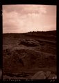
Unconformity between Moenkopi formation (lower part) and Shinarump conglomerate. Upper Chinle beds, middle top. Near mouth of Road Canyon. Kane County, UT. 1943 | P0013 Herbert E. Gregory Photograph Collection | P0013n12_028_2877E |
| 184 |
 |
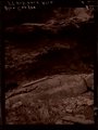
Unconformity. Base of Dakota in section VI, 15. West of Manuelito, NM. 1911 (Photo G194) | P0013 Herbert E. Gregory Photograph Collection | P0013n05_02_0667 |
| 185 |
 |
View looking west across Comb Wash at Navajo Springs, 12± miles west of Bluff, UT. 1910 (Photo G135) | P0013 Herbert E. Gregory Photograph Collection | P0013n04_10_0529 |
| 186 |
 |
View north along dike in Moses Rock garnet field, 1914 | P0013 Herbert E. Gregory Photograph Collection | P0013n07_089_1162 |
| 187 |
 |
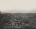
Warm Creek Canyon, June, 1915. | P0013 Herbert E. Gregory Photograph Collection | P0013n08_017_1340 |
| 188 |
 |
White Cone. 1911 (Photo G257) | P0013 Herbert E. Gregory Photograph Collection | P0013n05_57_0760 |
| 189 |
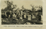 |
Camp in dune areas, Central Australia, 1916 | P0013 Herbert E. Gregory Photograph Collection | P0013n13_103_9-3175 |
| 190 |
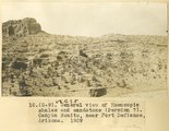 |
General view of Moencopie shales and sandstone (Permian?). Canyon Bonito, near Fort Defiance, Arizona, 1909 | P0013 Herbert E. Gregory Photograph Collection | P0013n02_005_205 |
| 191 |
 |
Same as G-85 (Many Waters Lake, Arizona, photo G-86) | P0013 Herbert E. Gregory Photograph Collection | P0013n02_047_293 |
| 192 |
 |
Arroyo in cienega, St. Michaels, Ariz. (negative for G-3) | P0013 Herbert E. Gregory Photograph Collection | P0013n02_002_198_neg |
| 193 |
 |
Black Creek Valley, Arizona (negative for photo G-11) | P0013 Herbert E. Gregory Photograph Collection | P0013n02_006_207_neg |
| 194 |
 |
Blue Canyon, Ariz. (negative for G-5) | P0013 Herbert E. Gregory Photograph Collection | P0013n02_003_200_neg |
| 195 |
 |
Blue Canyon, Ft. Defiance, Ariz. (negative for G-4) | P0013 Herbert E. Gregory Photograph Collection | P0013n02_002_199_neg |
| 196 |
 |
Canyon Bonito, Ariz. (negative for photo G-6) | P0013 Herbert E. Gregory Photograph Collection | P0013n02_004_202_neg |
| 197 |
 |
Concretions (Dakota?), Hlohala, Ariz., 1909 (photo G-106) | P0013 Herbert E. Gregory Photograph Collection | P0013n02_079_342 |
| 198 |
 |
Dug well, Cornfields, Ganado, Ariz. (Negative for photo G-40) | P0013 Herbert E. Gregory Photograph Collection | P0013n02_027_246_neg |
| 199 |
 |
Hand drill, Chinlee Valley (Negative for photo G-39) | P0013 Herbert E. Gregory Photograph Collection | P0013n02_026_244_neg |
| 200 |
 |
Lower Coyote Wash (negative for photo G-75) | P0013 Herbert E. Gregory Photograph Collection | P0013n02_042_282_neg |