Home
Browse
Ask Us
Chat
Harmful Language Statement
Log in
Advanced Search
Year
1872
1873
1874
1875
1876
1877
1878
1879
1880
1881
1882
1883
1884
1885
1886
1887
1888
1889
1890
1891
1892
1893
1894
1895
1896
1897
1898
1899
1900
1901
1902
1903
1904
1905
1906
1907
1908
1909
1910
1911
1912
1913
1914
1915
1916
1917
1918
1919
1920
1921
1922
1923
1924
1925
1926
1927
1928
1929
1930
1931
1932
1933
1934
1935
1936
1937
1938
1939
1940
1941
1942
1943
1944
1945
1946
1947
1948
1949
1950
1951
1952
1953
1954
1955
1956
1957
1958
1959
1960
1961
1962
1963
1964
1965
1966
1967
1968
1969
1970
1971
1972
1973
1974
1975
1976
1977
1978
1979
1980
1981
1982
1983
1984
1985
1986
1987
1988
1989
1990
1991
1992
1993
TO
1872
1873
1874
1875
1876
1877
1878
1879
1880
1881
1882
1883
1884
1885
1886
1887
1888
1889
1890
1891
1892
1893
1894
1895
1896
1897
1898
1899
1900
1901
1902
1903
1904
1905
1906
1907
1908
1909
1910
1911
1912
1913
1914
1915
1916
1917
1918
1919
1920
1921
1922
1923
1924
1925
1926
1927
1928
1929
1930
1931
1932
1933
1934
1935
1936
1937
1938
1939
1940
1941
1942
1943
1944
1945
1946
1947
1948
1949
1950
1951
1952
1953
1954
1955
1956
1957
1958
1959
1960
1961
1962
1963
1964
1965
1966
1967
1968
1969
1970
1971
1972
1973
1974
1975
1976
1977
1978
1979
1980
1981
1982
1983
1984
1985
1986
1987
1988
1989
1990
1991
1992
1993
Type
Image
3,451
Image/StillImage
143
Format
image/jpeg
3,594
Collection
Photo Archives
3,451
UAIDA Main Collection
143
Filters:
Collection Name:
"Herbert E. Gregory"
Format:
"image/jpeg"
276
-
300
of
3,594
<
7
8
9
10
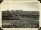
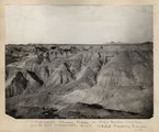
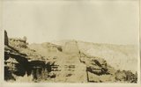
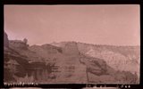
11
12
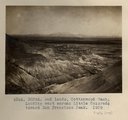
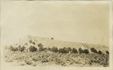
13
14
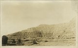
15
16
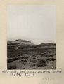
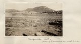
>
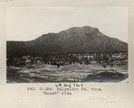
Gallery view
Number of results to display per page
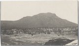
10
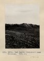
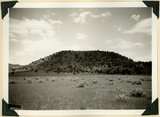
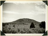
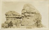
25
50
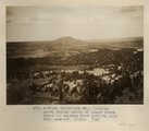
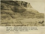
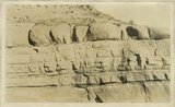
100
200
Sort by Relevance
Sort by Title A-Z
Sort by Title Z-A
Sort by Date Ascending
Sort by Date Descending
Sort by Last Modified Ascending
Sort by Last Modified Descending
Title
Date
Type
Setname
276
Ayusbamba. Senor and Senora Calvo at dining-room door.
1912
Image
uum_map
277
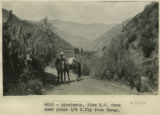
Ayusbamba. View SW from same place 1/4 N. Ely from Taray.
1912
Image
uum_map
278
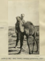
Baby camel, Central Australia, 1916
1916
Image
uum_map
279
Baby Llamas.
1911
Image
uum_map
280
The back slopes of Capitol Reef, viewed from the summit of the Fruita-Cainesville road 1/2 mile west of Pleasant Creek. Navajo, Carmel, and red gypsiferous shale above the Carmel in middle foreground, crest of roof on horizon. Wayne County, Utah, 1937.
1937
Image
uum_map
281
Bad Lands (Dolores) near Chinlee. VII, 26 (Photo G271)
1911
Image
uum_map
282
Bad lands, Chinle strata in Hopi Buttes region, north east of Holbrook, Ariz. USGS, probably Darton
1911
Image
uum_map
283
Bad Lands, Cottonwood Wash. 1909
1911
Image
uum_map
284
Bad Lands, Cottonwood Wash. 1909 (photograph from Herbert E. Gregory Book 5: Navajo, 1911)
1911
Image
uum_map
285
Bad Lands, Dolores. Lower Pueblo Colorado Wash. Section VI, 79-80. 1911 (Photo G226)
1911
Image
uum_map
286
Bad Lands. Dolores. Butte No. 24. VI, 76 (Photo G227)
1911
Image
uum_map
287
Baigaiche Mt.
1913
Image
uum_map
288
Baigaiche Mt. from "Beast" dike (Photo G388)
1913
Image
uum_map
289
Baigaiche Mt. from "Beast" dike (Photo G388)
1913
Image
uum_map
290
Baigaiche Mt., looking south across mouth of Black creek where it emerges from Todilto Park. Mrs. Gregory, photo. 1911 (Photo N-M118)
1911
Image
uum_map
291
Bald Knoll Volcanic Cone near head of Johnson Creek. Kane County, UT. 1940
1940
Image
uum_map
292
Bald Knoll Volcanic Cone near head of Johnson Creek. Kane County, UT. 1940
1940
Image
uum_map
293
Banded cliff, McElmo (?) formation capped by Dakota, 2+ miles east of Warm Creek, Kane County, Utah. June 8, 1915.
1915
Image
uum_map
294
Banded Navajo sandstone near place where Wingate and Kayenta first lose their identity. Chinle immediately below. Two miles northwest of Pipe Springs, Mohave County, Arizona, 1936.
1936
Image
uum_map
295
Banded red and white sands. 'Marine Jurassic', immediately west of Cannonville
1924
Image
uum_map
296
Banded red and white sands. 'Marine Jurassic', immediately west of Cannonville
1924
Image
uum_map
297
Banded red and white sands. 'Marine Jurassic', immediately west of Cannonville
1924
Image
uum_map
298
Banded red and white sands. 'Marine Jurassic', immediately west of Cannonville
1924
Image
uum_map
299
Banded red and white sands. 'Marine Jurassic', immediately west of Cannonville, Garfield County, Utah
Image
uum_map
300
Banded shales with 3 beds of gypsum, 'Marine Jurassic,' Cottonwood Wash section. Kane County, UT, 1924
1924
Image
uum_map
276
-
300
of
3,594
<
7
8
9
10
11
12
13
14
15
16
>