Home
Browse
Ask Us
Chat
Harmful Language Statement
Log in
Photo Archives
Advanced Search
About
Over 90,000 photos covering a variety of topics from Marriott Library Special Collections.
Year
1900
1901
1902
1903
1904
1905
1906
1907
1908
1909
1910
1911
1912
1913
1914
1915
1916
1917
1918
1919
1920
1921
1922
1923
1924
1925
1926
1927
1928
1929
1930
1931
1932
1933
1934
1935
1936
1937
TO
1900
1901
1902
1903
1904
1905
1906
1907
1908
1909
1910
1911
1912
1913
1914
1915
1916
1917
1918
1919
1920
1921
1922
1923
1924
1925
1926
1927
1928
1929
1930
1931
1932
1933
1934
1935
1936
1937
Type
Image
30
Format
image/jpeg
30
Collection
Photo Archives
30
Filters:
Collection Name:
"Herbert E. Gregory"
Format:
"image/jpeg"
Spatial Coverage:
"Utah"
1
-
25
of
30
<
1
2
>
Gallery view
Number of results to display per page
10
25
50
100
200
Sort by Relevance
Sort by Title A-Z
Sort by Title Z-A
Sort by Date Ascending
Sort by Date Descending
Sort by Last Modified Ascending
Sort by Last Modified Descending
Title
Date
Type
1
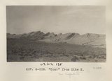
"Comb" from Dike H (Photo G338)
1913
Image
2
Basalt in Moenkopi, north wash.
1930; 1931; 1932; 1933; 1934; 1935; 1936; 1937
Image
3
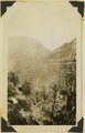
Camp, Utah
1900
Image
4
Congar Mt. fault, 1936.
1936
Image
5
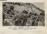
Contact of LaPlata and McElmo (?) or Dakokta (?) (Photo G357)
1913
Image
6
Detail of 661 (Photo G362)
1913
Image
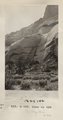
7
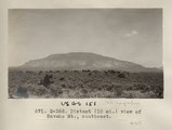
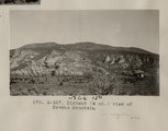
Distant (10 mi.) view of Navaho Mt., southeast (Photo G368)
1913
Image
8
Distant (10 mi.) view of Navaho Mt., southeast (Photo G368)
1913
Image
9
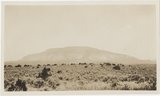
Distant (4 mi.) view of Navaho Mountain (Photo G367)
1913
Image
10
Dr. Pogue on Greybird, 1910
1910
Image
11
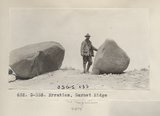
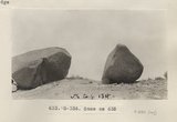
Erratics, Garnet Ridge (Photo G335)
1913
Image
12
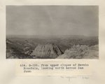
From upper slopes of Navaho Mountain, looking north across San Juan (Photo G355)
1913
Image
13
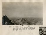
From upper slopes of Navaho Mt. looking northwest across Junction of San Juan and Colorado (Photo N-M158)
1913
Image
14
LaPlata in unnamed canyon, northwest base of Navaho Mt., Camp 22 (Photo G358)
1913
Image
15
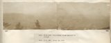
Panorama from Artist's ridge (Photo N-M159 and N-M160)
1913
Image
16
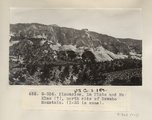
Pinnacles, La Plata and McElmo (?), north side of Navaho Mountain (I-33 is same) (Photo G356)
1913
Image
17
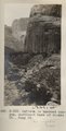
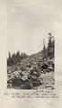
Rock slide, east side of Navaho Mt., elevation 9300' (Photo G361)
1913
Image
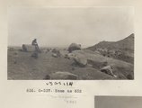
18
Same as 632 (Erratics, Garnet Ridge, Photo G336)
1913
Image
19
Same as 632 (Photo G337)
1913
Image
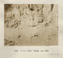
20
Same as 634 (Wash-filling structure, Lower Chinlee, Photo N-M158)
1913
Image
21
Same as 658 (La Plata, NW Navajo Mtn., Photo G359)
1913
Image
22
Same as 658 (La Plata, NW Navajo Mtn., Photo G360)
1913
Image
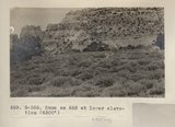
23
Same as 668 at lower elevation (6500') (Navajo Mtn, Photo G366)
1913
Image
24
San Francisco Mountain (Photo N-M83a)
1910
Image
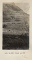
25
Shore line south of Provo, 1900
1900
Image
1
-
25
of
30
<
1
2
>