|
|
Title | Collection Number And Name | Photo Number |
| 26 |
 |
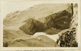
Cathedral Arch I. Arch Canyon | P0013 Herbert E. Gregory Photograph Collection | P0013n09_169_2040 |
| 27 |
 |
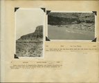
Keystone Arch, Arch Canyon, Coconino sandstone | P0013 Herbert E. Gregory Photograph Collection | P0013n09_169_2041 |
| 28 |
 |
Keystone Arch, Arch Canyon, Coconino sandstone | P0013 Herbert E. Gregory Photograph Collection | P0013n09_170_2042 |
| 29 |
 |
Bluffs at Bluff, UT | P0013 Herbert E. Gregory Photograph Collection | P0013n09_170_2043 |
| 30 |
 |
Herbert E. Gregory Book 10: San Juan, Zion, Capitol Reef, 1915-1938 | P0013 Herbert E. Gregory Photograph Collection | P0013n10 |
| 31 |
 |
Colorado River looking up stream from the mouth of Moki Canyon. | P0013 Herbert E. Gregory Photograph Collection | P0013n10_003_2095 |
| 32 |
 |
Colorado River looking down stream from the mouth of Moki Canyon (at the left). | P0013 Herbert E. Gregory Photograph Collection | P0013n10_004_2096 |
| 33 |
 |
Mouth of Moki Canyon. Colorado River would be at the right. | P0013 Herbert E. Gregory Photograph Collection | P0013n10_005_2097 |
| 34 |
 |
Looking into Moki Canyon 25 mi. up from the mouth. It is the only entrance except a trail nearby and one at the head. There is no way to get into the canyon between this point and the mouth 25 mi. below. | P0013 Herbert E. Gregory Photograph Collection | P0013n10_005_2098 |
| 35 |
 |
Face of cliffs about 2 miles north of Clay Hills Crossing (San Juan River). Lower and middle parts of "Moenkopi" above Coconino, San Juan County, Utah, 1930. | P0013 Herbert E. Gregory Photograph Collection | P0013n10_044_2162 |
| 36 |
 |
Face of cliffs about 3 miles north of Clay Hills Crossing (San Juan River). Middle and upper "Moenkopi." Chinle and Wingate in background. Chinle material forms slide. San Juan County, Utah, 1930. | P0013 Herbert E. Gregory Photograph Collection | P0013n10_044_2163 |
| 37 |
 |
Same as G(901). [Face of cliffs about 3 miles north of Clay Hills Crossing (San Juan River). Middle and upper "Moenkopi." Chinle and Wingate in background. Chinle material forms slide. San Juan County, Utah, 1930.] | P0013 Herbert E. Gregory Photograph Collection | P0013n10_045_2164 |
| 38 |
 |
Same as G(901). [Face of cliffs about 3 miles north of Clay Hills Crossing (San Juan River). Middle and upper "Moenkopi." Chinle and Wingate in background. Chinle material forms slide. San Juan County, Utah, 1930.] | P0013 Herbert E. Gregory Photograph Collection | P0013n10_045_2165 |
| 39 |
 |
Spring on desert flat at Red House, head of Red Canyon where by recession of cliffs the floor of Red Canyon is nearly on a level with Grand Flats, Marvin Lyman, San Juan County, Utah, 1930. | P0013 Herbert E. Gregory Photograph Collection | P0013n10_046_2166 |
| 40 |
 |
Montezuma Canyon at mouth of Verdure Creek, Morrison resting on Bluff sandstone (Dakota in left background). San Juan County, Utah, 1930. | P0013 Herbert E. Gregory Photograph Collection | P0013n10_046_2167 |
| 41 |
 |
Same as G(905) [Montezuma Canyon at mouth of Verdure Creek, Morrison resting on Bluff sandstone (Dakota in left background). San Juan County, Utah, 1930.] | P0013 Herbert E. Gregory Photograph Collection | P0013n10_047_2168 |
| 42 |
 |
Wall of Kanab Canyon, Wingate and Todilto. Kane County, Utah, 1930. | P0013 Herbert E. Gregory Photograph Collection | P0013n10_048_2169 |
| 43 |
 |
Wall of branch of Kanab Canyon, Wingate, Todilto, fragment of Navajo. Kane County, Utah, 1930. | P0013 Herbert E. Gregory Photograph Collection | P0013n10_048_2170 |
| 44 |
 |
Wingate sandstone, Kanab Canyon, Kane County, Utah, 1930. | P0013 Herbert E. Gregory Photograph Collection | P0013n10_049_2171 |
| 45 |
 |
Basalt wall of East Fork of Virgin River above Glendale. Lava that filled the ancient canyon has been trenched. Kane County, Utah. | P0013 Herbert E. Gregory Photograph Collection | P0013n10_049_2172 |
| 46 |
 |
Duck Lake (Navajo Lake) formed by lava flow (foreground) that crossed a branch of Sevier River. On road east of Cedar Breaks, Kane County, Utah, 1930. | P0013 Herbert E. Gregory Photograph Collection | P0013n10_050_2173 |
| 47 |
 |
Aspen forest, branch of Sevier River, east of Cedar Breaks, Kane County, Utah, 1930. | P0013 Herbert E. Gregory Photograph Collection | P0013n10_050_2174 |
| 48 |
 |
Upper wall of Big Meadow Canyon (on Zion-Mt. Carmel road). Morrison strata, unconsolidated Dakota ? (black band), and coal-bearing Cretaceous. Kane County, Utah, 1930. | P0013 Herbert E. Gregory Photograph Collection | P0013n10_051_2175 |
| 49 |
 |
[Upper wall of Big Meadow Canyon (on Zion-Mt. Carmel road). Morrison strata, unconsolidated Dakota ? (black band), and coal-bearing Cretaceous. Kane County, Utah, 1930] | P0013 Herbert E. Gregory Photograph Collection | P0013n10_051_2176 |
| 50 |
 |
Upper wall of Big Meadow Canyon, Morrison, Dakota, Cretaceous. Kane County, Utah, 1930. | P0013 Herbert E. Gregory Photograph Collection | P0013n10_051_2177 |