1 - 25 of 66
Number of results to display per page
TitleDateType
1 "Dome formation" (Navajo sandstone) east of "Wilson Creek," 1921.1921Image
2 "Sand waves" just breaking and flattening near Honoker Trail, San Juan canyon, 1921.1921Image
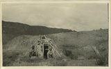
3 Abandoned hogan on east side of the San Juan some 3 miles above the mouth of Pinte Creek. San Juan County, UT. 19211921Image
4 Abandoned Logan, San Juan River, 10 miles above mouth1920; 1921; 1922; 1923; 1924; 1925; 1926; 1927; 1928; 1929; 1930Image
5 Arch Canyon, Coconino over Supai1920; 1921; 1922; 1923; 1924; 1925; 1926; 1927; 1928; 1929; 1930Image
6 Bluffs at Bluff, UT1920; 1921; 1922; 1923; 1924; 1925; 1926; 1927; 1928; 1929; 1930Image
7 Camp in San Juan Canyon near mouth of Johns Canyon. Lower Part of wall formed by Goodridge formation and upper part by Moonlight sandstone and Hermit shale. San Juan County, UT. 19211921Image
8 Cathedral Arch I. Arch Canyon1920; 1921; 1922; 1923; 1924; 1925; 1926; 1927; 1928; 1929; 1930Image
9 Cathedral Arch I. Arch Canyon1920; 1921; 1922; 1923; 1924; 1925; 1926; 1927; 1928; 1929; 1930Image
10 Cathedral Arch II, Arch Canyon, Coconino over Supai1920; 1921; 1922; 1923; 1924; 1925; 1926; 1927; 1928; 1929; 1930Image
11 Cathedral Arch II, Arch Canyon, Coconino over Supai1920; 1921; 1922; 1923; 1924; 1925; 1926; 1927; 1928; 1929; 1930Image
12 Cliff house north side of San Juan near Bluff1920; 1921; 1922; 1923; 1924; 1925; 1926; 1927; 1928; 1929; 1930Image
13 Cliff House, Fable Valley (Fred Lowrey, Honolulu)1920; 1921; 1922; 1923; 1924; 1925; 1926; 1927; 1928; 1929; 1930Image
14 Cliff House, Fable Valley (Fred Lowrey, Honolulu)1920; 1921; 1922; 1923; 1924; 1925; 1926; 1927; 1928; 1929; 1930Image
15 Cliff House, Fable Valley (Fred Lowrey, Honolulu)1920; 1921; 1922; 1923; 1924; 1925; 1926; 1927; 1928; 1929; 1930Image
16 Entrance into San Juan Canyon just below mouth of Chinle Creek. Canyon in Goodridge formation. Looking southwest. 1921. San Juan County, UT1921Image
17 Entrance into San Juan Canyon just below mouth of Chinle Creek. Canyon in Goodridge formation. Looking southwest. 1921. San Juan County, UT1921Image
18 Goosenecks near Tabernacle Loop, San Juan canyon, 1921.1921Image
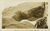
19 Hole in the Rock, Colorado River, 10 miles above mouth of San Juan, 1921.1921Image
20 Inscriptions right bank, Glen Canyon below Smith's Fork1920; 1921; 1922; 1923; 1924; 1925; 1926; 1927; 1928; 1929; 1930Image
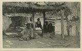
21 Jim Joe's house and family near mouth of Butler Wash, 1921.1921Image
22 Jim Joe's House, U.S.G.S. = U.S. Geological Survey, Miser 654 (Robert T. Allen), near mouth of Butler Wash1920; 1921; 1922; 1923; 1924; 1925; 1926; 1927; 1928; 1929; 1930Image
23 Keystone Arch, Arch Canyon, Coconino sandstone1920; 1921; 1922; 1923; 1924; 1925; 1926; 1927; 1928; 1929; 1930Image
24 Keystone Arch, Arch Canyon, Coconino sandstone1920; 1921; 1922; 1923; 1924; 1925; 1926; 1927; 1928; 1929; 1930Image
25 Looking down San Juan Canyon between mouth of Moonlight Creek and Clay Hill Crossing. Canyon walls formed by Moonlight sandstone. K.W. Trimble topographic engineer, at plane table. R.W. Allen recorder, standing nearby. San Juan County, UT. H. D. Miser, 19211921Image
1 - 25 of 66