Over 70,000 photos covering a variety of topics from Marriott Library Special Collections
TO
| Title | Date | Type | ||
|---|---|---|---|---|
| 1 |
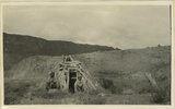 |
Abandoned Logan, San Juan River, 10 miles above mouth | 1920; 1921; 1922; 1923; 1924; 1925; 1926; 1927; 1928; 1929; 1930 | Image |
| 2 |
 |
Arch Canyon, Coconino over Supai | 1920; 1921; 1922; 1923; 1924; 1925; 1926; 1927; 1928; 1929; 1930 | Image |
| 3 |
 |
Bluffs at Bluff, UT | 1920; 1921; 1922; 1923; 1924; 1925; 1926; 1927; 1928; 1929; 1930 | Image |
| 4 |
 |
Cathedral Arch I. Arch Canyon | 1920; 1921; 1922; 1923; 1924; 1925; 1926; 1927; 1928; 1929; 1930 | Image |
| 5 |
 |
Cathedral Arch I. Arch Canyon | 1920; 1921; 1922; 1923; 1924; 1925; 1926; 1927; 1928; 1929; 1930 | Image |
| 6 |
 |
Cathedral Arch II, Arch Canyon, Coconino over Supai | 1920; 1921; 1922; 1923; 1924; 1925; 1926; 1927; 1928; 1929; 1930 | Image |
| 7 |
 |
Cathedral Arch II, Arch Canyon, Coconino over Supai | 1920; 1921; 1922; 1923; 1924; 1925; 1926; 1927; 1928; 1929; 1930 | Image |
| 8 |
 |
Cliff house north side of San Juan near Bluff | 1920; 1921; 1922; 1923; 1924; 1925; 1926; 1927; 1928; 1929; 1930 | Image |
| 9 |
 |
Cliff House, Fable Valley (Fred Lowrey, Honolulu) | 1920; 1921; 1922; 1923; 1924; 1925; 1926; 1927; 1928; 1929; 1930 | Image |
| 10 |
 |
Cliff House, Fable Valley (Fred Lowrey, Honolulu) | 1920; 1921; 1922; 1923; 1924; 1925; 1926; 1927; 1928; 1929; 1930 | Image |
| 11 |
 |
Cliff House, Fable Valley (Fred Lowrey, Honolulu) | 1920; 1921; 1922; 1923; 1924; 1925; 1926; 1927; 1928; 1929; 1930 | Image |
| 12 |
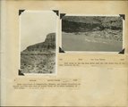 |
Herbert E. Gregory Book 10: San Juan, Zion, Capitol Reef, 1915-1938 | 1915; 1916; 1917; 1918; 1919; 1920; 1921; 1922; 1923; 1924; 1925; 1926; 1927; 1928; 1929; 1930; 1931; 1932; 1933; 1934; 1935; 1936; 1937; 1938 | Image |
| 13 |
 |
Inscriptions right bank, Glen Canyon below Smith's Fork | 1920; 1921; 1922; 1923; 1924; 1925; 1926; 1927; 1928; 1929; 1930 | Image |
| 14 |
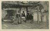 |
Jim Joe's House, U.S.G.S. = U.S. Geological Survey, Miser 654 (Robert T. Allen), near mouth of Butler Wash | 1920; 1921; 1922; 1923; 1924; 1925; 1926; 1927; 1928; 1929; 1930 | Image |
| 15 |
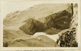 |
Keystone Arch, Arch Canyon, Coconino sandstone | 1920; 1921; 1922; 1923; 1924; 1925; 1926; 1927; 1928; 1929; 1930 | Image |
| 16 |
 |
Keystone Arch, Arch Canyon, Coconino sandstone | 1920; 1921; 1922; 1923; 1924; 1925; 1926; 1927; 1928; 1929; 1930 | Image |
| 17 |
 |
Looking down San Juan River, 3/4 mile below Makai Creek | 1920; 1921; 1922; 1923; 1924; 1925; 1926; 1927; 1928; 1929; 1930 | Image |
| 18 |
 |
Looking down San Juan River, near Spencer Camp, U.S.G.S. Miser 607, Robert T. Allen | 1920; 1921; 1922; 1923; 1924; 1925; 1926; 1927; 1928; 1929; 1930 | Image |
| 19 |
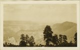 |
Looking into head of Arch Canyon from Elk ridge. Coconino, Moenkopi, Shinarump | 1920; 1921; 1922; 1923; 1924; 1925; 1926; 1927; 1928; 1929; 1930 | Image |
| 20 |
 |
Looking up San Juan River 6 miles below Spencer Camp, U.S.G.S. Miser 610, Robert T. Allen | 1920; 1921; 1922; 1923; 1924; 1925; 1926; 1927; 1928; 1929; 1930 | Image |
| 21 |
 |
Monuments in Arch Canyon, Coconino over Supai | 1920; 1921; 1922; 1923; 1924; 1925; 1926; 1927; 1928; 1929; 1930 | Image |
| 22 |
 |
Red House in Red Canyon, U. S. G. S., Miser, 448 | 1920; 1921; 1922; 1923; 1924; 1925; 1926; 1927; 1928; 1929; 1930 | Image |
| 23 |
 |
San Juan Canyon at mouth of Grand Gulch. Goodridge, Moonlight, and Hermit formations, Miser | 1920; 1921; 1922; 1923; 1924; 1925; 1926; 1927; 1928; 1929; 1930 | Image |
| 24 |
 |
San Juan Canyon between Honoker trail and Johns Canyon, Goodridge formation, Miser | 1920; 1921; 1922; 1923; 1924; 1925; 1926; 1927; 1928; 1929; 1930 | Image |
| 25 |
 |
San Juan River between narrows and mouth of Chinle, U. S. G. S., Miser, 418 | 1920; 1921; 1922; 1923; 1924; 1925; 1926; 1927; 1928; 1929; 1930 | Image |
