Home
Browse
Ask Us
Chat
Harmful Language Statement
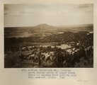
Log in
Photo Archives
Advanced Search
About
Over 70,000 photos covering a variety of topics from Marriott Library Special Collections
Year
1911
1912
1913
1914
1915
1916
1917
1918
1919
1920
1921
1922
1923
1924
1925
1926
TO
1911
1912
1913
1914
1915
1916
1917
1918
1919
1920
1921
1922
1923
1924
1925
1926
Type
Image
232
Format
image/jpeg
230
application/pdf
2
Collection
Photo Archives
232
Filters:
Collection Name:
"Herbert E. Gregory"
Date:
"1911"
Type:
"Image"
1
-
25
of
232
<
1
2
3
4
5
6
7
8
9
10
>
Gallery view
Number of results to display per page
10
25
50
100
200
Sort by Relevance
Sort by Title A-Z
Sort by Title Z-A
Sort by Date Ascending
Sort by Date Descending
Sort by Last Modified Ascending
Sort by Last Modified Descending
Title
Date
Type
1
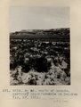
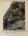
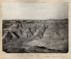
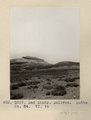
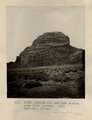
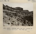
3± mi. north of Ganado. Tertiary unconformable on Dolores. VII, 19. 1911 (Photo G218)
1911
Image
2
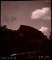
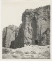
[Whiskey Creek palisades] (Photo N-M130)
1911
Image
3
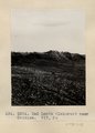
Abancay to La Estrella. Concacha. Nearer view of the same.
1911; 1912; 1915
Image
4
Another view of Photo G213. VI, 38 (Photo G213A)
1911
Image
5
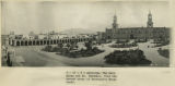
Arequipa. The main plaza and Mt. Chachani, from the second story of Morosini's Hotel Anexo.
1911; 1912; 1915
Image
6
Arnold and family (Chinlee) Navajo loom. Heald, photo, 1911 (Photo G282)
1911
Image
7
Ash and tuff near Biddehoche. VI, 84 (Photo G231)
1911
Image
8
Ash, Twin Buttes (Photo G252)
1911
Image
9
Ash, Twin Buttes (Photo G252)
1911
Image
10
Baby Llamas.
1911
Image
11
Bad Lands (Dolores) near Chinlee. VII, 26 (Photo G271)
1911
Image
12
Bad lands, Chinle strata in Hopi Buttes region, north east of Holbrook, Ariz. USGS, probably Darton
1911
Image
13
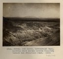
Bad Lands, Cottonwood Wash. 1909
1911
Image
14
Bad Lands, Cottonwood Wash. 1909 (photograph from Herbert E. Gregory Book 5: Navajo, 1911)
1911
Image
15
Bad Lands, Dolores. Lower Pueblo Colorado Wash. Section VI, 79-80. 1911 (Photo G226)
1911
Image
16
Bad Lands. Dolores. Butte No. 24. VI, 76 (Photo G227)
1911
Image
17
Baigaiche Mt., looking south across mouth of Black creek where it emerges from Todilto Park. Mrs. Gregory, photo. 1911 (Photo N-M118)
1911
Image
18
Basalt, Cedar Springs, AZ. 35± mi. north of Winslow. 1911 (Photo G242)
1911
Image
19
Bed (4), section of Dolores and LaPlata, west of Chinlee. VII, 28 (Photo G278)
1911
Image
20
Bed (9), section of Dolores and LaPlata west of Chinlee. VII, 28 (Photo G277)
1911
Image
21
Bedded ash and mud shales near Twin buttes. Barrows, photo 1911 (Photo G253)
1911
Image
22
Bedded ash, 2± mi. south of Cedar Springs. VI, 73 (2) (Photo G232)
1911
Image
23
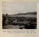
Black Creek valley, east toward Baigaiche Mt. VI, 45, 55 (Photo G299)
1911
Image
24
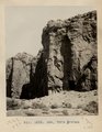
Butte, 3± mi. west of Stiles Ranche (Photo G238)
1911
Image
25
Butte, 3± mi. west of Stiles Ranche (Photo G238)
1911
Image
1
-
25
of
232
<
1
2
3
4
5
6
7
8
9
10
>