|
|
Title | Date | Type | Setname |
| 76 |
 |
Gregory's pack train at Marsh Pass, Ariz. (Edna H. Gregory, 1910, Photo N-M105) | 1910 | Image | uum_map |
| 77 |
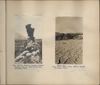 |
Herbert E. Gregory Book 4: Navajo, San Juan, 1910 | 1910 | Image | uum_map |
| 78 |
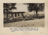 |
Holly's Ranche. 33+ mi. W. of Cortez, Colo., in McElmo valley, 1910 (Photo G128) | 1910 | Image | uum_map |
| 79 |
 |
Hotel Alvarado, Albuquerque, N.M., 1910 | 1910 | Image | uum_map |
| 80 |
 |
Indian trading post, John Wetherill, Oljato, Utah, 1910 (Photo G143) | 1910 | Image | uum_map |
| 81 |
 |
John Wetherill's store, Objato, Utah, 1910. | 1910 | Image | uum_map |
| 82 |
 |
Joints in LaPlata (?) sandstone. Head of Payute canyon, Utah, 1910 (Photo G183) | 1910 | Image | uum_map |
| 83 |
 |
Joints in LaPlata sandstone. Head of Pahute canyon, UT. 1910 (Photo G183) | 1910 | Image | uum_map |
| 84 |
 |
Keet Seel, cliff ruins east middle branch of Sagy (Towanaoche) canyon, Ariz., 1910 (Photo G165) | 1910 | Image | uum_map |
| 85 |
 |
Keet Seel, Segi Canyon, Navajo Reservation (J.D.L. VerPlank photo) | 1910 | Image | uum_map |
| 86 |
 |
LaPlata sandstone, Navajo Spring, 1910. | 1910 | Image | uum_map |
| 87 |
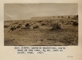 |
LaPlata sandstone, north bank of San Juan, 3+ mi. west of Bluff, Utah, 1910 (Photo N-M79 | 1910 | Image | uum_map |
| 88 |
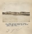 |
LaPlata sandstone, south bank of San Juan River, 3+ mi. above Bluff, Utah, 1910 (Photo G132) | 1910 | Image | uum_map |
| 89 |
 |
LaPlata sandstone, south bank of San Juan river, Bluff, Utah, 1910 (Photo G133) | 1910 | Image | uum_map |
| 90 |
 |
Looking across Navajo Canyon toward Navajo Mt. (Stephen Janus photo) | 1910 | Image | uum_map |
| 91 |
 |
Marsh Pass, Ariz. Recent cutting in alluvial filling of Laguna Creek, 1910 (Photo G156) | 1910 | Image | uum_map |
| 92 |
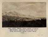 |
Marsh Pass, Ariz., looking northeast, LaPlata sandstone dipping southeast under Black Mesa (Photo G155) | 1910 | Image | uum_map |
| 93 |
 |
McElmo strata, Holly's ranch, McElmo valley, Colorado, 33± miles west of Cortez, Colorado. 1910 (Photo G-125) | 1910 | Image | uum_map |
| 94 |
 |
McElmo strata, Holly's ranche, McElmo valley, Colo., 33+ mi. west of Cortez, Colo., 1910 (Photo G-125) | 1910 | Image | uum_map |
| 95 |
 |
McElmo strata, Holly's ranche, McElmo valley, Colo., 33+ mi. west of Cortez, Colo., 1910 (Photo G-126) | 1910 | Image | uum_map |
| 96 |
 |
McElmo strata, Holly's ranche, McElmo valley, Colo., 33+ mi. west of Cortez, Colo., 1910 (Photo N-M76) | 1910 | Image | uum_map |
| 97 |
 |
McElmo strata, north bank of San Juan River, 10+ mi. below Aneth, Utah, 1910 (Photo G129) | 1910 | Image | uum_map |
| 98 |
 |
McElmo strata, north bank of San Juan River, 10+ mi. below Aneth, Utah, 1910 (Photo G130) | 1910 | Image | uum_map |
| 99 |
 |
McElmo strata, north bank of San Juan River, 10± mi. below Aneth, Utah, 1910 (Photo G129) | 1910 | Image | uum_map |
| 100 |
 |
Method of trapping coyotes, Oljato, Utah, 1910 (Photo G141) | 1910 | Image | uum_map |