Home
Browse
Ask Us
Chat
Harmful Language Statement
Log in
Photo Archives
Advanced Search
About
Over 70,000 photos covering a variety of topics from Marriott Library Special Collections
Year
1908
1909
1910
1911
1912
1913
1914
TO
1908
1909
1910
1911
1912
1913
1914
Type
Image
77
Format
image/jpeg
77
Collection Name
H.W. Bailey
77
Filters:
Collection Name:
"H.W. Bailey"
Collection:
uum_map
Format:
"image/jpeg"
1
-
25
of
77
<
1
2
3
4
>
Gallery view
Number of results to display per page
10
25
50
100
200
Sort by Relevance
Sort by Title A-Z
Sort by Title Z-A
Sort by Date Ascending
Sort by Date Descending
Sort by Last Modified Ascending
Sort by Last Modified Descending
Sort by Photo Number
Title
Setname
Type
1
Machinery
uum_map
Image
2
Machinery
uum_map
Image
3
Machinery
uum_map
Image
4
Machinery
uum_map
Image
5
Machinery
uum_map
Image
6
Machinery
uum_map
Image
7
1908 U. S. Land Office Map of the State of Nevada; showing location of Fairview, Churchill County, Nevada
uum_map
Image
8
Photographic copy of U.S. Geologic Survey Publication Geological Chart of the State of Nevada; Showing location of Fairview, Churchill County, Nevada
uum_map
Image
9
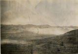
Hot Springs on Hot Springs Flat [1]
uum_map
Image
10
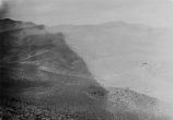
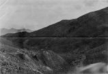
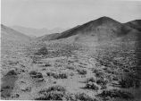
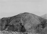
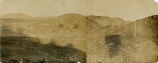
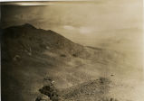
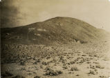
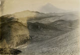
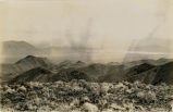
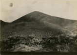
Ophir Mine - General vicinity [01]
uum_map
Image
11
Ore dump and waste dump on Golden Gate Lode Claim of Eagle Group of Mines Mineral County, Nevada; looking Southeast from point near camp on Golden Gate Lode.
uum_map
Image
12
Ophir Mine - General vicinity [02]
uum_map
Image
13
Ophir Mine - General vicinity [03]
uum_map
Image
14
Ophir Mine - General vicinity [04]
uum_map
Image
15
Ophir Mine - General vicinity [05]
uum_map
Image
16
Ophir Mine - General vicinity [06]
uum_map
Image
17
Ophir Mine - General vicinity [07]
uum_map
Image
18
Ophir Mine - General vicinity [08]
uum_map
Image
19
Ophir Mine - General vicinity [09]
uum_map
Image
20
Ophir Mine - General vicinity [10]
uum_map
Image
21
Ophir Mine - General vicinity [01]
uum_map
Image
22
Hot Springs on Hot Springs Flat [2]
uum_map
Image
23
Ophir Mine - General vicinity [11]
uum_map
Image
24
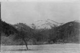
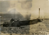
Wabuska Smelter
uum_map
Image
25
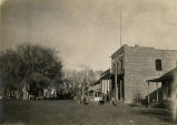
Birds eye view of Rawhide Nevada and vicinity of Ophir Camp
uum_map
Image
1
-
25
of
77
<
1
2
3
4
>