|
|
Title | Collection Number And Name | Photo Number |
| 1 |
 |
Machinery | P0023 H.W. Bailey Photograph Collection | p0023n01 |
| 2 |
 |
Machinery | P0023 H.W. Bailey Photograph Collection | p0023n02 |
| 3 |
 |
Machinery | P0023 H.W. Bailey Photograph Collection | p0023n03 |
| 4 |
 |
Machinery | P0023 H.W. Bailey Photograph Collection | p0023n04 |
| 5 |
 |
Machinery | P0023 H.W. Bailey Photograph Collection | p0023n05 |
| 6 |
 |
Machinery | P0023 H.W. Bailey Photograph Collection | p0023n06 |
| 7 |
 |
Hot Springs on Hot Springs Flat [1] | P0023 H.W. Bailey Photograph Collection | p0023n07 |
| 8 |
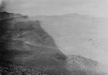 |
Ophir Mine - General vicinity [01] | P0023 H.W. Bailey Photograph Collection | p0023n08 |
| 9 |
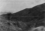 |
Ore dump and waste dump on Golden Gate Lode Claim of Eagle Group of Mines Mineral County, Nevada; looking Southeast from point near camp on Golden Gate Lode. | P0023 H.W. Bailey Photograph Collection | p0023n09 |
| 10 |
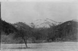 |
Ophir Mine - General vicinity [02] | P0023 H.W. Bailey Photograph Collection | p0023n10 |
| 11 |
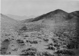 |
Ophir Mine - General vicinity [03] | P0023 H.W. Bailey Photograph Collection | p0023n11 |
| 12 |
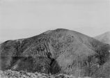 |
Ophir Mine - General vicinity [04] | P0023 H.W. Bailey Photograph Collection | p0023n12 |
| 13 |
 |
Ophir Mine - General vicinity [05] | P0023 H.W. Bailey Photograph Collection | p0023n13 |
| 14 |
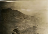 |
Ophir Mine - General vicinity [06] | P0023 H.W. Bailey Photograph Collection | p0023n14 |
| 15 |
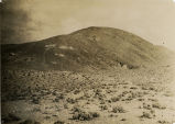 |
Ophir Mine - General vicinity [07] | P0023 H.W. Bailey Photograph Collection | p0023n15 |
| 16 |
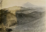 |
Ophir Mine - General vicinity [08] | P0023 H.W. Bailey Photograph Collection | p0023n16 |
| 17 |
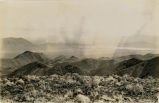 |
Ophir Mine - General vicinity [09] | P0023 H.W. Bailey Photograph Collection | p0023n17 |
| 18 |
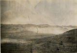 |
Ophir Mine - General vicinity [10] | P0023 H.W. Bailey Photograph Collection | p0023n18 |
| 19 |
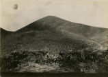 |
Ophir Mine - General vicinity [01] | P0023 H.W. Bailey Photograph Collection | p0023n19 |
| 20 |
 |
Hot Springs on Hot Springs Flat [2] | P0023 H.W. Bailey Photograph Collection | p0023n20 |
| 21 |
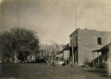 |
Ophir Mine - General vicinity [11] | P0023 H.W. Bailey Photograph Collection | p0023n21 |
| 22 |
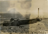 |
Wabuska Smelter | P0023 H.W. Bailey Photograph Collection | p0023n22 |
| 23 |
 |
Birds eye view of Rawhide Nevada and vicinity of Ophir Camp | P0023 H.W. Bailey Photograph Collection | p0023n23 |
| 24 |
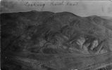 |
Looking Northeast -- Joe Dandy, Scotchman | P0023 H.W. Bailey Photograph Collection | p0023n24 |
| 25 |
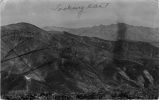 |
Looking East Scotchman Peak showing Ophir group and principal workings thereof | P0023 H.W. Bailey Photograph Collection | p0023n25 |
| 26 |
 |
View of Rawhide Nevada - from Hooligan Hill looking North and East | P0023 H.W. Bailey Photograph Collection | p0023n26 |
| 27 |
 |
Ophir Camp, Birds eye. Neco mining district - Nevada | P0023 H.W. Bailey Photograph Collection | p0023n27 |
| 28 |
 |
Nebraska sweller which is the custom swellers for Rawhide, Oplin and surrounding camps in Nevada | P0023 H.W. Bailey Photograph Collection | p0023n27b |
| 29 |
 |
Photographic copy of U.S. Geologic Survey Publication Geological Chart of the State of Nevada, with location of Ophir Mines drawn in | P0023 H.W. Bailey Photograph Collection | p0023n28 |
| 30 |
 |
Map of Nevada 1908; Photographic copy of General Land Office Mape of the State of Nevada, with location of Ophir Mines drawn in | P0023 H.W. Bailey Photograph Collection | p0023n29 |
| 31 |
 |
Nevada Mineral Districts 1912; Photographic copy of Map of Nevada showing location of Mining Districts and Ophir Mines | P0023 H.W. Bailey Photograph Collection | p0023n30 |
| 32 |
 |
Photographic copy of List of Mining Districts; 1912-1914 | P0023 H.W. Bailey Photograph Collection | p0023n31 |
| 33 |
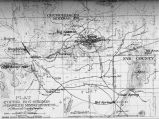 |
Photographic copy Contour Map of Ophir Mining District, Hot Springs District, Rawhide Mining District of Mineral County, Nevada | P0023 H.W. Bailey Photograph Collection | p0023n32 |
| 34 |
 |
General Map of Ophir Lode Claims; showing trend of lodes, contours, etc; 1910-1914 | P0023 H.W. Bailey Photograph Collection | p0023n33 |
| 35 |
 |
Geological Sheet - Ophir Lode Claims; 1910-1914 | P0023 H.W. Bailey Photograph Collection | p0023n34 |
| 36 |
 |
General plat of proposed work on Ophir Lode Claims; 1910-1914 | P0023 H.W. Bailey Photograph Collection | p0023n35 |
| 37 |
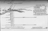 |
Prospective work - construction and installations on Ophir Mines;1910-1914 | P0023 H.W. Bailey Photograph Collection | p0023n36 |
| 38 |
 |
Nevada - Carson Sink Quadrangle; 1910 | P0023 H.W. Bailey Photograph Collection | p0023n37 |
| 39 |
 |
Nevada - California Hawthorne Quadrangle; 1909 | P0023 H.W. Bailey Photograph Collection | p0023n38 |
| 40 |
 |
View of Ophir Mines from summit of Ophir Peak; Olive and Eagle Mountains; looking West | P0023 H.W. Bailey Photograph Collection | p0023n39 |
| 41 |
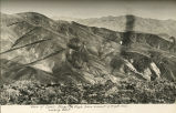 |
View of Ophir Mines and Peak from summit of Eagle Mountain; looking East | P0023 H.W. Bailey Photograph Collection | p0023n40 |
| 42 |
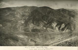 |
View of Ophir Mines and Peak from near summit of Olive Mountain | P0023 H.W. Bailey Photograph Collection | p0023n41 |
| 43 |
 |
View of Mountains from Summit Olive Mountain looking Southeast | P0023 H.W. Bailey Photograph Collection | p0023n42 |
| 44 |
 |
View of Mountains looking south east from summit of Eagle Mountain | P0023 H.W. Bailey Photograph Collection | p0023n43 |
| 45 |
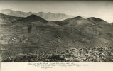 |
View of Ophir Peak, Eagle Mountain, Olive Mountain, etc; from Chieftan Hill showing Ophir and Royal Mines; looking East | P0023 H.W. Bailey Photograph Collection | p0023n44 |
| 46 |
 |
View of Eagle Mountain, Ophir Peak, Olive Mountain, etc; from summit of Monitor Hill; looking North and East | P0023 H.W. Bailey Photograph Collection | p0023n45 |
| 47 |
 |
View of Eagle Mountain Mines (Royal Mines); looking Northeast | P0023 H.W. Bailey Photograph Collection | p0023n46 |
| 48 |
 |
View of Royal Mines from summit Olive Mountain; looking Northeast | P0023 H.W. Bailey Photograph Collection | p0023n47 |
| 49 |
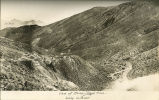 |
View of Ilump - Royal Mines; looking Southeast | P0023 H.W. Bailey Photograph Collection | p0023n48 |
| 50 |
 |
View of Olive Mountain looking East | P0023 H.W. Bailey Photograph Collection | p0023n49 |
| 51 |
 |
View looking West and South from Summit of Olive Mountain. | P0023 H.W. Bailey Photograph Collection | p0023n50 |
| 52 |
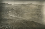 |
View looking West from Summit of Olive Mountain | P0023 H.W. Bailey Photograph Collection | p0023n51 |
| 53 |
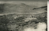 |
View of Eagle Mountain, Ophir Peak and Olive Mountain | P0023 H.W. Bailey Photograph Collection | p0023n52 |
| 54 |
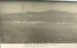 |
Wabuska Smelter at Thompson, Nevada; property of Mason Valley Mines Company | P0023 H.W. Bailey Photograph Collection | p0023n53 |
| 55 |
 |
Close up of Wabuska Smelter | P0023 H.W. Bailey Photograph Collection | p0023n54 |
| 56 |
 |
Wabuska Smelter - View looking Southwest | P0023 H.W. Bailey Photograph Collection | p0023n55 |
| 57 |
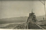 |
Dumping slag at Wabuska Smelter | P0023 H.W. Bailey Photograph Collection | p0023n56 |
| 58 |
 |
Rawhide, Nevada, Mineral County; view from Hooligan Hill looking North; Nevada's phenominal gold-silver camp producing $50,000 gold and silver per month | P0023 H.W. Bailey Photograph Collection | p0023n57 |
| 59 |
 |
Rawhide, Nevada, view from Grutt Hill looking South | P0023 H.W. Bailey Photograph Collection | p0023n58 |
| 60 |
 |
Interior of Black Eagle Mill; all steel construction | P0023 H.W. Bailey Photograph Collection | p0023n59 |
| 61 |
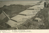 |
Nevada Hills Mill at Fairview, Churchill County, Nevada | P0023 H.W. Bailey Photograph Collection | p0023n60 |
| 62 |
 |
Hot Springs on Hot Springs Flat [3] | P0023 H.W. Bailey Photograph Collection | p0023n61 |
| 63 |
 |
1908 U. S. Land Office Map of the State of Nevada; showing location of Fairview, Churchill County, Nevada | P0023 H.W. Bailey Photograph Collection | p0023n62 |
| 64 |
 |
Photographic copy of U.S. Geologic Survey Publication Geological Chart of the State of Nevada; Showing location of Fairview, Churchill County, Nevada | P0023 H.W. Bailey Photograph Collection | p0023n63 |
| 65 |
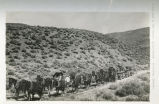 |
On the road to the Nevada Hills Mines, Fairview, Nevada | P0023 H.W. Bailey Photograph Collection | p0023n64 |
| 66 |
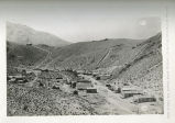 |
The town of Fairview, Nevada (New Town) looking South towards the hill and mine | P0023 H.W. Bailey Photograph Collection | p0023n65 |
| 67 |
 |
Rock Canyon near Nevada Hills Mine; big strike was made here in 1908 | P0023 H.W. Bailey Photograph Collection | p0023n66 |
| 68 |
 |
Town of Fairview looking North from Nevada Hills Mine; showing (Old) Town of Fairview in distance | P0023 H.W. Bailey Photograph Collection | p0023n67 |
| 69 |
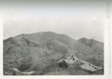 |
Nevada Hills Mine and Mill; looking East and showing Fairview Mountian distance | P0023 H.W. Bailey Photograph Collection | p0023n68 |
| 70 |
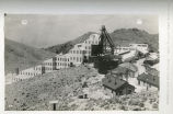 |
Nevada Hills Mill looking North; showing tanks and headframe | P0023 H.W. Bailey Photograph Collection | p0023n69 |
| 71 |
 |
Nevada Hills Mine and Mill; looking Northwest; showing residences, offices and headframe; Fairview, Nevada; Churchhill County | P0023 H.W. Bailey Photograph Collection | p0023n70 |
| 72 |
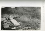 |
Nevada Hills Mine and Mill; Fairview; looking Northeast showing mill and Fairview Peak | P0023 H.W. Bailey Photograph Collection | p0023n71 |
| 73 |
 |
Fairview (Nevada Hills) Mill and surroundings; looking East and North | P0023 H.W. Bailey Photograph Collection | p0023n72 |
| 74 |
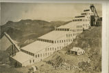 |
Nevada Hills Mill and surroundings; looking Northeast | P0023 H.W. Bailey Photograph Collection | p0023n73 |
| 75 |
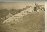 |
Nevada Hills Mill (at Fairview) looking North and East | P0023 H.W. Bailey Photograph Collection | p0023n74 |
| 76 |
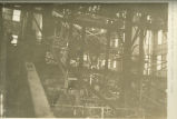 |
Interior view of Nevada Hills Mill at Fairview, Nevada | P0023 H.W. Bailey Photograph Collection | p0023n75 |
| 77 |
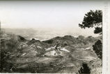 |
Nevada Hills Mine and Mill; looking North and West from near summit of Fairview Peak | P0023 H.W. Bailey Photograph Collection | p0023n76 |