Home
Browse
Ask Us
Chat
Harmful Language Statement
Log in
Photo Archives
Advanced Search
About
Over 70,000 photos covering a variety of topics from Marriott Library Special Collections
Year
1908
1909
1910
1911
1912
TO
1908
1909
1910
1911
1912
Type
Image
73
Format
image/jpeg
73
Collection
Photo Archives
73
Filters:
Collection Name:
"H.W. Bailey"
Date:
"1910"
26
-
50
of
73
<
1
2
3
>
Gallery view
Number of results to display per page
10
25
50
100
200
Sort by Relevance
Sort by Title A-Z
Sort by Title Z-A
Sort by Date Ascending
Sort by Date Descending
Sort by Last Modified Ascending
Sort by Last Modified Descending
Title
Date
Type
26
Nevada Hills Mill at Fairview, Churchill County, Nevada
1908; 1909; 1910; 1911; 1912
Image
27
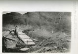
Nevada Hills Mill looking North; showing tanks and headframe
1908; 1909; 1910; 1911; 1912
Image
28
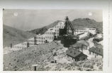
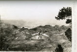
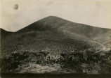
Nevada Hills Mine and Mill; Fairview; looking Northeast showing mill and Fairview Peak
1908; 1909; 1910; 1911; 1912
Image
29
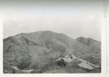
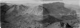
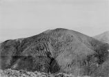
Nevada Hills Mine and Mill; looking East and showing Fairview Mountian distance
1908; 1909; 1910; 1911; 1912
Image
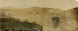
30
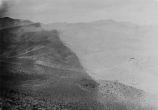
Nevada Hills Mine and Mill; looking North and West from near summit of Fairview Peak
1908; 1909; 1910; 1911; 1912
Image
31
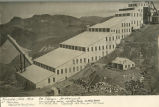
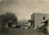
Nevada Hills Mine and Mill; looking Northwest; showing residences, offices and headframe; Fairview, Nevada; Churchhill County
1908; 1909; 1910; 1911; 1912
Image
32
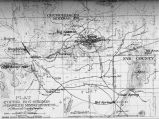
Nevada Mineral Districts 1912; Photographic copy of Map of Nevada showing location of Mining Districts and Ophir Mines
1908; 1909; 1910; 1911; 1912
Image
33
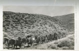
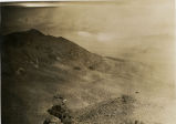
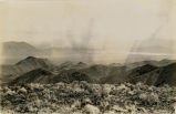
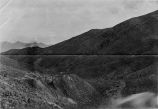
On the road to the Nevada Hills Mines, Fairview, Nevada
1908; 1909; 1910; 1911; 1912
Image
34
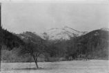
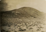
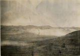
Ophir Camp, Birds eye. Neco mining district - Nevada
1908; 1909; 1910; 1911; 1912
Image
35
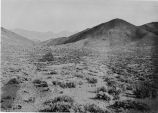
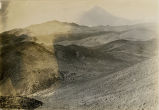
Ophir Mine - General vicinity [01]
1908; 1909; 1910; 1911; 1912
Image
36
Ophir Mine - General vicinity [01]
1908; 1909; 1910; 1911; 1912
Image
37
Ophir Mine - General vicinity [02]
1908; 1909; 1910; 1911; 1912
Image
38
Ophir Mine - General vicinity [03]
1908; 1909; 1910; 1911; 1912
Image
39
Ophir Mine - General vicinity [04]
1908; 1909; 1910; 1911; 1912
Image
40
Ophir Mine - General vicinity [05]
1908; 1909; 1910; 1911; 1912
Image
41
Ophir Mine - General vicinity [06]
1908; 1909; 1910; 1911; 1912
Image
42
Ophir Mine - General vicinity [07]
1908; 1909; 1910; 1911; 1912
Image
43
Ophir Mine - General vicinity [08]
1908; 1909; 1910; 1911; 1912
Image
44
Ophir Mine - General vicinity [09]
1908; 1909; 1910; 1911; 1912
Image
45
Ophir Mine - General vicinity [10]
1908; 1909; 1910; 1911; 1912
Image
46
Ophir Mine - General vicinity [11]
1908; 1909; 1910; 1911; 1912
Image
47
Ore dump and waste dump on Golden Gate Lode Claim of Eagle Group of Mines Mineral County, Nevada; looking Southeast from point near camp on Golden Gate Lode.
1908; 1909; 1910; 1911; 1912
Image
48
Photographic copy Contour Map of Ophir Mining District, Hot Springs District, Rawhide Mining District of Mineral County, Nevada
1908; 1909; 1910; 1911; 1912
Image
49
Photographic copy of U.S. Geologic Survey Publication Geological Chart of the State of Nevada, with location of Ophir Mines drawn in
1908; 1909; 1910; 1911; 1912
Image
50
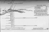
Prospective work - construction and installations on Ophir Mines;1910-1914
1908; 1909; 1910; 1911; 1912
Image
26
-
50
of
73
<
1
2
3
>