|
|
Title | Date | Type |
| 1 |
 |
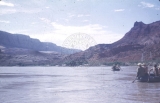
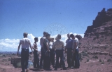
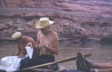
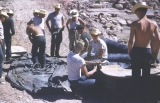
And then there were 3! | 1952-08-16 | Image |
| 2 |
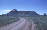 |
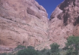
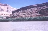
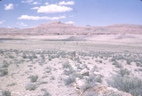
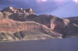
Approaching Bears Ear | 1952-08-11 | Image |
| 3 |
 |
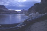
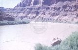
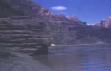
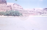
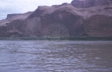
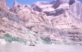
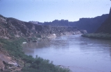
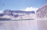
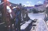
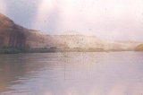
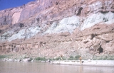
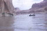
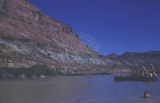
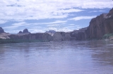
Approaching Lee's Ferry, Colorado River | 1952-08-18 | Image |
| 4 |
 |
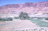
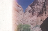
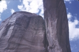
Arches country | 1952-08-11 | Image |
| 5 |
 |
Arches country | 1952-08-11 | Image |
| 6 |
 |
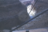
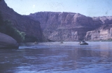
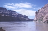
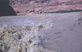
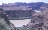
At Marble Canyon dam site | 1952-08-18 | Image |
| 7 |
 |
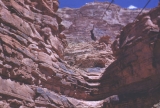
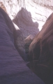
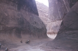
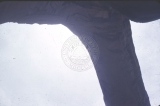
Aztec Canyon | 1952-08-16 | Image |
| 8 |
 |
Aztec Canyon | 1952-08-16 | Image |
| 9 |
 |
Aztec Canyon | 1952-08-16 | Image |
| 10 |
 |
Aztec Canyon | 1952-08-16 | Image |
| 11 |
 |
Aztec Canyon | 1952-08-16 | Image |
| 12 |
 |
Aztec Canyon | 1952-08-16 | Image |
| 13 |
 |
Aztec Canyon | 1952-08-16 | Image |
| 14 |
 |
Aztec Canyon, only 2 boats | 1952-08-16 | Image |
| 15 |
 |
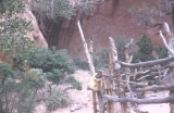
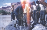
Beneath Rainbow Bridge registry | 1952-08-16 | Image |
| 16 |
 |
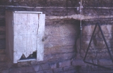
Bert Loper's cabin | 1952-08-12 | Image |
| 17 |
 |
Bert Loper's cabin, irrigation lift | 1952-08-12 | Image |
| 18 |
 |
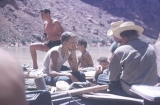
Boat scene, lower Glen Canyon | 1952-08 | Image |
| 19 |
 |
Bob Kenyon, Ray Day at Hole in Rock spring | 1952-08-15 | Image |
| 20 |
 |
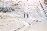
Boys look around a bit, Lower White Canyon | 1952-08-11 | Image |
| 21 |
 |
Boys on a rock, Hole in Rock | 1952-08-15 | Image |
| 22 |
 |
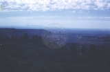
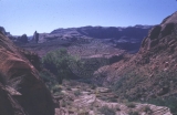
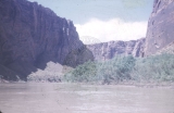
Boys overlook arches scenery | 1952-08-11 | Image |
| 23 |
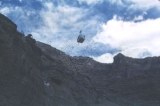 |
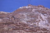
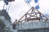
Cable and cable car, late summer, 1952 | 1952-08 | Image |
| 24 |
 |
Cable and cable car, late summer, 1952 | 1952-08 | Image |
| 25 |
 |
Cable and cable car, late summer, 1952 | 1952-08 | Image |
| 26 |
 |
Cable and cable car, late summer, 1952 | 1952-08 | Image |
| 27 |
 |
Cable and cable car, late summer, 1952 | 1952-08 | Image |
| 28 |
 |
Cable and cable car, late summer, 1952 | 1952-08 | Image |
| 29 |
 |
Cable and cable car, late summer, 1952 | 1952-08 | Image |
| 30 |
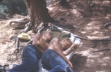
 |
Cable and cable car, late summer, 1952 | 1952-08 | Image |
| 31 |
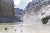
 |
Cable and cable car, late summer, 1952 | 1952-08 | Image |
| 32 |
 |
Cable and cable car, late summer, 1952 | 1952-08 | Image |
| 33 |
 |
Cable and cable car, late summer, 1952 | 1952-08 | Image |
| 34 |
 |
Cable and cable car, late summer, 1952 | 1952-08 | Image |
| 35 |
 |
Cable and cable car, late summer, 1952 | 1952-08 | Image |
| 36 |
 |
Cable and cable car, late summer, 1952 | 1952-08 | Image |
| 37 |
 |
Cable and cable car, late summer, 1952 | 1952-08 | Image |
| 38 |
 |
Cable and cable car, late summer, 1952 | 1952-08 | Image |
| 39 |
 |
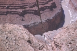
Colorado River, Marble Canyon dam site | 1952-08-18 | Image |
| 40 |
 |
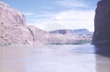
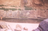
Cove, Marble Canyon, from motor boat below Marble Canyon dam site | 1952-08-18 | Image |
| 41 |
 |
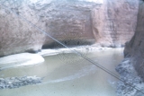
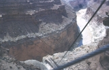
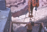
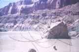
Crossing Colorado to river level on lower cable way, raining | 1952-08-18 | Image |
| 42 |
 |
Diving exhibition, mid-Glen Canyon | 1952-08-14 | Image |
| 43 |
 |
Drift past old mining installation, about 12-15 miles below Hite | 1952-08-12 | Image |
| 44 |
 |
Drifting down the river on a lazy afternoon, lower Glen Canyon | 1952-08 | Image |
| 45 |
 |
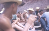
Echo Camp, chow | 1952-08-16 | Image |
| 46 |
 |
Echo Camp, chow time | 1952-08-16 | Image |
| 47 |
 |
Echo Camp, corral | 1952-08-16 | Image |
| 48 |
 |
Echo Camp, corral | 1952-08-16 | Image |
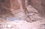
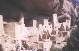
| 49 |
 |
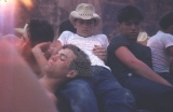
Echo Camp, resting | 1952-08-16 | Image |
| 50 |
 |
Falls | 1952-08 | Image |
| 51 |
 |
Fastening Deck | 1952-08-11 | Image |
| 52 |
 |
Glen Canyon near Hole in the Rock | 1952-08-15 | Image |
| 53 |
 |
Gong at Hite's Crossing, Chaffin's Ferry | 1952-08-11 | Image |
| 54 |
 |
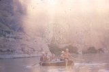
GRB in "old shady," August 18, 1952 | 1952-08-18 | Image |
| 55 |
 |
Hidden Canyon, Glen Canyon | 1952-08-16 | Image |
| 56 |
 |
Hole in Rock | 1952-08-15 | Image |
| 57 |
 |
Hole in Rock | 1952-08-15 | Image |
| 58 |
 |
Hole in Rock switchbacks toward river | 1952-08-15 | Image |
| 59 |
 |
Hole in the Rock, above-switchbacks below | 1952-08-15 | Image |
| 60 |
 |
Is that a boat over on that bar?!! | 1952-08 | Image |
| 61 |
 |
It must be Arizona up ahead | 1952-08-18 | Image |
| 62 |
 |
Just above Escalante mouth | 1952-08-14 | Image |
| 63 |
 |
Just below Hole in Rock, note grade of old Mormon road up bluff | 1952-08-15 | Image |
| 64 |
 |
Last 10 miles, Glen Canyon | 1952-08-18 | Image |
| 65 |
 |
Last 10 miles, Glen Canyon | 1952-08-18 | Image |
| 66 |
 |
Leaving (down river) Hole in Rock | 1952-08-15 | Image |
| 67 |
 |
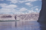
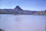
Little Colorado, Shadow Mountain, Marble Platform | 1952-08 | Image |
| 68 |
 |
Looking up Marble Canyon from desert view, Grand Canyon and Colorado Chiquito in foreground | 1952-08 | Image |
| 69 |
 |
Looking up river, over Hole in Rock camp | 1952-08-15 | Image |
| 70 |
 |
Lower Glen Canyon | 1952-08 | Image |
| 71 |
 |
Lower Glen Canyon | 1952-08 | Image |
| 72 |
 |
Lower Glen Canyon | 1952-08 | Image |
| 73 |
 |
Lower Glen Canyon | 1952-08 | Image |
| 74 |
 |
Lower Glen Canyon | 1952-08 | Image |
| 75 |
 |
Lower Glen Canyon | 1952-08 | Image |
| 76 |
 |
Lower Glen Canyon | 1952-08 | Image |
| 77 |
 |
Lower Glen Canyon | 1952-08 | Image |
| 78 |
 |
Lower Glen Canyon | 1952-08 | Image |
| 79 |
 |
Lower Glen Canyon | 1952-08 | Image |
| 80 |
 |
Lower Glen Canyon, sidewalls start to steepen | 1952-08 | Image |
| 81 |
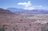 |
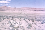
Lower White Canyon, Henry Mountains | 1952-08-11 | Image |
| 82 |
 |
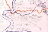
Map drawn by Barfoot of formation of Rainbow Bridge | 1952 | Image |
| 83 |
 |
Map drawn by Barfoot of Glen Canyon Detail | 1952 | Image |
| 84 |
 |
Map drawn by Barfoot of Hite's Landing, White Canyon, Red Canyon, Loper's Cabin, and Bear's Ear | 1952 | Image |
| 85 |
 |
Map drawn by Barfoot of Hole in Rock detail | 1952-08-14 | Image |
| 86 |
 |
Map drawn by Barfoot of mid-Glen Canyon detail | 1952 | Image |
| 87 |
 |
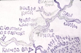
Map drawn by Barfoot of Narrow Canyon, Music Temple | 1952 | Image |
| 88 |
 |
Map drawn by Barfoot of Rainbow Bridge detail | 1952 | Image |
| 89 |
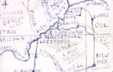 |
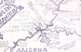
Map drawn by Barfoot of the Four Corner's Area | 1952 | Image |
| 90 |
 |
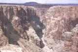
Marble Canyon, from ledge near dam site | 1952-08-18 | Image |
| 91 |
 |
Mealtime | 1952-08 | Image |
| 92 |
 |
Mid Glen Canyon, above Rincon, shallow water, wide and slow river | 1952-08-14 | Image |
| 93 |
 |
Mid Glen Canyon, drifting just below Escalante | 1952-08-14 | Image |
| 94 |
 |
Middle Glen Canyon, Narrow Canyon | 1952-08-15 | Image |
| 95 |
 |
Mile 15, dam site, USBR, Glen Canyon | 1952-08-18 | Image |
| 96 |
 |
Monument Valley, August, 1955 | 1952-08 | Image |
| 97 |
 |
Mouth of Escalante | 1952-08-14 | Image |
| 98 |
 |
Mouth of Narrow Canyon | 1952-08-15 | Image |
| 99 |
 |
Mouth of Narrow Canyon | 1952-08-15 | Image |
| 100 |
 |
Mouth of the Escalante, north shore (note "Bullfrog") | 1952-08-14 | Image |
| 101 |
 |
Mr. Chaffin's ferry, Hite, Utah | 1952-08-11 | Image |
| 102 |
 |
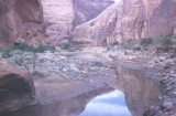
Music Temple, time exposed | 1952-08-15 | Image |
| 103 |
 |
Narrow Canyon | 1952-08-15 | Image |
| 104 |
 |
Narrow Canyon | 1952-08-15 | Image |
| 105 |
 |
Narrow Canyon | 1952-08-15 | Image |
| 106 |
 |
Narrow Canyon, Mile 76 | 1952-08-15 | Image |
| 107 |
 |
Narrows, lower Bridge Canyon | 1952-08-16 | Image |
| 108 |
 |
Navajo Mountain from Colorado River, west aspect, about mile 72, below Music Temple, above Aztec Canyon | 1952-08-15 | Image |
| 109 |
 |
Navajo Mountain from mid-Glen Canyon, or possibly looking back at Henry | 1952-08 | Image |
| 110 |
 |
Navajo Mountain, about mile 72 | 1952-08-15 | Image |
| 111 |
 |
Near Elvado De Los Padres | 1952-08-17 | Image |
| 112 |
 |
New vistas every minute, Upper Glen Canyon | 1952-08-12 | Image |
| 113 |
 |
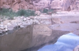
Nice riffle above the Rincon | 1952-08-14 | Image |
| 114 |
 |
Nice spring here, lower Glen Canyon | 1952-08 | Image |
| 115 |
 |
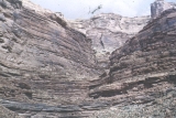
Note geologic layers | 1952-08 | Image |
| 116 |
 |
One jumps off, Hole in Rock | 1952-08-15 | Image |
| 117 |
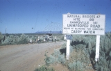 |
Outskirts of Blanding | 1952-08-11 | Image |
| 118 |
 |
Past mid-Glen Canyon | 1952-08 | Image |
| 119 |
 |
Petrified log on desert near Gap | 1952-08 | Image |
| 120 |
 |
Petrified log on desert near Gap | 1952-08 | Image |
| 121 |
 |
Petrified log, Marble Platform near Gap | 1952-08 | Image |
| 122 |
 |
Petrified Wood, Marble Platform | 1952-08 | Image |
| 123 |
 |
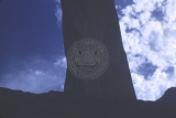
Plaque beneath Rainbow Bridge | 1952-08-16 | Image |
| 124 |
 |
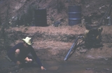
Pumping exercises | 1952-08 | Image |
| 125 |
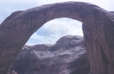 |
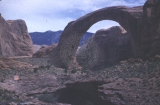
Rainbow Bridge | 1952-08-16 | Image |
| 126 |
 |
Rainbow Bridge | 1952-08-16 | Image |
| 127 |
 |
Rainbow Bridge | 1952-08-16 | Image |
| 128 |
 |
Rainbow Bridge | 1952-08-16 | Image |
| 129 |
 |
Rainbow Bridge | 1952-08-16 | Image |
| 130 |
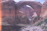 |
Rainbow Bridge from south side | 1952-08-16 | Image |
| 131 |
 |
Rainbow Bridge from trail, Navajo Mountain in background | 1952-08-16 | Image |
| 132 |
 |
Rainbow Bridge register | 1952-08-16 | Image |
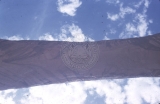
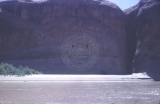
| 133 |
 |
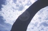
Rainbow Bridge, belly view | 1952-08-16 | Image |
| 134 |
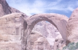 |
Rainbow Bridge, conventional view | 1952-08-16 | Image |
| 135 |
 |
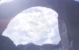
Rainbow Bridge, looking up | 1952-08-16 | Image |
| 136 |
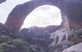 |
Rainbow Bridge, north side from creek, not boys | 1952-08-16 | Image |
| 137 |
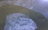 |
Rainbow Bridge, reflection in pool | 1952-08-16 | Image |
| 138 |
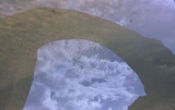 |
Rainbow Bridge, reflection in pool | 1952-08-16 | Image |
| 139 |
 |
Riffle above the Rincon | 1952-08-14 | Image |
| 140 |
 |
Riffle above the Rincon | 1952-08-14 | Image |
| 141 |
 |
Riffle, lower Glen Canyon | 1952-08 | Image |
| 142 |
 |
The Rincon-upwarp (circle cliffs upwarp) here exposes painted desert (chinle) formation | 1952-08-14 | Image |
| 143 |
 |
River just below Hite's ferry | 1952-08-11 | Image |
| 144 |
 |
Side Canyon off Glen Canyon | 1952-08 | Image |
| 145 |
 |
Time to relax, past mid-Glen Canyon | 1952-08 | Image |
| 146 |
 |
Trees, sand bar, slit of a canyon wall, down Glen Canyon | 1952-08 | Image |
| 147 |
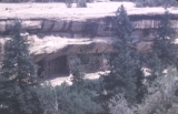 |
Unidentified cliff dwellings | 1952-08 | Image |
| 148 |
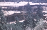 |
Unidentified cliff dwellings | 1952-08 | Image |
| 149 |
 |
Unidentified cliff dwellings | 1952-08 | Image |
| 150 |
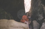 |
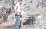
Unidentified woman and child in a canyon | 1952-08 | Image |
| 151 |
 |
Upper Glen Canyon | 1952-08-12 | Image |
| 152 |
 |
Upper Glen Canyon | 1952-08-12 | Image |
| 153 |
 |
Upper Glen Canyon | 1952-08 | Image |
| 154 |
 |
Upper Glen Canyon, canyon walls gradually deepen | 1952-08 | Image |
| 155 |
 |
Upper Glen Canyon, late afternoon | 1952-08 | Image |
| 156 |
 |
Vertical striping | 1952-08 | Image |
| 157 |
 |
View of river from switchbacks at Hole in the Rock | 1952-08-15 | Image |
| 158 |
 |
Vistas, lower Glen Canyon | 1952-08 | Image |
| 159 |
 |
What's trump? Who's a tramp? | 1952-08 | Image |
| 160 |
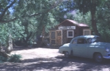 |
White Canyon Trading Post | 1952-08-11 | Image |
| 161 |
 |
Wish we could find those boats! | 1952-08-16 | Image |
| 162 |
 |
½ way down side of Marble Canyon cable way | 1952-08-18 | Image |