|
|
Title | Collection Number And Name | Photo Number |
| 1 |
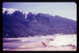 |
Flooding from snow runoff, mouth of Weber Canyon. Weber River has overtopped its normal channel banks and covers its flood plain. Periodically, structures situated on this flood plain become inundated. Note: ancient Lake Bonneville terraces may be seen on the mountain front. | P1274 Environmental Geology and Geologic Hazards in Utah Photograph Collection | p1274n001 |
| 2 |
 |
Big Cottonwood Creek flooding in Salt Lake City. Numerous houses along its banks were flooded in 1952. | P1274 Environmental Geology and Geologic Hazards in Utah Photograph Collection | p1274n002 |
| 3 |
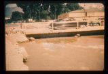 |
Sandbagging of Big Cottonwood Creek to confine its flow. Bridge was temporary, to span floodwaters. | P1274 Environmental Geology and Geologic Hazards in Utah Photograph Collection | p1274n003 |
| 4 |
 |
September 1970 flooding, by widespread cloudburst, of the San Juan River, seen here to occupy most of its floodplain. Bridge is only link to civilization for approximately 1,000 Navajo Indians. Note that only the left one-third of bridge has escaped attack by rising flood waters (other two-thirds appear muddy). Oblique aerial view. Most of Utah is subject to cloudburst flooding from April to September. Cloudbursts are of short duration and high intensity. | P1274 Environmental Geology and Geologic Hazards in Utah Photograph Collection | p1274n004 |
| 5 |
 |
Cloudburst flood caused erosion of the North Bench in Salt Lake City. Eroded channel begins where paved street ends. | P1274 Environmental Geology and Geologic Hazards in Utah Photograph Collection | p1274n005 |
| 6 |
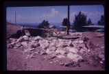 |
Breach of highway embankment on East Bench in Salt Lake City caused extensive damage to residential neighborhood downslope. | P1274 Environmental Geology and Geologic Hazards in Utah Photograph Collection | p1274n006 |
| 7 |
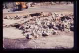 |
Pavement of Big Cottonwood Canyon Road, east of Salt Lake City, torn up by cloudburst flood in August 1969. | P1274 Environmental Geology and Geologic Hazards in Utah Photograph Collection | p1274n007 |
| 8 |
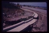 |
Damage to newly laid curb and gutter on Salt Lake City's East Bench, resulting from August 1969 cloudburst. | P1274 Environmental Geology and Geologic Hazards in Utah Photograph Collection | p1274n008 |
| 9 |
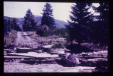 |
Damage to the Salt Lake City Cemetery from a flood channeled in Perry's Hollow, a normally dry drainage course. | P1274 Environmental Geology and Geologic Hazards in Utah Photograph Collection | p1274n009 |
| 10 |
 |
Erosion of a hillside fill- more than 2 feet from a single cloudburst. Sediment is deposited at foot of slope in neighbor's back yard. | P1274 Environmental Geology and Geologic Hazards in Utah Photograph Collection | p1274n010 |
| 11 |
 |
Erosion of fill placed from home construction. Deposition of material in foreground gives braided stream appearance. | P1274 Environmental Geology and Geologic Hazards in Utah Photograph Collection | p1274n011 |
| 12 |
 |
Monument to campers who lost their lives in cloudburst flood in Sheep Creek Canyon, in Flaming Gorge National Recreational Area, 1963. Note: boulder on which bronze monument has been placed is striated and polished by glacial action in the ice age. | P1274 Environmental Geology and Geologic Hazards in Utah Photograph Collection | p1274n012 |
| 13 |
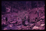 |
Upstream from the monument was this scene in May 1969. Broken tree trunks and picnic table (beneath feet of observer in photo) recently re-exposed from under 8 feet of debris. | P1274 Environmental Geology and Geologic Hazards in Utah Photograph Collection | p1274n013 |
| 14 |
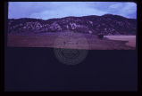 |
Nose of sagebrush-covered debris pointing out into grassy valley, in Sanpete County. Debris deposit was a sharply defined mud-rock flow. | P1274 Environmental Geology and Geologic Hazards in Utah Photograph Collection | p1274n014 |
| 15 |
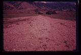 |
Mud-flow which occurred in same season in which photo was taken, in Tooele County. Cloudburst probably descended on the background watershed in the Oquirrh Range. | P1274 Environmental Geology and Geologic Hazards in Utah Photograph Collection | p1274n015 |
| 16 |
 |
Rock-debris flow from source onto road in foreground. | P1274 Environmental Geology and Geologic Hazards in Utah Photograph Collection | p1274n016 |
| 17 |
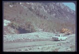 |
Cone or fan of debris deposited on highway after cloudburst flood in Big Cottonwood Canyon. | P1274 Environmental Geology and Geologic Hazards in Utah Photograph Collection | p1274n017 |
| 18 |
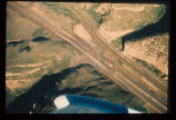 |
Mud-rock flow from upper steep-walled tributary canyon into Echo Canyon (Summit County) and over Interstate 80. Note that one lane of traffic has been cleared of debris. Aerial photo July 1968. | P1274 Environmental Geology and Geologic Hazards in Utah Photograph Collection | p1274n018 |
| 19 |
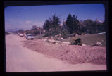 |
Mud-flow debris cleared from residence after storm on Salt Lake City's East Bench. | P1274 Environmental Geology and Geologic Hazards in Utah Photograph Collection | p1274n019 |
| 20 |
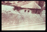 |
House carried on mud-flow from Davis Creek, Davis County. Historic photo, 1930. Debris covered the highway to a depth of about 6 feet. | P1274 Environmental Geology and Geologic Hazards in Utah Photograph Collection | p1274n020 |
| 21 |
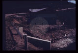 |
Expensive new house being constructed on banks of perennial stream which is subject to flood each spring and throughout the summer. Should not a form of flood plain zoning be in effect? | P1274 Environmental Geology and Geologic Hazards in Utah Photograph Collection | p1274n021 |
| 22 |
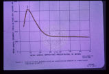 |
Sediment load is a factor to be considered with surface streams. This graph shows the relationship between mean annual sediment load and mean annual precipitation for the specific environment where the mean annual temperature is 40 degrees F. Other curves may be drawn for various other mean annual temperatures. Note that in this regime sediment yield is greatest at about 8 or 9 inches of precipitation. This factor must be given careful consideration when designing flood impoundment structures. The greater the sediment load the quicker the reservoir fills up. | P1274 Environmental Geology and Geologic Hazards in Utah Photograph Collection | p1274n022 |
| 23 |
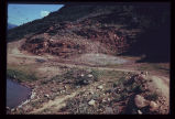 |
Landsliding of an abutment encroaching on the reservoir which is near its peak stage (elevation). Structures for impoundment of flood waters must be sited with strict regard for geological conditions. | P1274 Environmental Geology and Geologic Hazards in Utah Photograph Collection | p1274n023 |
| 24 |
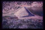 |
A reservoir showing the earth-fill dam and a landslide block separated from the abutment in the foreground. Opposite abutment is an ancient landslide. | P1274 Environmental Geology and Geologic Hazards in Utah Photograph Collection | p1274n024 |
| 25 |
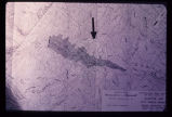 |
Engineering plan for a proposed reservoir in Salt Lake City. Note the anomalous contour spacing under the arrow. This indicates that the hillside has slid in the past. Construction of a reservoir here would inundate the toe of an ancient landslide and destroy the balance and stability of the weak landslide mass. | P1274 Environmental Geology and Geologic Hazards in Utah Photograph Collection | p1274n025 |
| 26 |
 |
Leakage through the undisturbed abutment of an earthfill dam, measured in a wooden weir. | P1274 Environmental Geology and Geologic Hazards in Utah Photograph Collection | p1274n026 |
| 27 |
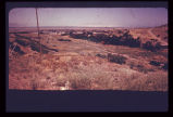 |
Looking downstream from the crest of the same earthfill dam (p1274n026). Note urban area at mouth of canyon. | P1274 Environmental Geology and Geologic Hazards in Utah Photograph Collection | p1274n027 |
| 28 |
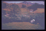 |
The old drainage below the dam through the city is now the site of numerous houses. Severe destruction would result from the dam failure. | P1274 Environmental Geology and Geologic Hazards in Utah Photograph Collection | p1274n028 |
| 29 |
 |
Looking across a dam towards a massive ancient landslide. Recent highway construction has rejuvenated landsliding just below the spillway; note receding hillside under arrow. | P1274 Environmental Geology and Geologic Hazards in Utah Photograph Collection | p1274n029 |
| 30 |
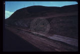 |
View along the highway traffic lanes and the dam abutment at the newly created cut slope. | P1274 Environmental Geology and Geologic Hazards in Utah Photograph Collection | p1274n030 |
| 31 |
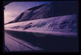 |
Same view showing notch in cut slope, the result of a failure onto the road soon after opening to traffic (p1274n030). Landsliding is predictable. | P1274 Environmental Geology and Geologic Hazards in Utah Photograph Collection | p1274n031 |
| 32 |
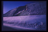 |
Front end view of the slide (p1274n030). | P1274 Environmental Geology and Geologic Hazards in Utah Photograph Collection | p1274n032 |
| 33 |
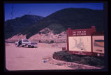 |
Reservoir slopes failing just upstream from dam. A failure overtopping the road would cause turbidity in the drinking water for a large city since the intake is directly downstream and in line with the current. | P1274 Environmental Geology and Geologic Hazards in Utah Photograph Collection | p1274n033 |
| 34 |
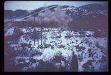 |
Blasting for an interstate highway in the immediate vicinity of a dam. Concrete railing of dam appears in lower right corner. Vibrations, whether natural (earthquake) or manmade, may damage structures on sensitive foundations. | P1274 Environmental Geology and Geologic Hazards in Utah Photograph Collection | p1274n034 |
| 35 |
 |
Excavation for a covered distribution reservoir is pointed out in the photo. Note that drainages have been truncated. Reservoir is in an urban area with considerable development downslope. Geologic materials comprising the site are unstable. Geologic faults are mapped bounding the site, and springs issue from excavation walls and floor. | P1274 Environmental Geology and Geologic Hazards in Utah Photograph Collection | p1274n035 |
| 36 |
 |
Failure of ground bordering on a covered distribution reservoir. Hammer provides scale on displacement scarp. | P1274 Environmental Geology and Geologic Hazards in Utah Photograph Collection | p1274n036 |
| 37 |
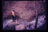 |
Rockfall, American Fork Canyon, February 1970. Observer stands on one of the boulders of rockfall looking across at debris fan which was washed down when aquaduct was struck and severed on the mountain side. Note height at which tree in foreground was broken off by boulder. | P1274 Environmental Geology and Geologic Hazards in Utah Photograph Collection | p1274n037 |
| 38 |
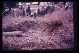 |
Erosion caused by release of water on severance of aquaduct in foreground. Timpanogas Cave National Monument Visitor Center lies at bottom of canyon. | P1274 Environmental Geology and Geologic Hazards in Utah Photograph Collection | p1274n038 |
| 39 |
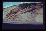 |
Landslide of bedrock onto highway; a frequent problem for highway maintenance, sometimes necessitating blasting of large bedrock blocks. | P1274 Environmental Geology and Geologic Hazards in Utah Photograph Collection | p1274n039 |
| 40 |
 |
Crack down the highway centerline, showing displacement. U.S. 6 near Colton. | P1274 Environmental Geology and Geologic Hazards in Utah Photograph Collection | p1274n040 |
| 41 |
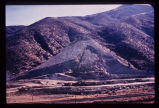 |
Large scale landsliding during construction of Interstate 80 in Echo Canyon. Bedding plane slide. | P1274 Environmental Geology and Geologic Hazards in Utah Photograph Collection | p1274n041 |
| 42 |
 |
Ancient landslides show up on maps with scales as small as one inch to the mile. Three such ancient slides are pointed out along the mountain front in Juab County. Note swath of anomalous contours leading down to lowermost slide, obviously the path of bedrock which failed. | P1274 Environmental Geology and Geologic Hazards in Utah Photograph Collection | p1274n042 |
| 43 |
 |
Aerial photograph showing same swath and slide as on topographic map. Arrow points to displaced mass from swath behind it in mountain range. | P1274 Environmental Geology and Geologic Hazards in Utah Photograph Collection | p1274n043 |
| 44 |
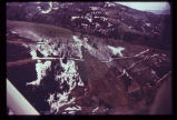 |
Landslide in Empire Canyon, Park City, in altered bedrock. Mining of metallic ores occurs just up the canyon. Park City lies just down-canyon. Switchbacks on road to Brighton have been wiped out; A further failure two years later took away even more of the hillside and dammed the creek in the canyon. Oblique aerial view. | P1274 Environmental Geology and Geologic Hazards in Utah Photograph Collection | p1274n044 |
| 45 |
 |
Closer view of head and foot of Park City landslide. Note tilt blocks at head of slide. | P1274 Environmental Geology and Geologic Hazards in Utah Photograph Collection | p1274n045 |
| 46 |
 |
Incipient landslide failure on subdivision road. Note characteristic arcuate configuration of ground surface, also patching along crack. | P1274 Environmental Geology and Geologic Hazards in Utah Photograph Collection | p1274n046 |
| 47 |
 |
Dropping of street which crossed old landslide failure plane. Note break in slope towards distance in line with fresh scarplet across street. Utility pole is seated along the slide plane. | P1274 Environmental Geology and Geologic Hazards in Utah Photograph Collection | p1274n047 |
| 48 |
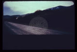 |
Failure of undisturbed hillside bordering on Bear Lake (to left just off edge of road and photo). This hillside is particularly valuable as view property for resort development, yet is failing without any terrain modification by man. | P1274 Environmental Geology and Geologic Hazards in Utah Photograph Collection | p1274n048 |
| 49 |
 |
Landslide scarplet "getting closer to home" in mountain subdivision. | P1274 Environmental Geology and Geologic Hazards in Utah Photograph Collection | p1274n049 |
| 50 |
 |
Failure of front yard before completion of home construction in mountain subdivision. | P1274 Environmental Geology and Geologic Hazards in Utah Photograph Collection | p1274n050 |
| 51 |
 |
Characteristic arcuate crack pattern in basement of house. Both vertical and lateral displacement is apparent. | P1274 Environmental Geology and Geologic Hazards in Utah Photograph Collection | p1274n051 |
| 52 |
 |
In the same house; the ceiling is clearly distressed. | P1274 Environmental Geology and Geologic Hazards in Utah Photograph Collection | p1274n052 |
| 53 |
 |
Landslide scarp behind house along mountain front in Weber County. | P1274 Environmental Geology and Geologic Hazards in Utah Photograph Collection | p1274n053 |
| 54 |
 |
Ogden Standard Examiner newspaper photograph of mudslide encroaching into dining room. | P1274 Environmental Geology and Geologic Hazards in Utah Photograph Collection | p1274n054 |
| 55 |
 |
Weber Basin Job Corpsmen digging out mudslide debris from hillside house. | P1274 Environmental Geology and Geologic Hazards in Utah Photograph Collection | p1274n055 |
| 56 |
 |
Foothill terrain at base of Wasatch Mountains experienced failure illustrated above. | P1274 Environmental Geology and Geologic Hazards in Utah Photograph Collection | p1274n056 |
| 57 |
 |
Low sun angle illumination, vertical aerial photograph of large ancient landslide in urban environment at mouth of Ogden Canyon. | P1274 Environmental Geology and Geologic Hazards in Utah Photograph Collection | p1274n057 |
| 58 |
 |
Party of people viewing large landslide mass. Slide plane (surface along which mass of earth moved) is evident in photo half way down the exposed wall, sloping towards the party. | P1274 Environmental Geology and Geologic Hazards in Utah Photograph Collection | p1274n058 |
| 59 |
 |
Closeup of slide plane. Note deposition of white calcium carbonate by groundwater along slide plane. Arrow points to smooth, slickensided (grooved) surface on underside of sliding mass. | P1274 Environmental Geology and Geologic Hazards in Utah Photograph Collection | p1274n059 |
| 60 |
 |
Slide of fill material in high, steep fill slope on Salt Lake City's North Bench. | P1274 Environmental Geology and Geologic Hazards in Utah Photograph Collection | p1274n060 |
| 61 |
 |
Closer view of slide cracks in high fill in Salt Lake City subdivision. Note housing density downslope. | P1274 Environmental Geology and Geologic Hazards in Utah Photograph Collection | p1274n061 |
| 62 |
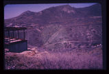 |
View across City Creek Canyon in Salt Lake City, showing amphitheater-like appearance of ancient landslide. Houses are short distance to left of landslide. | P1274 Environmental Geology and Geologic Hazards in Utah Photograph Collection | p1274n062 |
| 63 |
 |
Hillside subdivision in landslide terrain. Terrain in background has slid in the past. Instrument for measuring ground displacement is housed in box in foreground. White rain gage sits atop instrument housing. | P1274 Environmental Geology and Geologic Hazards in Utah Photograph Collection | p1274n063 |
| 64 |
 |
Undisturbed hillside failing because of lateral and vertical erosion by creek. Debris is continuously removed from toe of sliding hillside by the creek. | P1274 Environmental Geology and Geologic Hazards in Utah Photograph Collection | p1274n064 |
| 65 |
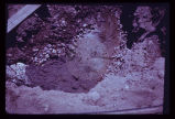 |
Groundwater, boiling up sand, at depth of a few feet in Sugarhouse, Salt Lake City, revealed by foundation excavation. Water probably arises along East Bench branch of the Wasatch Fault. | P1274 Environmental Geology and Geologic Hazards in Utah Photograph Collection | p1274n065 |
| 66 |
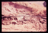 |
Well points (small diameter water wells) used to dewater a hillside in loose sand to stabilize it after cut was made for roadway. | P1274 Environmental Geology and Geologic Hazards in Utah Photograph Collection | p1274n066 |
| 67 |
 |
Hydrograph depicting flow for the year 1945 of Utah's second largest spring, Swan Creek Spring, west of Bear Lake in northern Utah. Note the fluctuation in flow from April to September. Note also rapid response to spring snowmelt (April and May) and rainfall (June and July). The rock from which the spring issues (aquifer) is limestone. The graph illustrates the importance of controlling development on limestone terrain. | P1274 Environmental Geology and Geologic Hazards in Utah Photograph Collection | p1274n067 |
| 68 |
 |
Bear Lake area map showing: (1) point of issue of Swan Creek Spring, (2) possible contributory sink holes (in red) in the Bear River Range, (3) precipitation (rain and snow) measuring stations (in bluelined blocks). | P1274 Environmental Geology and Geologic Hazards in Utah Photograph Collection | p1274n068 |
| 69 |
 |
Areas of carbonate rock (limestone) outcrops (in blue) in the vicinity of Bear Lake, Utah. Rocks range in age from Cambrian to Jurassic. Development on the outcrop area should be closely monitored to protect the underlying potable water aquifer. | P1274 Environmental Geology and Geologic Hazards in Utah Photograph Collection | p1274n069 |
| 70 |
 |
Table listing types of geologic terrain in the Bear Lake area and their limiting factors for fluid waste disposal by individual home systems. Yellow indicates caution is required and red indicates a critical situation. | P1274 Environmental Geology and Geologic Hazards in Utah Photograph Collection | p1274n070 |
| 71 |
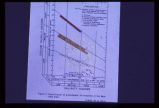 |
Standard Salinity Hazard chart for groundwater from all aquifers in the Bear Lake area. This chart is used for agricultural purposes. Note that all waters sampled are satisfactory for all plant types. | P1274 Environmental Geology and Geologic Hazards in Utah Photograph Collection | p1274n071 |
| 72 |
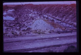 |
Surficial or shallow ground water is subject to pollution from buried solid wastes. Leaching of the wastes can occur in time. This excavation is for a land fill operation where ground water was encountered at a depth of less than 6 feet. | P1274 Environmental Geology and Geologic Hazards in Utah Photograph Collection | p1274n072 |
| 73 |
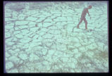 |
This pattern of cracking in the unconsolidated clays and silts from ancient Lake Bonneville is the result of shrinking upon drying. Geologic material may be considered as dynamic, not static, and may deform readily under stress. Deformation may damage or destroy structures placed upon this type of geologic material. | P1274 Environmental Geology and Geologic Hazards in Utah Photograph Collection | p1274n073 |
| 74 |
 |
Another example of dynamic forces at work in the geologic environment: pressure ridges formed in the salt crust of Utah's Bonneville Salt Flats. These ridges grow and shrink seasonally. | P1274 Environmental Geology and Geologic Hazards in Utah Photograph Collection | p1274n074 |
| 75 |
 |
Swelling of clay soil as it takes on additional moisture heaved up this garage floor and cracked it. | P1274 Environmental Geology and Geologic Hazards in Utah Photograph Collection | p1274n075 |
| 76 |
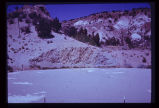 |
This water storage reservoir has failed; it was placed improperly upon a stratum of gypsum (white layers in photo) which partially dissolved. | P1274 Environmental Geology and Geologic Hazards in Utah Photograph Collection | p1274n076 |
| 77 |
 |
Crack in soil alongside reservoir, showing subsidence. Reservoir was the only water storage facility serving several thousand people. | P1274 Environmental Geology and Geologic Hazards in Utah Photograph Collection | p1274n077 |
| 78 |
 |
These twin tanks deverge from bottom to top. Differential settling of their foundations caused this. | P1274 Environmental Geology and Geologic Hazards in Utah Photograph Collection | p1274n078 |
| 79 |
 |
Damage to a house in Salt Lake City results from an unsatisfactory foundation. Note in particular the dropping of the arch over the doorway. | P1274 Environmental Geology and Geologic Hazards in Utah Photograph Collection | p1274n079 |
| 80 |
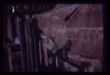 |
Arrow points to incipient failure of an excavation wall for a foundation for a multistory office building. Material is horizontally stratified Lake Bonneville silts and sands. | P1274 Environmental Geology and Geologic Hazards in Utah Photograph Collection | p1274n080 |
| 81 |
 |
Excavation and trench cave-ins occur all too frequently along Utah's Wasatch Front. Each year sees its fatalities from this cause. | P1274 Environmental Geology and Geologic Hazards in Utah Photograph Collection | p1274n081 |
| 82 |
 |
The circumstances here probably make a utility trench cave-in inevitable. A perched water table is sapping fine sand from underneath a thick silt bed, leaving the latter unsupported. Failure will be too rapid for escape of a workman who may be in the trench at the wrong moment. | P1274 Environmental Geology and Geologic Hazards in Utah Photograph Collection | p1274n082 |
| 83 |
 |
Damage to a major edifice in Salt Lake City resulted from differential settling of the two portions of the building. Arrow points to zone of distress which extends to foundation level. Note that window frames are askew. | P1274 Environmental Geology and Geologic Hazards in Utah Photograph Collection | p1274n083 |
| 84 |
 |
Ground subsidence leaves this fireplug supported above the sidewalk in downtown Salt Lake City. | P1274 Environmental Geology and Geologic Hazards in Utah Photograph Collection | p1274n084 |
| 85 |
 |
Map of Utah showing the 5 major active fault zones in the state. | P1274 Environmental Geology and Geologic Hazards in Utah Photograph Collection | p1274n085 |
| 86 |
 |
Photograph of a relief map using oblique illumination to highlight the topography. Note the steep slope along the east shore of Bear Lake. This slope marks the active Bear Lake Fault bounding the lake on the east. The lake sits in a graben, a downdropping block of earth. | P1274 Environmental Geology and Geologic Hazards in Utah Photograph Collection | p1274n086 |
| 87 |
 |
View across the north end of Bear Lake looking east at the truncated spurs, geomorphologic evidence of the Bear Lake Fault. | P1274 Environmental Geology and Geologic Hazards in Utah Photograph Collection | p1274n087 |
| 88 |
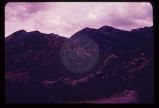 |
Fault trace of the active Wasatch Fault across a glacial moraine at the mouth of Little Cottonwood Canyon in Salt Lake County. Note that the fault scarplet is virtually unvegetated, indicative of its recency. | P1274 Environmental Geology and Geologic Hazards in Utah Photograph Collection | p1274n088 |
| 89 |
 |
Hebgen Fault scarp near Cabin Creek, aftermath of the 1959 Montana earthquake. Note tilt of trees and the recovery of vegetation over the scarp in only 11 years (photo taken August 1970). | P1274 Environmental Geology and Geologic Hazards in Utah Photograph Collection | p1274n089 |
| 90 |
 |
Exposure of a branch of the Wasatch Fault in a sand and gravel pit along the mountain front. Amount of displacement is indeterminable from the stratigraphy exposed. Note that the fault is planar and stands out with relative resistance to the elements despite lack of cementation of the sand and gravel. | P1274 Environmental Geology and Geologic Hazards in Utah Photograph Collection | p1274n090 |
| 91 |
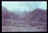 |
Portion of the East Bench along the mountain front in Salt Lake County. It has been dissected by strands of the Wasatch Fault. Since this photo was taken a housing development has been built on this terrain. | P1274 Environmental Geology and Geologic Hazards in Utah Photograph Collection | p1274n091 |
| 92 |
 |
Multistory apartment house sitting astride the East Bench Fault of the Wasatch Fault Zone in Salt Lake City. | P1274 Environmental Geology and Geologic Hazards in Utah Photograph Collection | p1274n092 |
| 93 |
 |
Fault trace revealed in the foundation excavation for the building depicted in the preceding photograph (p1274n092). | P1274 Environmental Geology and Geologic Hazards in Utah Photograph Collection | p1274n093 |
| 94 |
 |
Closeup view of the fault shown in last slide (p1274n093). | P1274 Environmental Geology and Geologic Hazards in Utah Photograph Collection | p1274n094 |
| 95 |
 |
Map of portion of the Wasatch Front showing the Wasatch Fault Zone in relation to the Salt Lake City aqueduct system (with water system facilities as projected into the 20th Century). Map illustrates severity of the earthquake problem in urban Utah. | P1274 Environmental Geology and Geologic Hazards in Utah Photograph Collection | p1274n095 |
| 96 |
 |
Branch of the Wasatch Fault exposed in utility trench excavation in Salt Lake City. Hammer and field book are at the same stratigraphic horizon, indicating a displacement of 2 1/2 feet in late mudflow deposits, just below the ground surface. | P1274 Environmental Geology and Geologic Hazards in Utah Photograph Collection | p1274n096 |
| 97 |
 |
Geologic map of Bear Lake showing the geologic hazards in the area. The active Bear Lake fault zone is outlined in yellow, and landslides in red. Hazardous areas must be given due consideration by planning authorities. | P1274 Environmental Geology and Geologic Hazards in Utah Photograph Collection | p1274n097 |
| 98 |
 |
Map of Bear Lake showing bottom contours of the lake and depth to bedrock beneath soft valley sediments. The delta-fan areas along the east shore are colored yellow to indicate another hazard. Response of the delta-fan soft sediments to earthquake vibrations is anticipated to be poor, almost certainly causing severe damage to structures built on these level areas. Different earth materials may be expected to behave differently when shaken in an earthquake. The closeness of the contours bounding the delta-fans indicates a steep front for each. Movement of material in an earthquake may be expected to occur towards these steep fronts. | P1274 Environmental Geology and Geologic Hazards in Utah Photograph Collection | p1274n098 |
| 99 |
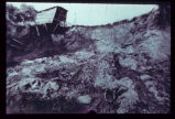 |
Landslide along a scarp of the East Bench Fault in Salt Lake City. No earth tremor is known to have triggered this slide, but an earthquake could trigger similar slides, given similar geologic conditions. | P1274 Environmental Geology and Geologic Hazards in Utah Photograph Collection | p1274n099 |
| 100 |
 |
Steep, high, artificial fill slopes in or near the Wasatch Fault Zone. Downslope from these fills lie dense residential developments. Atop these fills are residences. How may these earth materials be expected to react to seismic vibrations? | P1274 Environmental Geology and Geologic Hazards in Utah Photograph Collection | p1274n100 |