TO
Filters: Subject: "Timber"
| Title | Date | Type | Setname | ||
|---|---|---|---|---|---|
| 76 |
 |
Map of Dry Gulch Irrigation District, Uintah Indian Reservation, Utah | Image/StillImage | uaida_main | |
| 77 |
 |
Map of the Northern Part of the Former Uintah Indian Reservation Showing the Irrigation System | Image/StillImage | uaida_main | |
| 78 |
 |
Map of the Uintah Basin and the Uintah Ouray Reservation | Image/StillImage | uaida_main | |
| 79 |
 |
Mountain stream, winter | 1910; 1911; 1912; 1913; 1914; 1915; 1916; 1917; 1918; 1919; 1920; 1921; 1922; 1923; 1924; 1925; 1926; 1927; 1928; 1929; 1930; 1931; 1932; 1933; 1934; 1935; 1936; 1937; 1938; 1939; 1940 | Image/StillImage | dha_gmo |
| 80 |
 |
Oral history interview with Alfred Simper by Diedra Northern [Transcript] | 1977-11-01 | Text | dha_uhsoh |
| 81 |
 |
Presentation given about Uintah Basin history by Briant Stringham | 1974-09 | Text | dha_uhsoh |
| 82 |
 |
Problems of Navajo Male Graduates of Intermountain School During Their First Year of Employment | 1959 | Text | uaida_main |
| 83 |
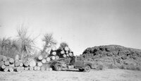 |
Timber Trucking Near Ouray | 1964-12-24 | Image/StillImage | ucl_vep |
| 84 |
 |
Uintah & Ouray Res. Agent to Commissioner regarding Indian refusal to allow the obtainment of timber | 1913-10-16 | Text | uaida_main |
| 85 |
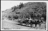 |
Wagon hauling timber | 1900; 1901; 1902; 1903; 1904; 1905; 1906; 1907; 1908; 1909; 1910; 1911; 1912; 1913; 1914; 1915; 1916; 1917; 1918; 1919; 1920 | Image/StillImage | dha_rucc |
| 86 |
 |
Wood Piles | 1930; 1931; 1932; 1933; 1934; 1935; 1936; 1937; 1938; 1939; 1940 | Image/StillImage | dha_rkc |
