Home
Browse
Ask Us
Chat
Harmful Language Statement
Log in
Advanced Search
Year
1849
1850
1851
1852
1853
1854
1855
1856
1857
1858
1859
1860
1861
1862
1863
1864
1865
1866
1867
1868
1869
1870
1871
1872
1873
1874
1875
1876
1877
1878
1879
1880
1881
1882
1883
1884
1885
1886
1887
1888
1889
1890
1891
1892
1893
1894
1895
1896
1897
1898
1899
1900
1901
1902
1903
1904
1905
1906
1907
1908
1909
1910
1911
1912
1913
1914
1915
1916
1917
1918
1919
1920
1921
1922
1923
1924
1925
1926
1927
1928
1929
1930
1931
1932
1933
1934
1935
1936
1937
1938
1939
1940
1941
1942
1943
1944
1945
1946
1947
1948
1949
1950
1951
1952
1953
1954
1955
1956
1957
1958
1959
1960
1961
1962
1963
1964
1965
1966
1967
1968
1969
1970
1971
1972
1973
1974
1975
1976
1977
1978
1979
1980
1981
1982
1983
1984
1985
1986
1987
1988
1989
1990
1991
1992
1993
1994
1995
1996
1997
1998
1999
2000
2001
2002
2003
2004
2005
2006
2007
2008
2009
2010
2011
2012
2013
2014
2015
2016
2017
2018
2019
TO
1849
1850
1851
1852
1853
1854
1855
1856
1857
1858
1859
1860
1861
1862
1863
1864
1865
1866
1867
1868
1869
1870
1871
1872
1873
1874
1875
1876
1877
1878
1879
1880
1881
1882
1883
1884
1885
1886
1887
1888
1889
1890
1891
1892
1893
1894
1895
1896
1897
1898
1899
1900
1901
1902
1903
1904
1905
1906
1907
1908
1909
1910
1911
1912
1913
1914
1915
1916
1917
1918
1919
1920
1921
1922
1923
1924
1925
1926
1927
1928
1929
1930
1931
1932
1933
1934
1935
1936
1937
1938
1939
1940
1941
1942
1943
1944
1945
1946
1947
1948
1949
1950
1951
1952
1953
1954
1955
1956
1957
1958
1959
1960
1961
1962
1963
1964
1965
1966
1967
1968
1969
1970
1971
1972
1973
1974
1975
1976
1977
1978
1979
1980
1981
1982
1983
1984
1985
1986
1987
1988
1989
1990
1991
1992
1993
1994
1995
1996
1997
1998
1999
2000
2001
2002
2003
2004
2005
2006
2007
2008
2009
2010
2011
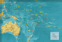
2012
2013
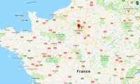
2014
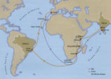
2015
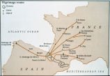
2016
2017
2018
2019
Type
Image
270
Image/StillImage
181
Text
84
Format
image/jpeg
413
application/pdf
114
application/xml
3
application/zip
3
Collection
Art and Art History
169
Aziz Suryal Atiya papers
5
Beckwith Photograph Collection
8
Classified Photographs
62
Clifton Bray Film Negatives
10
Extractions from the Land: Mining and...
2
Marriott Library Digital Stacks
1
Olympic Legacy
5
Peoples of Utah Revisited
6
Photo Archives
12
Salt Lake Tribune Negative Collection
14
Shipler Collection Negative Preservat...
18
Shipler Commercial Photographers
6
Ski and Snow Sports Archives
1
Theses & Dissertations
1
UAIDA Main Collection
201
Vernal Express Photographs
2
Western Waters Electronic Resources
4
Westminster College Finding Aids (EAD)
3
Westminster College Photographs
5
More
Filters:
Subject:
"Maps"
326
-
350
of
535
<
9
10
11
12
13
14
15
16
17
18
>
Gallery view
Number of results to display per page
10
25
50
100
200
Sort by Relevance
Sort by Title A-Z
Sort by Title Z-A
Sort by Date Ascending
Sort by Date Descending
Sort by Last Modified Ascending
Sort by Last Modified Descending
Title
Date
Type
Setname
326
Map: Latin America around the year 1500, with the principal native societies and the three empires: Aztec, Mayan, and Incan
Image
uu_aah_art
327
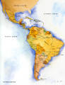
Map: Latin America Political Map
Image
uu_aah_art
328
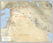
Map: Location of Dura Europos in the Middle East
Image
uu_aah_art
329
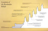
Map: Location of the Borobudur reliefs
Image
uu_aah_art
330
Map: Locations of 1937 Paris World's Fair, the Berlin Olympics, Nuremberg Rallies, and Great German and Degenerate Art Exhibits
Image
uu_aah_art
331
Map: Major sites in Rome, Italy
Image
uu_aah_art
332
Map: Major Sites of the Eastern Zhou Dynasty
Image
uu_aah_art
333
Map: Major Sites of the Qin State and Dynasty
Image
uu_aah_art
334
Map: Major Sites of the Shang Dynasty, Erligang Culture
Image
uu_aah_art
335
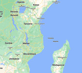
Map: Makonde people were in contemporary Kenya, Tanzania, and Mozambique
Image
uu_aah_art
336
Map: Mediterranean and Northern Africa
Image
uu_aah_art
337
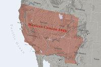
Map: Mexican Cession 1848
Image
uu_aah_art
338
Map: Minoan Crete and the Bronze Age Aegean
Image
uu_aah_art
339
Map: Nara, Japan
Image
uu_aah_art
340
Map: Nigeria in West Africa
Image
uu_aah_art
341
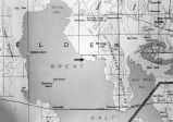
Map: Northen Great Salt Lake Area
Image
uu_aah_art
342
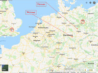
Map: Northern Europe showing Dessau and Weimar, Germany
Image
uu_aah_art
343
Map: Oceania
Image
uu_aah_art
344
Map: Osogbo
Image
uu_aah_art
345
Map: Paris and Versailles, France
Image
uu_aah_art
346
Map: Pedro Álvares Cabral's Voyage to and from India with the discovery of Brazil
Image
uu_aah_art
347
Map: Pilgrimage Routes of France and Spain
Image
uu_aah_art
348
Map: Plan of Constantinople during the Middle Byzantine Period
Image
uu_aah_art
349
Map: Pompeii
Image
uu_aah_art
350
Map: Pompeii in 79 CE
Image
uu_aah_art
326
-
350
of
535
<
9
10
11
12
13
14
15
16
17
18
>