Home
Browse
Ask Us
Chat
Harmful Language Statement
Log in
Advanced Search
Year
1849
1850
1851
1852
1853
1854
1855
1856
1857
1858
1859
1860
1861
1862
1863
1864
1865
1866
1867
1868
1869
1870
1871
1872
1873
1874
1875
1876
1877
1878
1879
1880
1881
1882
1883
1884
1885
1886
1887
1888
1889
1890
1891
1892
1893
1894
1895
1896
1897
1898
1899
1900
1901
1902
1903
1904
1905
1906
1907
1908
1909
1910
1911
1912
1913
1914
1915
1916
1917
1918
1919
1920
1921
1922
1923
1924
1925
1926
1927
1928
1929
1930
1931
1932
1933
1934
1935
1936
1937
1938
1939
1940
1941
1942
1943
1944
1945
1946
1947
1948
1949
1950
1951
1952
1953
1954
1955
1956
1957
1958
1959
1960
1961
1962
1963
1964
1965
1966
1967
1968
1969
1970
1971
1972
1973
1974
1975
1976
1977
1978
1979
1980
1981
1982
1983
1984
1985
1986
1987
1988
1989
1990
1991
1992
1993
1994
1995
1996
1997
1998
1999
2000
2001
2002
2003
2004
2005
2006
2007
2008
2009
2010
2011
2012
2013
2014
2015
2016
2017
2018
2019
TO
1849
1850
1851
1852
1853
1854
1855
1856
1857
1858
1859
1860
1861
1862
1863
1864
1865
1866
1867
1868
1869
1870
1871
1872
1873
1874
1875
1876
1877
1878
1879
1880
1881
1882
1883
1884
1885
1886
1887
1888
1889
1890
1891
1892
1893
1894
1895
1896
1897
1898
1899
1900
1901
1902
1903
1904
1905
1906
1907
1908
1909
1910
1911
1912
1913
1914
1915
1916
1917
1918
1919
1920
1921
1922
1923
1924
1925
1926
1927
1928
1929
1930
1931
1932
1933
1934
1935
1936
1937
1938
1939
1940
1941
1942
1943
1944
1945
1946
1947
1948
1949
1950
1951
1952
1953
1954
1955
1956
1957
1958
1959
1960
1961
1962
1963
1964
1965
1966
1967
1968
1969
1970
1971
1972
1973
1974
1975
1976
1977
1978
1979
1980
1981
1982
1983
1984
1985
1986
1987
1988
1989
1990
1991
1992
1993
1994
1995
1996
1997
1998
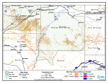
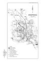
1999
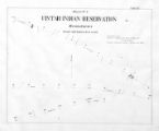
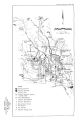
2000
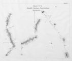
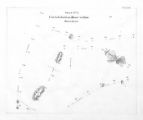
2001
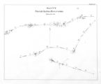
2002
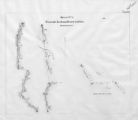
2003
2004
2005
2006
2007
2008
2009
2010
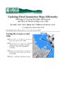
2011
2012
2013
2014
2015
2016
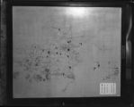
2017
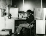
2018
2019
Type
Image/StillImage
181
Image
101
Text
84
Format
image/jpeg
244
application/pdf
114
application/xml
3
application/zip
3
Collection
Aziz Suryal Atiya papers
5
Beckwith Photograph Collection
8
Classified Photographs
62
Clifton Bray Film Negatives
10
Extractions from the Land: Mining and...
2
Marriott Library Digital Stacks
1
Olympic Legacy
5
Peoples of Utah Revisited
6
Photo Archives
12
Salt Lake Tribune Negative Collection
14
Shipler Collection Negative Preservat...
18
Shipler Commercial Photographers
6
Ski and Snow Sports Archives
1
Theses & Dissertations
1
UAIDA Main Collection
201
Vernal Express Photographs
2
Western Waters Electronic Resources
4
Westminster College Finding Aids (EAD)
3
Westminster College Photographs
5
More
Filters:
Subject:
"Maps"
326
-
350
of
366
<
6
7
8
9
10
11
12
13
14
15
>
Gallery view
Number of results to display per page
10
25
50
100
200
Sort by Relevance
Sort by Title A-Z
Sort by Title Z-A
Sort by Date Ascending
Sort by Date Descending
Sort by Last Modified Ascending
Sort by Last Modified Descending
Title
Date
Type
Setname
326
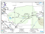
Uintah & Ouray Reservation Geothermal Map
2004-01-13
Image/StillImage
uaida_main
327
Uintah & Ouray Reservation Report from the U.S. Dept. of Energy
2007-08-01
Text
uaida_main
328
Uintah & Ouray Wind Resources Map
2004-01-13
Image/StillImage
uaida_main
329
Uintah & Ouray Wind Resources Map
2004-01-09
Image/StillImage
uaida_main
330
Uintah Basin Replacement Project March 1995
1995-03-10
Image/StillImage
uaida_main
331
Uintah Indian Reservation and the Three Band Divisions 1903.
1903
Image/StillImage
uaida_main
332
Uintah Indian Reservation Boundaries Sheet Number 4
Image/StillImage
uaida_main
333
Uintah Indian Reservation Boundaries; Sheet Number 1
Image/StillImage
uaida_main
334
Uintah Indian Reservation Boundaries; Sheet Number 2
Image/StillImage
uaida_main
335
Uintah Indian Reservation Boundaries; Sheet Number 3
Image/StillImage
uaida_main
336
Uintah Indian Reservation Boundaries; Sheet Number 5
Image/StillImage
uaida_main
337
Uintah Unit Alernative No. 4 Coyote Basin Alternative
Image/StillImage
uaida_main
338
Uintah Unit Alernative No. 4 Coyote Basin Alternative
Text
uaida_main
339
Uintah Unit Alternative No. 1 Lower Uinta Alternative
Text
uaida_main
340
Upalco Unit Alternative No. 8 Twin Pots Alternative
Image/StillImage
uaida_main
341
Upalco Unit Alternative No. 8 Twin Pots Alternative
1995-01
Text
uaida_main
342
Updating flood inundation maps efficiently: building on existing hydraulic information and modern elevation data with a GIS
1998
Text
wwdl_er
343
Updating flood maps efficiently using existing hydraulic models, very-high-accuracy elevation data, and a geographic information system- a pilot study on the Nisqually River, Washington
2001
Text
wwdl_er
344
Utah Churches, Missions NW
Image
wc_pc
345
Utah Churches, Schools SW
Image
wc_pc
346
Utah Churches, Schools, Missions SE.
Image
wc_pc
347
Utah Council of Churches records
1949; 1950; 1951; 1952; 1953; 1954; 1955; 1956; 1957; 1958; 1959; 1960; 1961; 1962; 1963; 1964; 1965; 1966
wc_ead
348
Utah County--Maps Traffic Accidents
1939-09
Image/StillImage
dha_sltnc
349
Utah Highway Patrol p. 1
1935; 1936; 1937; 1938; 1939; 1940; 1941; 1942; 1943; 1944; 1945; 1946; 1947
Image/StillImage
dha_cp
350
Utah Power & Light Company, Copy of Map Showing Location of Electric Ranges
1925-08-06
Image/StillImage
dha_scnpp
326
-
350
of
366
<
6
7
8
9
10
11
12
13
14
15
>