| Title | Date | Type | Setname | ||
|---|---|---|---|---|---|
| 1 |
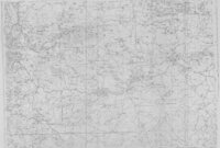 |
Ashley National Forest - Uinta National Forest - Wasatch National Forest - Manti La Sal National Forest | Image/StillImage | ucl_maps | |
| 2 |
 |
Ashley National Forest, Utah, Salt Lake and Uinta Special Meridians. 1955 - reprint of 1945 edition | 1955 | Image/StillImage | ucl_maps |
| 3 |
 |
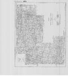
Carbon US DOI BLM 1978 | 1978 | Image/StillImage | ucl_maps |
| 4 |
 |
Geology of the Soldier Summit quadrangle, Utah (Thesis and maps) | 1965-06 | Text; Image | ir_etd |
| 5 |
 |
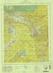
Geology of the Soldier Summit quadrangle, Utah: Georeferenced map files | 1965-06 | Image | ir_etd |
| 6 |
 |
Map 1 Geologic map of the Soldier Summit Quadrangle, Utah (Google Earth map overlay KMZ file) | 1965-06 | Image | ir_etd |
| 7 |
 |
Oil-impregnated sandstones in Utah and Wayne Counties, Utah | 1972 | Text | ir_eua |
| 8 |
 |
Oquirrh US DOI BLM 1977 | 1977 | Image/StillImage | ucl_maps |