|
|
Title | Date | Type | Setname |
| 101 |
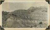 |
Chinle "marls" Springdale, 1936. | 1936 | Image | uum_map |
| 102 |
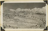 |
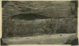
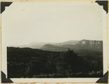
Chinle and above, near Springdale, Utah, 1936. | 1936 | Image | uum_map |
| 103 |
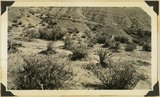 |
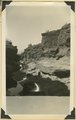
Chinle marls and desert vegetation, Springdale, 1936. | 1936 | Image | uum_map |
| 104 |
 |
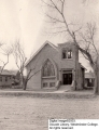
Church at St. George, NV. 1922 | 1922 | Image | uum_map |
| 105 |
 |
Church Building in Cedar City | | Image | wc_pc |
| 106 |
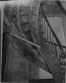 |
Circular staircase inside the St. George Tabernacle | 1870; 1871; 1872; 1873; 1874; 1875; 1876; 1877; 1878; 1879; 1880; 1881; 1882; 1883; 1884; 1885; 1886; 1887; 1888; 1889; 1890; 1891; 1892; 1893; 1894; 1895; 1896; 1897; 1898; 1899; 1900; 1901; 1902; 1903; 1904; 1905; 1906; 1907; 1908; 1909; 1910 | Image | uum_map |
| 107 |
 |
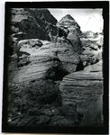
Cliff dweller niche, base of Navajo sandstone. Zion Park. | 1930; 1931; 1932; 1933; 1934; 1935; 1936; 1937 | Image | uum_map |
| 108 |
 |
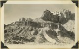
Cliffs of southern Zion [1] | 1928; 1929; 1930; 1931; 1932 | | uum_map |
| 109 |
 |
Cliffs of southern Zion [2] | 1928; 1929; 1930; 1931; 1932 | | uum_map |
| 110 |
 |
Cliffs of southern Zion [3] | 1928; 1929; 1930; 1931; 1932 | | uum_map |
| 111 |
 |
Cliffs of southern Zion [4] | 1928; 1929; 1930; 1931; 1932 | | uum_map |
| 112 |
 |
Cliffs of southern Zion [5] | 1928; 1929; 1930; 1931; 1932 | | uum_map |
| 113 |
 |
Cliffs, mouth of Parunuweap, Utah, 1936. | 1936 | Image | uum_map |
| 114 |
 |
Coalpits volcano north of Grafton. | 1930; 1931; 1932; 1933; 1934; 1935; 1936; 1937 | Image | uum_map |
| 115 |
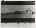 |
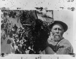
The Community of Price City and its inhabitants, circa 1880. | 1875; 1876; 1877; 1878; 1879; 1880; 1881; 1882; 1883; 1884; 1885 | Image | uum_map |
| 116 |
 |
Conglomerates, base of Timpoweep member of the Moenkopi Tarper Creek. Washington County, UT. 1941 | 1941 | Image | uum_map |
| 117 |
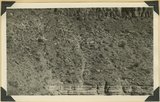 |
Contact of fossiliferous Kaibab (base) and fossiliferous Moenkopi (top), Isom Wash, Washington Co., UT, 1939. Exact contact not placed | 1939 | Image | uum_map |
| 118 |
 |
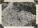
Contact of old and recent basalt flows near head of Gould Canyon, Washington County, UT, 1939 | 1939 | Image | uum_map |
| 119 |
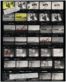 |
Contact sheet of images of Utah Power & Light Company employees in front Milford Service Center, Utah Power & Light Company employee ID photos, Milford District Substation building, and IPP 500 kV DC line west of Veyo, Utah | 1985-09 | Image | uum_map |
| 120 |
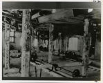 |
Cotton factory, interior | 1870; 1871; 1872; 1873; 1874; 1875; 1876; 1877; 1878; 1879; 1880; 1881; 1882; 1883; 1884; 1885; 1886; 1887; 1888; 1889; 1890; 1891; 1892; 1893; 1894; 1895; 1896; 1897; 1898; 1899; 1900; 1901; 1902; 1903; 1904; 1905; 1906; 1907; 1908; 1909; 1910 | Image | uum_map |
| 121 |
 |
Cotton Mill and workers | 1870; 1871; 1872; 1873; 1874; 1875; 1876; 1877; 1878; 1879; 1880; 1881; 1882; 1883; 1884; 1885; 1886; 1887; 1888; 1889; 1890; 1891; 1892; 1893; 1894; 1895; 1896; 1897; 1898; 1899; 1900; 1901; 1902; 1903; 1904; 1905; 1906; 1907; 1908; 1909; 1910 | Image | uum_map |
| 122 |
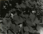 |
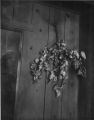
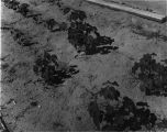
Cotton plants | 1870; 1871; 1872; 1873; 1874; 1875; 1876; 1877; 1878; 1879; 1880; 1881; 1882; 1883; 1884; 1885; 1886; 1887; 1888; 1889; 1890; 1891; 1892; 1893; 1894; 1895; 1896; 1897; 1898; 1899; 1900; 1901; 1902; 1903; 1904; 1905; 1906; 1907; 1908; 1909; 1910 | Image | uum_map |
| 123 |
 |
Cotton Plants | 1940; 1941; 1942; 1943; 1944; 1945; 1946; 1947; 1948; 1949; 1950; 1951; 1952; 1953; 1954; 1955; 1956; 1957; 1958; 1959; 1960; 1961; 1962; 1963; 1964; 1965; 1966; 1967; 1968; 1969; 1970; 1971; 1972; 1973; 1974; 1975; 1976; 1977; 1978; 1979; 1980 | Image | uum_map |
| 124 |
 |
Cotton Plants | 1940; 1941; 1942; 1943; 1944; 1945; 1946; 1947; 1948; 1949; 1950; 1951; 1952; 1953; 1954; 1955; 1956; 1957; 1958; 1959; 1960; 1961; 1962; 1963; 1964; 1965; 1966; 1967; 1968; 1969; 1970; 1971; 1972; 1973; 1974; 1975; 1976; 1977; 1978; 1979; 1980 | Image | uum_map |
| 125 |
 |
Cotton Plants | 1940; 1941; 1942; 1943; 1944; 1945; 1946; 1947; 1948; 1949; 1950; 1951; 1952; 1953; 1954; 1955; 1956; 1957; 1958; 1959; 1960; 1961; 1962; 1963; 1964; 1965; 1966; 1967; 1968; 1969; 1970; 1971; 1972; 1973; 1974; 1975; 1976; 1977; 1978; 1979; 1980 | Image | uum_map |