| Title | Date | Type | Setname | ||
|---|---|---|---|---|---|
| 251 |
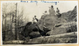 |
Four people sitting on a boulder - likely Cedar Mountain | Image | uum_map | |
| 252 |
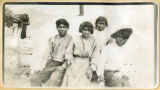 |
Four Piaute children in Cedar City | Image | uum_map | |
| 253 |
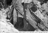
 |
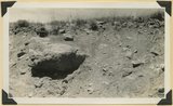
The Gap [01] | 1929 | Image | dc_bpc |
| 254 |
 |
The Gap [02] | 1939 | Image | dc_bpc |
| 255 |
 |
The Gap [03] | 1929-10-12 | Image | dc_bpc |
| 256 |
 |
The Gap [04] | Image | dc_bpc | |
| 257 |
 |
The Gap [05] | 1939 | Image | dc_bpc |
| 258 |
 |
The Gap [06] | 1939 | Image | dc_bpc |
| 259 |
 |
The Gap [07] | 1938 | Image | dc_bpc |
| 260 |
 |
The Gap [08] | 1939-03-16 | Image | dc_bpc |
| 261 |
 |
The Gap [09] | 1938-11 | Image | dc_bpc |
| 262 |
 |
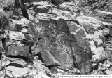
The Gap [10] | 1928-11 | Image | dc_bpc |
| 263 |
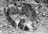 |
The Gap [11] | 1939 | Image | dc_bpc |
| 264 |
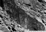 |
The Gap [12] | 1929-10-12 | Image | dc_bpc |
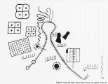
| 265 |
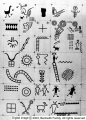 |
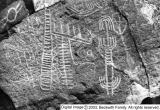
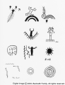
Gap chart series | 1939-03-16 | Image | dc_bpc |
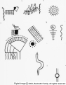
| 266 |
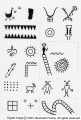 |
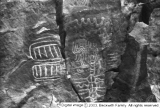
Gap Sipapu | 1938-10 | Image | dc_bpc |
| 267 |
 |
General view of eroded Pink Cliffs (Wasatch formation) near Cedar Breaks, Iron County, UT | 1941 | Image | uum_map |
| 268 |
 |
Georg Hartlmaier [01] | 1978; 1979; 1980; 1981; 1982; 1983; 1984; 1985; 1986; 1987; 1988; 1989; 1990; 1991; 1992; 1993; 1994; 1995; 1996; 1997; 1998; 1999; 2000; 2001; 2002 | Image/StillImage | uum_map_usa |
| 269 |
 |
Georg Hartlmaier [02] | 1978; 1979; 1980; 1981; 1982; 1983; 1984; 1985; 1986; 1987; 1988; 1989; 1990; 1991; 1992; 1993; 1994; 1995; 1996; 1997; 1998; 1999; 2000; 2001; 2002 | Image/StillImage | uum_map_usa |
| 270 |
 |
Georg Hartlmaier [03] | 1978; 1979; 1980; 1981; 1982; 1983; 1984; 1985; 1986; 1987; 1988; 1989; 1990; 1991; 1992; 1993; 1994; 1995; 1996; 1997; 1998; 1999; 2000; 2001; 2002 | Image/StillImage | uum_map_usa |
| 271 |
 |
Glacial till, Castle Creek below Sidney Valley. Top of Markagunt Plateau. Iron County, UT. 1941 | 1941 | Image | uum_map |
| 272 |
 |
The Gospel Tent at Parowan | Image | wc_pc | |
| 273 |
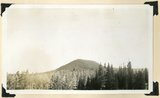 |
Hancock Peak. Volcanic cone, Iron County, UT, 1942 | 1942 | Image | uum_map |
| 274 |
 |
Highway fo Steed Creek crossing during torrential flood, looking upstream [and] A woven wire fence parallel to direction of flow held a torrential flood within bounds, just above highway crossing at Fiddler's Creek near Cedar City | 1930; 1931; 1932 | Image/StillImage | uum_map |
| 275 |
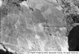 |
Human Footprints(?), The Gap | 1929-10-12 | Image | dc_bpc |