Home
Browse
Ask Us
Chat
Harmful Language Statement
Log in
Art and Art History
Advanced Search
About
Curriculum-based images for use in teaching, research, and learning.
Type
Image
12
Format
image/jpeg
12
Collection
Art and Art History
12
Filters:
Style Period:
"Medieval Art"
Subject:
"Maps"
1
-
25
of
12
Gallery view
Number of results to display per page
10
25
50
100
200
Sort by Relevance
Sort by Title A-Z
Sort by Title Z-A
Sort by Date Ascending
Sort by Date Descending
Sort by Last Modified Ascending
Sort by Last Modified Descending
Title
Date
Type
1
Atlas of Maritime Charts (The Catalan Atlas)
Image
2
Atlas of Maritime Charts (The Catalan Atlas), detail showing Mansa Musa
Image
3
Map showing the dissolution of the former Roman Empire, c. 600
Image
4
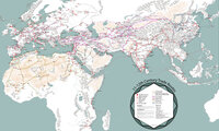
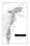
Map: 11th - 12th Century Trade Routes
Image
5
Map: 11th - 12th Century Trade Routes including Rome, Constantinople, Damascus, Jerusalem, and Dura-Europos
Image
6
Map: Empires and Spheres of Influence
Image
7
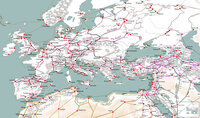
Map: Europe during the 14th Century CE
Image
8
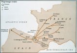
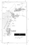
Map: Pilgrimage Routes of France and Spain
Image
9
Map: The Crusader States 1100 CE
Image
10
Map: The Crusader States 1118 CE
Image
11
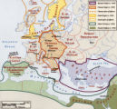
Map: The Hohenstaufen Empire under Frederick II
Image
12
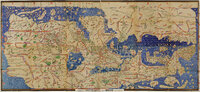
Tabula Rogeriana
Image
1
-
25
of
12