Home
Browse
Ask Us
Chat
Harmful Language Statement
Log in
Advanced Search
Year
1870
1871
1872
1873
1874
1875
1876
1877
1878
1879
1880
1881
1882
1883
1884
1885
1886
1887
1888
1889
1890
1891
1892
1893
1894
1895
1896
1897
1898
1899
1900
1901
1902
1903
1904
1905
1906
1907
1908
1909
1910
1911
1912
1913
1914
1915
1916
1917
1918
1919
1920
1921
1922
1923
1924
1925
1926
1927
1928
1929
1930
1931
1932
1933
1934
1935
1936
1937
1938
1939
1940
1941
1942
1943
1944
1945
1946
1947
1948
1949
1950
1951
1952
1953
1954
1955
1956
1957
1958
1959
1960
1961
1962
1963
1964
1965
1966
1967
1968
1969
1970
1971
1972
1973
1974
1975
1976
1977
1978
1979
1980
1981
1982
1983
1984
1985
1986
1987
1988
1989
1990
1991
1992
1993
1994
1995
1996
1997
1998
1999
2000
2001
2002
2003
2004
2005
TO
1870
1871
1872
1873
1874
1875
1876
1877
1878
1879
1880
1881
1882
1883
1884
1885
1886
1887
1888
1889
1890
1891
1892
1893
1894
1895
1896
1897
1898
1899
1900
1901
1902
1903
1904
1905
1906
1907
1908
1909
1910
1911
1912
1913
1914
1915
1916
1917
1918
1919
1920
1921
1922
1923
1924
1925
1926
1927
1928
1929
1930
1931
1932
1933
1934
1935
1936
1937
1938
1939
1940
1941
1942
1943
1944
1945
1946
1947
1948
1949
1950
1951
1952
1953
1954
1955
1956
1957
1958
1959
1960
1961
1962
1963
1964
1965
1966
1967
1968
1969
1970
1971
1972
1973
1974
1975
1976
1977
1978
1979
1980
1981
1982
1983
1984
1985
1986
1987
1988
1989
1990
1991
1992
1993
1994
1995
1996
1997
1998
1999
2000
2001
2002
2003
2004
2005
Type
Image
114
Image/StillImage
40
Text
4
Image/MovingImage
1
Format
image/jpeg
861
application/pdf
44
video/mp4
1
Collection
Beckwith Photograph Collection
1
O.L. Tapp Film Collection
1
Photo Archives
732
Regional History Center
6
Ski and Snow Sports Archives
37
Thorne Photographs
89
UAIDA Main Collection
1
Utah Artists Project
1
Utah River Running Photo Archives
19
Vernal Express Photographs
15
Western Waters NEH
4
More
Filters:
Spatial Coverage:
"Uinta Mountains (Utah and Wyo.)"
826
-
850
of
906
<
28
29
30
31
32
33
34
35
36
37
>
Gallery view
Number of results to display per page
10
25
50
100
200
Sort by Relevance
Sort by Title A-Z
Sort by Title Z-A
Sort by Date Ascending
Sort by Date Descending
Sort by Last Modified Ascending
Sort by Last Modified Descending
Title
Date
Type
Setname
826
Uinta Mountains, Utah 1970 [13]
1970
Image/StillImage
uum_map_usa
827
Uinta Mountains, Utah 1970 [15]
1970
Image/StillImage
uum_map_usa
828
Uinta ridge above Ryder Lake (negative) [1]
2001-06
uum_map
829
Uinta ridge above Ryder Lake (negative) [2]
2001-06
uum_map
830
Uinta ridge above Ryder Lake (negative) [3]
2001-06
uum_map
831
Uinta ridge above Ryder Lake (negative) [4]
2001-06
uum_map
832
Uinta ridge above Ryder Lake (negative) [5]
2001-06
uum_map
833
Uintah Mountains (1914)
1914
Image
ucl_tp
834
Uintah Unit, Central Utah Project: advance draft environmental statement
Text
wwdl_neh
835
Uintas
1998
Image/StillImage
uu_uap
836
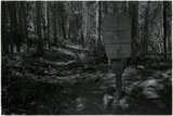
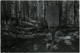
Uintas Wilderness sign (negative)
2001
uum_map
837
Uintas Wilderness sign (negative)
2001
uum_map
838
Uintas, canyon of the Duchesne?
1938; 1939; 1940; 1941
uum_map_usa
839
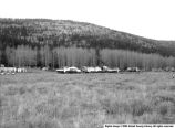
Wasatch Line Construction Base Camp
1958-10-22
Image
ucl_vep
840
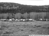
Wasatch Line Construction Company
1958-10-21
Image
ucl_vep
841
Washington (?) Lake en-route to Mirror Lake. Karl and Ted
1937; 1938; 1939; 1940; 1941
uum_map_usa
842
Waterfall, Left Hand Fork (negative) [01]
2001-08-26
uum_map
843
Waterfall, Left Hand Fork (negative) [02]
2001-08-26
uum_map
844
Waterfall, Left Hand Fork (negative) [03]
2001-08-26
uum_map
845
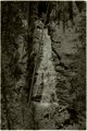
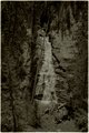
Waterfall, Left Hand Fork (negative) [04]
2001-08-26
uum_map
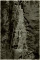
846
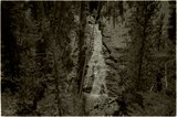
Waterfall, Left Hand Fork (negative) [05]
2001-08-26
uum_map
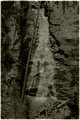
847
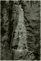
Waterfall, Left Hand Fork (negative) [06]
2001-08-26
uum_map
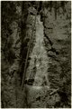
848
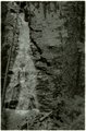
Waterfall, Left Hand Fork (negative) [07]
2001-08-26
uum_map
849
Waterfall, Left Hand Fork (negative) [08]
2001-08-26
uum_map
850
Waterfall, Left Hand Fork (negative) [09]
2001-08-26
uum_map
826
-
850
of
906
<
28
29
30
31
32
33
34
35
36
37
>