|
|
Title | Date | Type | Setname |
| 201 |
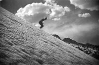 |
Probably Chick LeCayer on Wolverine | 1937; 1938; 1939; 1940; 1941 | | uum_map_usa |
| 202 |
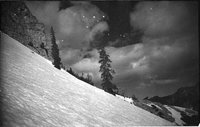 |
Relict trees protected from slides by cliff above (no couloir), Baldy looking West to shoulder | 1937; 1938; 1939; 1940; 1941 | | uum_map_usa |
| 203 |
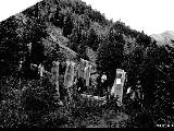 |
Riders on horses in Mill D Fork inspecting avalanche damage | 1937; 1938; 1939; 1940; 1941; 1942; 1943; 1944; 1945; 1946; 1947; 1948; 1949; 1950; 1951; 1952; 1953; 1954; 1955; 1956; 1957; 1958; 1959; 1960; 1961; 1962; 1963; 1964; 1965; 1966; 1967; 1968; 1969 | | uum_map_usa |
| 204 |
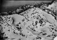 |
Ridge between Sunset Peak and Devil's Castle | 1937; 1938; 1939; 1940; 1941 | | uum_map_usa |
| 205 |
 |
Road cuts and erosion [01] | 1930; 1931; 1932; 1933; 1934; 1935; 1936; 1937; 1938; 1939; 1940; 1941; 1942; 1943; 1944; 1945; 1946; 1947; 1948; 1949; 1950; 1951; 1952; 1953; 1954; 1955; 1956; 1957; 1958; 1959 | Image/StillImage | uum_map_usa |
| 206 |
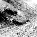 |
Road cuts and erosion [02] | 1930; 1931; 1932; 1933; 1934; 1935; 1936; 1937; 1938; 1939; 1940; 1941; 1942; 1943; 1944; 1945; 1946; 1947; 1948; 1949; 1950; 1951; 1952; 1953; 1954; 1955; 1956; 1957; 1958; 1959 | Image/StillImage | uum_map_usa |
| 207 |
 |
Road cuts and erosion [03] | 1930; 1931; 1932; 1933; 1934; 1935; 1936; 1937; 1938; 1939; 1940; 1941; 1942; 1943; 1944; 1945; 1946; 1947; 1948; 1949; 1950; 1951; 1952; 1953; 1954; 1955; 1956; 1957; 1958; 1959 | Image/StillImage | uum_map_usa |
| 208 |
 |
Road cuts and erosion [04] | 1930; 1931; 1932; 1933; 1934; 1935; 1936; 1937; 1938; 1939; 1940; 1941; 1942; 1943; 1944; 1945; 1946; 1947; 1948; 1949; 1950; 1951; 1952; 1953; 1954; 1955; 1956; 1957; 1958; 1959 | Image/StillImage | uum_map_usa |
| 209 |
 |
Road cuts and erosion [05] | 1930; 1931; 1932; 1933; 1934; 1935; 1936; 1937; 1938; 1939; 1940; 1941; 1942; 1943; 1944; 1945; 1946; 1947; 1948; 1949; 1950; 1951; 1952; 1953; 1954; 1955; 1956; 1957; 1958; 1959 | Image/StillImage | uum_map_usa |
| 210 |
 |
Road cuts and erosion [06] | 1930; 1931; 1932; 1933; 1934; 1935; 1936; 1937; 1938; 1939; 1940; 1941; 1942; 1943; 1944; 1945; 1946; 1947; 1948; 1949; 1950; 1951; 1952; 1953; 1954; 1955; 1956; 1957; 1958; 1959 | Image/StillImage | uum_map_usa |
| 211 |
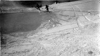 |
Rob, Bill Lence and Alexander | 1936; 1937; 1938; 1939; 1940 | | uum_map_usa |
| 212 |
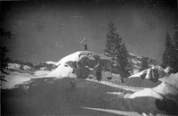 |
Rocks not yet fully covered | 1937; 1938; 1939; 1940; 1941 | | uum_map_usa |
| 213 |
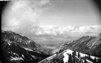 |
Salt Lake Valley down Little Cottonwood Canyon | 1937; 1938; 1939; 1940; 1941 | | uum_map_usa |
| 214 |
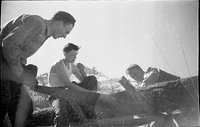 |
Sawing up the felled tree, Brighton | 1938; 1939; 1940; 1941; 1942; 1943; 1944; 1945; 1946; 1947; 1948; 1949 | | uum_map_usa |
| 215 |
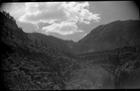 |
Scenic view (Negative) | 1935; 1936; 1937; 1938; 1939; 1940; 1941; 1942; 1943; 1944; 1945; 1946; 1947; 1948; 1949; 1950 | | uum_map_usa |
| 216 |
 |
Scenic view (Negative) | 1935; 1936; 1937; 1938; 1939; 1940; 1941; 1942; 1943; 1944; 1945; 1946; 1947; 1948; 1949; 1950 | | uum_map_usa |
| 217 |
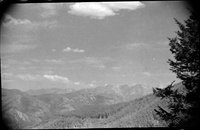 |
Scenic view (Negative) | 1935; 1936; 1937; 1938; 1939; 1940; 1941; 1942; 1943; 1944; 1945; 1946; 1947; 1948; 1949; 1950 | | uum_map_usa |
| 218 |
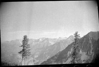 |
Scenic view (Negative) | 1935; 1936; 1937; 1938; 1939; 1940; 1941; 1942; 1943; 1944; 1945; 1946; 1947; 1948; 1949; 1950 | | uum_map_usa |
| 219 |
 |
Scenic view (Negative) | 1935; 1936; 1937; 1938; 1939; 1940; 1941; 1942; 1943; 1944; 1945; 1946; 1947; 1948; 1949; 1950 | | uum_map_usa |
| 220 |
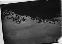 |
Schuss into the CCC Camp, Upper Basin, Albion Pass back | 1937; 1938; 1939; 1940; 1941 | | uum_map_usa |
| 221 |
 |
Short distance below camping ledge | 1938; 1939; 1940; 1941 | | uum_map_usa |
| 222 |
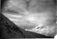 |
Shoulder of Baldy and Twin Peaks just breaking thru clouds from Alta Germania Pass, the Oquirrhs across the valley fog sea | 1937; 1938; 1939; 1940; 1941 | | uum_map_usa |
| 223 |
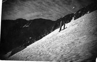 |
Shoulder of Millicent, 6 a.m. | 1938; 1939; 1940; 1941 | | uum_map_usa |
| 224 |
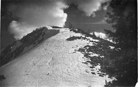 |
Shoulder of Millicent, Brighton | 1938; 1939; 1940; 1941 | | uum_map_usa |
| 225 |
 |
Showing the trail which we followed, camping near the top of the trees at the right of the gully, slide gully to right | 1937; 1938; 1939; 1940; 1941 | | uum_map_usa |


