| Title | Date | Type | Setname | ||
|---|---|---|---|---|---|
| 176 |
 |
More sunburn preventive, camping place | 1938; 1939; 1940; 1941 | uum_map_usa | |
| 177 |
 |
Morning of the second day, meadow 15 minutes above Timpanogos | 1938; 1939; 1940; 1941 | uum_map_usa | |
| 178 |
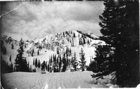 |
Mount Majestic and Uintas back from Albion Pass | 1938; 1939; 1940; 1941 | uum_map_usa | |
| 179 |
 |
Mount Millicent from just below cabin | 1936; 1937; 1938; 1939; 1940 | uum_map_usa | |
| 180 |
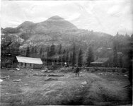 |
Mount Millicent, head of Big Cottonwood Canyon | 1910; 1911; 1912; 1913; 1914; 1915; 1916; 1917; 1918; 1919; 1920; 1921; 1922; 1923; 1924; 1925; 1926; 1927; 1928; 1929; 1930; 1931; 1932; 1933; 1934; 1935; 1936; 1937; 1938; 1939; 1940; 1941; 1942; 1943; 1944; 1945 | Image/StillImage | uum_map |
| 181 |
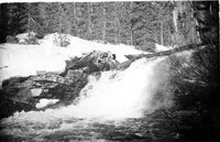 |
Mountain cascade | 1937; 1938; 1939; 1940; 1941 | uum_map_usa | |
| 182 |
 |
Mountain goats (Negative) | 1935; 1936; 1937; 1938; 1939; 1940; 1941; 1942; 1943; 1944; 1945; 1946; 1947; 1948; 1949; 1950 | uum_map_usa | |
| 183 |
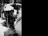 |
Mountain man with skis standing in front of a shack, Big Cottonwood Canyon. (Also known as Brighton's old blind miner.) | 1937; 1938; 1939; 1940; 1941; 1942; 1943; 1944; 1945; 1946; 1947; 1948; 1949; 1950; 1951; 1952; 1953; 1954; 1955; 1956; 1957; 1958; 1959; 1960; 1961; 1962; 1963; 1964; 1965; 1966; 1967; 1968; 1969 | uum_map_usa | |
| 184 |
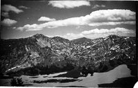 |
Mt. Majestic back and Albion Pass from Alta Germania | 1938; 1939; 1940; 1941 | uum_map_usa | |
| 185 |
 |
Notice how steep portion of slope (snow) is out from cliffs, also see dirt. Chick protects his scalp from sunburn | 1938; 1939; 1940; 1941 | uum_map_usa | |
| 186 |
 |
November, 1938. Irene Wink | 1938 | uum_map | |
| 187 |
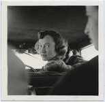 |
Oh, Katheryn! | 1937; 1938; 1939 | uum_map | |
| 188 |
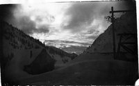 |
old mine building in Alta; torn down 1941 to make ice skating rink | 1937; 1938; 1939; 1940; 1941 | uum_map_usa | |
| 189 |
 |
On last slopes | 1938; 1939; 1940; 1941 | uum_map_usa | |
| 190 |
 |
On ridge between Dog Lake and Lake Mary | 1937; 1938; 1939; 1940; 1941 | uum_map_usa | |
| 191 |
 |
On shoulder of Millicent | 1938; 1939; 1940; 1941 | uum_map_usa | |
| 192 |
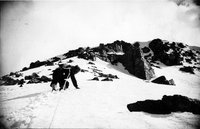 |
On the way up. This is really steep | 1938; 1939; 1940; 1941 | uum_map_usa | |
| 193 |
 |
Our slope and the peak | 1938; 1939; 1940; 1941 | uum_map_usa | |
| 194 |
 |
Paul Schenks, upper basin, December | 1937; 1938; 1939; 1940; 1941 | uum_map_usa | |
| 195 |
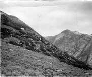 |
Perched, granite boulders on quartzite formation, Little Cottonwood Canyon | 1910; 1911; 1912; 1913; 1914; 1915; 1916; 1917; 1918; 1919; 1920; 1921; 1922; 1923; 1924; 1925; 1926; 1927; 1928; 1929; 1930; 1931; 1932; 1933; 1934; 1935; 1936; 1937; 1938; 1939; 1940; 1941; 1942; 1943; 1944; 1945 | Image/StillImage | uum_map |
| 196 |
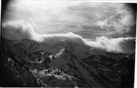 |
Peruvian Gulch and American Fork Twins, Hidden Peak first at left | 1938; 1939; 1940; 1941 | uum_map_usa | |
| 197 |
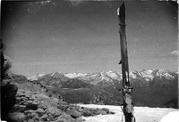 |
Pfeiferhorn recognizable, American Fork Twins to right | 1938; 1939; 1940; 1941 | uum_map_usa | |
| 198 |
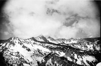 |
Pfeiferhorn, heads of all canyons West of Gad Valley | 1938; 1939; 1940; 1941 | uum_map_usa | |
| 199 |
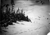 |
Powder under the Baldy Cliffs | 1937; 1938; 1939; 1940; 1941 | uum_map_usa | |
| 200 |
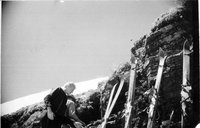 |
Probably above camp | 1938; 1939; 1940; 1941 | uum_map_usa |
