Home
Browse
Ask Us
Chat
Harmful Language Statement
Log in
Theses & Dissertations
Advanced Search
Year
1959
1960
1961
1962
1963
1964
1965
1966
1967
1968
1969
TO
1959
1960
1961
1962
1963
1964
1965
1966
1967
1968
1969
Type
Image
12
Text
2
Format
application/pdf
7
application/vnd.google-earth.kmz
3
application/zip
2
Collection
Theses & Dissertations
12
Filters:
Department:
"Materials Science & Engineering"
Publication Type:
"thesis"
Type:
"Image"
1
-
25
of
12
Gallery view
Number of results to display per page
10
25
50
100
200
Sort by Relevance
Sort by Title A-Z
Sort by Title Z-A
Sort by Date Ascending
Sort by Date Descending
Sort by Last Modified Ascending
Sort by Last Modified Descending
Title
Date
Type
1
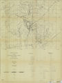
Geologic setting and origin of the Grouse Creek pluton, Box Elder County, Utah-Maps
1959-06
Image
2
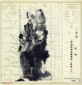
Geology and ore deposits of the lucin mining district, Box Elder County, Utah, and Elko County, Nevada-Maps
1960-08
Image
3
Map 1 Geologic map of the Mineral Range, Utah (Google Earth map overlay KMZ file)
1960-06
Image
4
Mount Ogden granite (Thesis and maps)
1969-06
Text; Image
5
Mount Ogden granite: Georeferenced map files
1969-06
Image
6
Petrogeneis of the Mineral Range Pluton, Southwestern Utah
1960-06
Text; Image
7
Petrogeneis of the Mineral Range Pluton, Southwestern Utah: Georeferenced map files
1960-06
Image
8
Plate 1: Lucin mining district and vicinity, Northern Pilot Range, Box Elder County, Utah - Elko County, Nevada (Google Earth map overlay KMZ file)
1960-08
Image
9
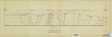
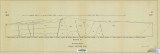
Plate 2: Cross-section A-A'
1959-06
Image
10
Plate 3: Cross-section B-B'
1959-06
Image
11
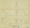
Plate 4: Evolution of the eastern fault block
1959-06
Image
12
Plates 2-3 Geologic map of the Mount Ogden granite, Weber County, Utah and Geologic sections to accompany the Geologic map of the Mount Ogden granite, Weber County, Utah (Google Earth map overlay KMZ file)
1969-06
Image
1
-
25
of
12