Over 70,000 photos covering a variety of topics from Marriott Library Special Collections
TO
| Title | Collection Number And Name | Photo Number | ||
|---|---|---|---|---|
| 101 |
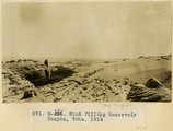 |
Wind filling Reservoir Canyon, Tuba, 1914 | P0013 Herbert E. Gregory Photograph Collection | P0013n07_067_1119 |
| 102 |
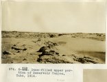 |
Dune-filled upper protion of Reservoir Canyon, Tuba, 1914 | P0013 Herbert E. Gregory Photograph Collection | P0013n07_068_1120 |
| 103 |
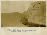 |
Dunes filling Reservoir Canyon, Tuba, 1914 | P0013 Herbert E. Gregory Photograph Collection | P0013n07_068_1121 |
| 104 |
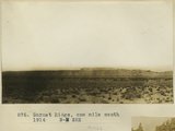 |
Garnet Ridge, one mile south 1914 | P0013 Herbert E. Gregory Photograph Collection | P0013n07_069_1122 |
| 105 |
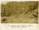 |
Sayoway ("rock babies"), Kayenta valley, 1914 | P0013 Herbert E. Gregory Photograph Collection | P0013n07_069_1123 |
| 106 |
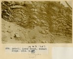 |
Detail, lower bench, Garnet Ridge, 1914 | P0013 Herbert E. Gregory Photograph Collection | P0013n07_070_1124 |
| 107 |
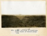 |
Jointing in sandstone, lower bench of Garnet Ridge 1914 | P0013 Herbert E. Gregory Photograph Collection | P0013n07_070_1125 |
| 108 |
 |
Garnet Ridge at five miles distance, 1914 | P0013 Herbert E. Gregory Photograph Collection | P0013n07_071_1126 |
| 109 |
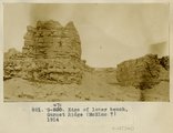 |
Edge of lower bench, Garnet Ridge (McElmo?), 1914 | P0013 Herbert E. Gregory Photograph Collection | P0013n07_071_1127 |
| 110 |
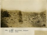 |
Erratics, Garnet Ridge, 1914 | P0013 Herbert E. Gregory Photograph Collection | P0013n07_072_1128 |
| 111 |
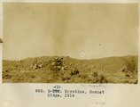 |
Erratics, Garnet Ridge, 1914 | P0013 Herbert E. Gregory Photograph Collection | P0013n07_072_1129 |
| 112 |
 |
Erratics, Garnet Ridge, 1914 | P0013 Herbert E. Gregory Photograph Collection | P0013n07_073_1130 |
| 113 |
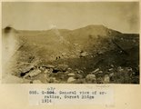 |
General view of erratics, Garnet Ridge, 1914 | P0013 Herbert E. Gregory Photograph Collection | P0013n07_073_1131 |
| 114 |
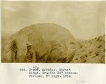 |
Erratic, Garnet Ridge. Granit 50' circumference, 9' high, 1914 | P0013 Herbert E. Gregory Photograph Collection | P0013n07_074_1132 |
| 115 |
 |
Edge of Comb looking SW 2± mi. NW of Garnet Ridge 1914 | P0013 Herbert E. Gregory Photograph Collection | P0013n07_074_1133 |
| 116 |
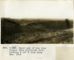 |
Upper end of San Juan Canyon thru Oilfields fold. Looking N 10° W from Mule Ear, 1914 | P0013 Herbert E. Gregory Photograph Collection | P0013n07_075_1134 |
| 117 |
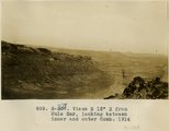 |
Views S 15° E from Mule Ear, looking between inner and outer Comb, 1914 | P0013 Herbert E. Gregory Photograph Collection | P0013n07_075_1135 |
| 118 |
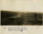 |
View north from Mule Ear. Junction of San Juan and Chinli, 1914 | P0013 Herbert E. Gregory Photograph Collection | P0013n07_076_1136 |
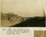
| 119 |
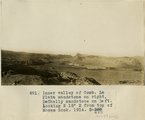 |
Inner valley of Comb, La Plata sandstone on right, DeChelly sandstone on left. Looking N 15° E from top of Moses Rock, 1914 | P0013 Herbert E. Gregory Photograph Collection | P0013n07_076_1137 |
| 120 |
 |
Inner valley of Comb between Wingate and DeChelly sandstone. 3/4 mi east of Moses Rock, 1914 | P0013 Herbert E. Gregory Photograph Collection | P0013n07_077_1138 |
| 121 |
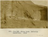 |
Moses Rock, DeChelly sandstone, 1914 | P0013 Herbert E. Gregory Photograph Collection | P0013n07_077_1139 |
| 122 |
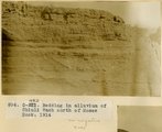 |
Bedding in alluvium of Chinli Wash north of Moses Rock, 1914 | P0013 Herbert E. Gregory Photograph Collection | P0013n07_078_1140 |
| 123 |
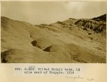 |
Tilted Chinli beds, 1 1/2 mile west of Tonygis, 1914 | P0013 Herbert E. Gregory Photograph Collection | P0013n07_078_1141 |
| 124 |
 |
Alcove in DeChelly sandstone near Mule Ear, 1914 | P0013 Herbert E. Gregory Photograph Collection | P0013n07_079_1142 |
| 125 |
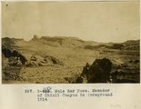 |
Mule Ear Pass. Meander of Chinli Canyon in foreground 1914 | P0013 Herbert E. Gregory Photograph Collection | P0013n07_079_1143 |