Home
Browse
Ask Us
Chat
Harmful Language Statement
Log in
Photo Archives
Advanced Search
About
Over 70,000 photos covering a variety of topics from Marriott Library Special Collections
Year
1875
1876
1877
1878
1879
1880
1881
1882
1883
1884
1885
1886
1887
1888
1889
1890
1891
1892
1893
1894
1895
1896
1897
1898
1899
1900
1901
1902
1903
1904
1905
1906
1907
1908
1909
1910
1911
1912
1913
1914
1915
1916
1917
1918
1919
1920
1921
1922
1923
1924
1925
1926
1927
1928
1929
1930
1931
1932
1933
1934
1935
1936
1937
1938
TO
1875
1876
1877
1878
1879
1880
1881
1882
1883
1884
1885
1886
1887
1888
1889
1890
1891
1892
1893
1894
1895
1896
1897
1898
1899
1900
1901
1902
1903
1904
1905
1906
1907
1908
1909
1910
1911
1912
1913
1914
1915
1916
1917
1918
1919
1920
1921
1922
1923
1924
1925
1926
1927
1928
1929
1930
1931
1932
1933
1934
1935
1936
1937
1938
Type
Image
130
Format
image/jpeg
127
application/pdf
3
Collection
Photo Archives
130
Filters:
Collection Name:
"Herbert E. Gregory"
Date:
"1928"
1
-
25
of
130
<
1
2
3
4
5
6
>
Gallery view
Number of results to display per page
10
25
50
100
200
Sort by Relevance
Sort by Title A-Z
Sort by Title Z-A
Sort by Date Ascending
Sort by Date Descending
Sort by Last Modified Ascending
Sort by Last Modified Descending
Title
Date
Type
1
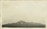
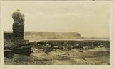
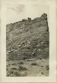
Abajo Mountains looking northwest from Blanding. Monticello Road. San Juan County, UT, 1928
1928
Image
2
Abandoned Logan, San Juan River, 10 miles above mouth
1920; 1921; 1922; 1923; 1924; 1925; 1926; 1927; 1928; 1929; 1930
Image
3
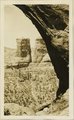
Ancient ladder some rungs recently nailed on leading to Cliff ruins 2 miles above Augusta Bridge, White Canyon
1928
Image
4
Arch Canyon, Coconino over Supai
1920; 1921; 1922; 1923; 1924; 1925; 1926; 1927; 1928; 1929; 1930
Image
5
Aspen and Yellow Pine near Kigalia Ranger Station, Elk Ridge. San Juan County, UT, 1928
1928
Image
6
Bluff and Twins looking southwest across San Juan River (W.H. Hopkins)
1928
Image
7
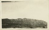
Bluffs at Bluff, UT
1920; 1921; 1922; 1923; 1924; 1925; 1926; 1927; 1928; 1929; 1930
Image
8
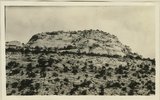
Butte of Coconino near junction Beef Basin and Fable Valley. San Juan County, UT, 1928
1928
Image
9
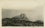
Butte of Coconino near mouth of Fable Valley. San Juan County, UT, 1928
1928
Image
10
Butte of Morrison shale capped by Dakota rising from a floor of Morrison(?) sand stone(Salt Wash). Near Mouth of Recapture Creek. San Juan County, UT, 1928
1928
Image
11
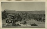
Camp scene, south bank of Armstrong Canyon looking northeast. Camp on Coconino; plateau in middle distance. Moenkopi capped by Shinarump; mesa in left background. Chinle and Glen Canyon, Fred Lowrey. San Juan County, UT, 1928
1928
Image
12
Cathedral Arch I. Arch Canyon
1920; 1921; 1922; 1923; 1924; 1925; 1926; 1927; 1928; 1929; 1930
Image
13
Cathedral Arch I. Arch Canyon
1920; 1921; 1922; 1923; 1924; 1925; 1926; 1927; 1928; 1929; 1930
Image
14
Cathedral Arch II, Arch Canyon, Coconino over Supai
1920; 1921; 1922; 1923; 1924; 1925; 1926; 1927; 1928; 1929; 1930
Image
15
Cathedral Arch II, Arch Canyon, Coconino over Supai
1920; 1921; 1922; 1923; 1924; 1925; 1926; 1927; 1928; 1929; 1930
Image
16
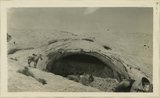
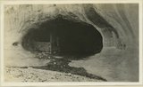
Cave in Navajo sandstone east slope Comb monocline in Butler Wash, 11 miles from mouth. San Juan County, UT, 1928
1928
Image
17
Cave in Navajo sandstone east slope Comb monocline in Butler Wash, 11 miles from mouth. San Juan County, UT, 1928
1928
Image
18
Cedar mesa looking north from edge of Johns Canyon. Coconino(?) on Supai(?). San Juan County, UT, 1928
1928
Image
19
Cedar mesa looking north from edge of Johns Canyon. Coconino(?) on Supai(?). San Juan County, UT, 1928
1928
Image
20
Cedar mesa looking north from edge of Johns Canyon. Coconino(?) on Supai(?). San Juan County, UT, 1928
1928
Image
21
Chinle and Wingate in Stevens Valley. Branch of Indian Creek. San Juan County, UT, 1928
1928
Image
22
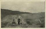
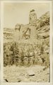
Cliff dwellers watch tower, stone house branch of McElmo Canyon. Stands on Dakota sandstone. San Juan County, UT, 1928
1928
Image
23
Cliff house north side of San Juan near Bluff
1920; 1921; 1922; 1923; 1924; 1925; 1926; 1927; 1928; 1929; 1930
Image
24
Cliff house rim and aurieul ladder pole near Edwin Bridge, Armstrong Canyon
1928
Image
25
Cliff House, Fable Valley (Fred Lowrey, Honolulu)
1920; 1921; 1922; 1923; 1924; 1925; 1926; 1927; 1928; 1929; 1930
Image
1
-
25
of
130
<
1
2
3
4
5
6
>