Home
Browse
Ask Us
Chat
Harmful Language Statement
Log in
Advanced Search
Year
1849
1850
1851
1852
1853
1854
1855
1856
1857
1858
1859
1860
1861
1862
1863
1864
1865
1866
1867
1868
1869
1870
1871
1872
1873
1874
1875
1876
1877
1878
1879
1880
1881
1882
1883
1884
1885
1886
1887
1888
1889
1890
1891
1892
1893
1894
1895
1896
1897
1898
1899
1900
1901
1902
1903
1904
1905
1906
1907
1908
1909
1910
1911
1912
1913
1914
1915
1916
1917
1918
1919
1920
1921
1922
1923
1924
1925
1926
1927
1928
1929
1930
1931
1932
1933
1934
1935
1936
1937
1938
1939
1940
1941
1942
1943
1944
1945
1946
1947
1948
1949
1950
1951
1952
1953
1954
1955
1956
1957
1958
1959
1960
1961
1962
1963
1964
1965
1966
1967
1968
1969
1970
1971
1972
1973
1974
1975
1976
1977
1978
1979
1980
1981
1982
1983
1984
1985
1986
1987
1988
1989
1990
1991
1992
1993
1994
1995
1996
1997
1998
1999
2000
2001
2002
2003
2004
2005
2006
2007
2008
2009
2010
2011
2012
2013
2014
2015
2016
2017
2018
2019
2020
TO
1849
1850
1851
1852
1853
1854
1855
1856
1857
1858
1859
1860
1861
1862
1863
1864
1865
1866
1867
1868
1869
1870
1871
1872
1873
1874
1875
1876
1877
1878
1879
1880
1881
1882
1883
1884
1885
1886
1887
1888
1889
1890
1891
1892
1893
1894
1895
1896
1897
1898
1899
1900
1901
1902
1903
1904
1905
1906
1907
1908
1909
1910
1911
1912
1913
1914
1915
1916
1917
1918
1919
1920
1921
1922
1923
1924
1925
1926
1927
1928
1929
1930
1931
1932
1933
1934
1935
1936
1937
1938
1939
1940
1941
1942
1943
1944
1945
1946
1947
1948
1949
1950
1951
1952
1953
1954
1955
1956
1957
1958
1959
1960
1961
1962
1963
1964
1965
1966
1967
1968
1969
1970
1971
1972
1973
1974
1975
1976
1977
1978
1979
1980
1981
1982
1983
1984
1985
1986
1987
1988
1989
1990
1991
1992
1993
1994
1995
1996
1997
1998
1999
2000
2001
2002
2003
2004
2005
2006
2007
2008
2009
2010
2011
2012
2013
2014
2015
2016
2017
2018
2019
2020
Type
Text
666
Image/StillImage
606
Image
6
Image/MovingImage
2
Sound
1
Format
application/pdf
1,174
image/jpeg
78
video/mp4
1
Collection
Classified Photographs
1
College of Law Publications
3
Theses & Dissertations
1
UAIDA Main Collection
1,269
Utah COVID-19
4
Utah Historical Society Oral History ...
1
Western Waters Electronic Resources
2
More
Filters:
Subject:
"Indian reservations"
701
-
725
of
1,281
<
24
25
26
27
28
29
30
31
32
33
>
Gallery view
Number of results to display per page
10
25
50
100
200
Sort by Relevance
Sort by Title A-Z
Sort by Title Z-A
Sort by Date Ascending
Sort by Date Descending
Sort by Last Modified Ascending
Sort by Last Modified Descending
Title
Date
Type
Setname
701
Map of Southern Ute Agencies
Image/StillImage
uaida_main
702
Map of Stock Mining Claims in the Uintah Basin
Image/StillImage
uaida_main
703
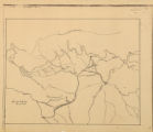
Map of the Four Corners Region and the Reservation of the Ute Mountain Ute Tribe
Image/StillImage
uaida_main
704
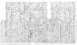
Map of the Northern Part of the Former Uintah Indian Reservation Showing the Irrigation System
Image/StillImage
uaida_main
705
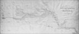
Map of the South West Boundary of the Uintah Indian Reserve Utah Territory
1920; 1921; 1922; 1923; 1924; 1925; 1926; 1927; 1928; 1929; 1930; 1931; 1932; 1933; 1934; 1935; 1936; 1937; 1938; 1939; 1940
Image/StillImage
uaida_main
706
Map of the South West Boundary of the Uintah Indian Reserve Utah Territory.
Image/StillImage
uaida_main
707
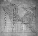
Map of the Southern Part of the Former Uintah Indian Reservation Showing the Irrigation System of Indian Allotments
Image/StillImage
uaida_main
708
Map of the Uintah Basin and the Uintah Ouray Reservation
Image/StillImage
uaida_main
709
Map of Uintah Basin and Fort Duchesne
Image/StillImage
uaida_main
710
Map of Uintah Irrigation Project June 1926 Myton, Utah
Image/StillImage
uaida_main
711
Map of Uintah Reservation. Green River Area
Image/StillImage
uaida_main
712
Map of Uintah Valley Reserve, formed by order of President Abraham Lincoln, 1861.
Image/StillImage
uaida_main
713
Map of Uncompahgre Ute Indian Reservation Boundaries, Sheet Number 1, 1889
Image/StillImage
uaida_main
714
Map of Uncompahgre Ute Indian Reservation Boundaries, Sheet Number 2, 1889
Image/StillImage
uaida_main
715
Map of Uncompahgre Ute Indian Reservation Boundaries, Sheet Number 3, 1889
Image/StillImage
uaida_main
716
Map of Uncompahgre Ute Indian Reservation Boundaries, Sheet Number 4, 1889
Image/StillImage
uaida_main
717
Map of Uncompahgre Ute Indian Reservation Boundaries, Sheet Number 5, 1889
Image/StillImage
uaida_main
718
Map of Uncompahgre Ute Indian Reservation Boundaries, Sheet Number 6, 1889
Image/StillImage
uaida_main
719
Map of Uncompahgre Ute Indian Reservation Boundaries, Sheet Number 7, 1889
Image/StillImage
uaida_main
720
Map of Uncompahgre Ute Indian Reservation Boundaries, Sheet Number 8, 1889
Image/StillImage
uaida_main
721
Map of Uncompahgre Ute reservation, Includes parcel divisions
Image/StillImage
uaida_main
722
Map of Ute Reservation in Western Colorado, and Lands Ceded Over Time
1882
Image/StillImage
uaida_main
723
Map of Ute Territory by Band
Image/StillImage
uaida_main
724
Map of Walker River Paiute Tribe Original Reservation Centennial 1874-1974
1874
Image/StillImage
uaida_main
725
Map of Western Indian Territory Before 1850
Image/StillImage
uaida_main
701
-
725
of
1,281
<
24
25
26
27
28
29
30
31
32
33
>