Home
Browse
Ask Us
Chat
Harmful Language Statement
Log in
Advanced Search
Year
1915
1916
1917
1918
1919
1920
1921
1922
1923
1924
1925
1926
1927
1928
1929
1930
1931
1932
1933
1934
1935
1936
1937
1938
1939
1940
1941
1942
1943
1944
1945
1946
1947
1948
1949
1950
1951
1952
1953
1954
1955
1956
1957
1958
1959
1960
1961
1962
1963
1964
1965
1966
1967
1968
1969
1970
1971
1972
1973
1974
1975
1976
1977
1978
1979
1980
1981
1982
1983
1984
1985
1986
1987
1988
1989
1990
1991
1992
1993
1994
1995
1996
1997
1998
1999
2000
2001
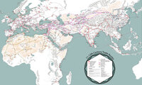
2002
TO
1915
1916
1917
1918
1919
1920
1921
1922
1923
1924
1925
1926
1927
1928
1929
1930
1931
1932
1933
1934
1935
1936
1937
1938
1939
1940
1941
1942
1943
1944
1945
1946
1947
1948
1949
1950
1951
1952
1953
1954
1955
1956
1957
1958
1959
1960
1961
1962
1963
1964
1965
1966
1967
1968
1969
1970
1971
1972
1973
1974
1975
1976
1977
1978
1979
1980
1981
1982
1983
1984
1985
1986
1987
1988
1989
1990
1991
1992
1993
1994
1995
1996
1997
1998
1999
2000
2001
2002
Type
Image
269
Text
1
Format
image/jpeg
269
Collection
Art and Art History
169
Beckwith Photograph Collection
8
Classified Photographs
52
Clifton Bray Film Negatives
10
Extractions from the Land: Mining and...
2
Olympic Legacy
5
Peoples of Utah Revisited
1
Photo Archives
8
Shipler Commercial Photographers
6
Ski and Snow Sports Archives
1
Vernal Express Photographs
2
Westminster College Photographs
5
More
Filters:
Format:
"image/jpeg"
Subject:
"Maps"
Type:
"Image"
76
-
100
of
269
<
1
2
3
4
5
6
7
8
9
10
>
Gallery view
Number of results to display per page
10
25
50
100
200
Sort by Relevance
Sort by Title A-Z
Sort by Title Z-A
Sort by Date Ascending
Sort by Date Descending
Sort by Last Modified Ascending
Sort by Last Modified Descending
Title
Date
Type
Setname
76
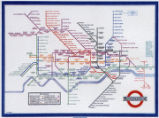
Map of London Underground, After Re-Design
Image
uu_aah_art
77
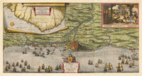
Map of the Dutch capture of the town of Olinda in Pernambuco by the Dutch West Indies Company in February 1630
Image
uu_aah_art
78
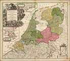
Map of the Dutch Republic
Image
uu_aah_art
79
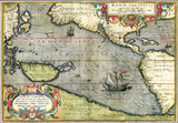
Map of the Pacific
Image
uu_aah_art
80
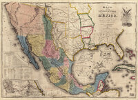
Map of the United States of Méjico (Mexico)
Image
uu_aah_art
81
Map of Utah with Cross
1951-10-18
Image
dha_scp
82
Map on Wall at Walgreen Drug Store, May 1936
1936-05-28
Image
dha_cbfm
83
Map on Wall at Walgreen Drug Store, May 1936
1936-05-28
Image
dha_cbfm
84
Map showing Ravenna and Aachen
Image
uu_aah_art
85
Map showing the dissolution of the former Roman Empire, c. 600
Image
uu_aah_art
86
Map showing three locations of Zhuang Hui's site-specific project "Longitude 109.88°E and Latitude 31.09°N
Image
uu_aah_art
87
Map, annotated
1975
Image
dha_eftl
88
Map, July 1938
1938-07-12
Image
dha_cbfm
89
Map, July 1938
1938-07-12
Image
dha_cbfm
90
Map, Mar. 1938
1938-03-03
Image
dha_cbfm
91
Map, Mar. 1938
1938-03-03
Image
dha_cbfm
92
Map, Mar. 1938
1938-03-03
Image
dha_cbfm
93
Map, May 1938
1938-05-16
Image
dha_cbfm
94
Map, Salt Lake Valley
1975
Image
dha_eftl
95
Map: 11th - 12th Century Trade Routes
Image
uu_aah_art
96
Map: 11th - 12th Century Trade Routes including Rome, Constantinople, Damascus, Jerusalem, and Dura-Europos
Image
uu_aah_art
97
Map: Abbasid caliphate
Image
uu_aah_art
98
Map: Ancient Egypt
Image
uu_aah_art
99
Map: Ancient Near East
Image
uu_aah_art
100
Map: Ancient Silk Routes between China and the West
Image
uu_aah_art
76
-
100
of
269
<
1
2
3
4
5
6
7
8
9
10
>