Home
Browse
Ask Us
Chat
Harmful Language Statement
Log in
Advanced Search
Year
1860
1861
1862
1863
1864
1865
1866
1867
1868
1869
1870
1871
1872
1873
1874
1875
1876
1877
1878
1879
1880
1881
1882
1883
1884
1885
1886
1887
1888
1889
1890
1891
1892
1893
1894
1895
1896
1897
1898
1899
1900
1901
1902
1903
1904
1905
1906
1907
1908
1909
1910
1911
1912
1913
1914
1915
1916
1917
1918
1919
1920
1921
1922
1923
1924
1925
1926
1927
1928
1929
1930
1931
1932
1933
1934
1935
1936
1937
1938
1939
1940
1941
1942
1943
1944
1945
1946
1947
1948
1949
1950
1951
1952
1953
1954
1955
1956
1957
1958
1959
1960
1961
1962
1963
1964
1965
1966
1967
1968
1969
1970
1971
1972
1973
1974
1975
1976
1977
1978
1979
1980
1981
1982
1983
1984
1985
1986
1987
1988
1989
1990
1991
1992
1993
1994
1995
1996
1997
1998
1999
2000
2001
2002
2003
2004
2005
2006
2007
2008
2009
TO
1860
1861
1862
1863
1864
1865
1866
1867
1868
1869
1870
1871
1872
1873
1874
1875
1876
1877
1878
1879
1880
1881
1882
1883
1884
1885
1886
1887
1888
1889
1890
1891
1892
1893
1894
1895
1896
1897
1898
1899
1900
1901
1902
1903
1904
1905
1906
1907
1908
1909
1910
1911
1912
1913
1914
1915
1916
1917
1918
1919
1920
1921
1922
1923
1924
1925
1926
1927
1928
1929
1930
1931
1932
1933
1934
1935
1936
1937
1938
1939
1940
1941
1942
1943
1944
1945
1946
1947
1948
1949
1950
1951
1952
1953
1954
1955
1956
1957
1958
1959
1960
1961
1962
1963
1964
1965
1966
1967
1968
1969
1970
1971
1972
1973
1974
1975
1976
1977
1978
1979
1980
1981
1982
1983
1984
1985
1986
1987
1988
1989
1990
1991
1992
1993
1994
1995
1996
1997
1998
1999
2000
2001
2002
2003
2004
2005
2006
2007
2008
2009
Type
Image/StillImage
1,187
Image
244
Sound
24
Text
2
Image/MovingImage
1
Format
image/jpeg
2,227
application/pdf
178
video/mp4
21
audio/mpeg
4
Collection
College of Law Publications
1
Everett L. Cooley Oral History Project
1
O.L. Tapp Film Collection
1
Photo Archives
1,343
Ski and Snow Sports Photo Archives
1,060
UAIDA Main Collection
9
Western Soundscape
24
More
Filters:
Spatial Coverage:
"Wasatch Range (Utah and Idaho)"
1076
-
1100
of
2,439
<
39
40
41
42
43
44
45
46
47
48
>
Gallery view
Number of results to display per page
10
25
50
100
200
Sort by Relevance
Sort by Title A-Z
Sort by Title Z-A
Sort by Date Ascending
Sort by Date Descending
Sort by Last Modified Ascending
Sort by Last Modified Descending
Title
Date
Type
Setname
1076
Looking toward saddle and almost on glacier, 1935
1935
uum_map_usa
1077
Looking toward saddle and almost on glacier, 1935 (Negative)
1935
uum_map_usa
1078
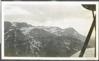
Looking toward Twin Lakes from down hill course, June 1937
1937-06
uum_map_usa
1079
Looking toward Twin Lakes from down hill course, June 1937
1937-06
uum_map_usa
1080
Looking toward Twin Lakes from down hill course, June 1937 (Negative)
1937-06
uum_map_usa
1081
Looking toward Twin Lakes from down hill course, June 1937 (Negative)
1937-06
uum_map_usa
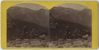
1082
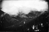
Looking up Cottonwood Canyon from Mt. Emma
1879; 1880; 1881
Image/StillImage
uum_map
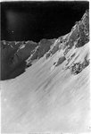
1083
Looking up Stairs Gulch, east face of Storm Mountain at right; 1963
1963
Image
uum_map
1084
Looking west
1930; 1931; 1932; 1933; 1934; 1935; 1936
Image/StillImage
uum_map
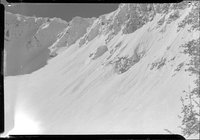
1085
Loose snow avalanche in Easter Bowl about one day after 6 inches of snow fell, 13 February 1949
1949-02-13
uum_map_usa
1086
Loose snow avalanche in Easter Bowl about one day after 6 inches of snow fell, 13 February 1949
1949-02-13
uum_map_usa
1087
Loose snow avalanche in Easter Bowl about one day after 6 inches of snow fell, 13 February 1949 (Negative)
1949-02-13
uum_map_usa
1088
Loose snow avalanche in Easter Bowl about one day after 6 inches of snow fell, 13 February 1949 (Negative)
1949-02-13
uum_map_usa
1089
Lovers yet, 1927
1927
Image/StillImage
uum_map
1090
Loyal and Oscar, North Fork
1924; 1925; 1926; 1927
Image/StillImage
uum_map
1091
Lull between storms: Brighton, February 1929
1929-02-22
Image/StillImage
uum_map
1092
Lunch time
1930; 1931; 1932; 1933; 1934; 1935; 1936
Image/StillImage
uum_map
1093
Mac Fraser in Eccles Cup, Snowbasin, 6 February 1949
1949-02-06
uum_map_usa
1094
Mac Fraser in Eccles Cup, Snowbasin, 6 February 1949 (Negative)
1949-02-06
uum_map_usa
1095
Main store at Alta
1920; 1921; 1922; 1923; 1924; 1925
Image/StillImage
uum_map
1096
Man sitting next to a tree, posed for the camera.
1931-08-30
Image
uum_map
1097
Map of the "Salt Lake Olympic Area."
1999
uum_map_usa
1098
Map of the Salt Lake City area showing the canyons and location of ski resorts, circa 2000.
2000
uum_map_usa
1099
Map of the Wasatch Front ski areas, 2000. Illustration by James Niehues
2000
uum_map_usa
1100
Marble Cliffs below Alta, edge of Superior
1937; 1938; 1939; 1940; 1941
uum_map_usa
1076
-
1100
of
2,439
<
39
40
41
42
43
44
45
46
47
48
>