201 - 225 of 253
Number of results to display per page
TitleDateType
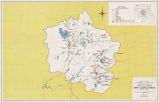
201 Tube 211: Maps - Upper Colorado Region (October 1965)Text
202 Tube 211: Upper Colorado Region (October 1965, Revised Spetember 82)1982-09Text
203 Tube 214 : Clay Basin, Utah (1952)1952Text
204 Tube 214: Maps - Clay Basin Utah (1952)Text
205 Tube 214: Maps - Dutch John, Utah - Wyo (1966)Text
206 Tube 214: Maps - Goslin MTN., Utah (1952)Text
207 Tube 214: Maps - Willow Creek Butte, Utah-Colo (1952)Text
208 Tube 214: Maps -Swallow Canyon, Utah-Colo (1952)Text
209 Tube 217: Maps - Delta Colorado (1980)Text
210 Twentieth Century Zuni Political and Economic Development in Relation to Federal Indian Policy1988Text
211 U.S. Department of Interior Water Projects Review Office Preliminary Information and Data Sheets for Bonneville Unit1977-03-15Text
212 Uintah Unit, Central Utah Project: advance draft environmental statementText
213 Utah and Interior Agreement on Stream Flows for Uinta Range Rivers1980Text
214 Utah Board of Water Resources Tour & Meeting, August 3 and 4, 1972: Supplementary information regarding Kolob Reservoir and related items1972-08Text
215 Utah Water Resources Council papers, 1980-19811975; 1979; 1980; 1981; 1983Text
216 Wah-to-yah and the Taos Trail [Excerpt]1974Text
217 Warner Valley Water Project documents1977; 1978Text
218 Warner Valley Water Project, report and responses, 1977-19781977; 1978Text
219 Water Boundaries of the Colville Indian Reservation (Draft)2002-04-10Text
220 Water Log: Citizens for a Responsible CUP (newsletter)1978Text
221 Wells Dam Project: Acquisition of Colville Indian Reservation land1959; 1960; 1964; 1965; 1966; 1967; 1968; 1974; 2003Text
222 Wells Hydro-electric development, Columbia River, Washington: Detail map of project area1957-07Text
223 Zia Pueblo Agriculture and Water Use Through the Centuries1987-02Text
224 Zia Pueblo Agriculture and Water Use Through the Centuries: Plaintiff's Footnotes 1-371987-02Text
225 Zuni ancestral gods and masks1898-02Text
201 - 225 of 253