Home
Browse
Ask Us
Chat
Harmful Language Statement
Log in
Photo Archives
Advanced Search
About
Over 70,000 photos covering a variety of topics from Marriott Library Special Collections
Year
1911
1912
1913
1914
1915
TO
1911
1912
1913
1914
1915
Type
Image
154
Format
image/jpeg
154
Collection
Photo Archives
154
Filters:
Format:
"image/jpeg"
Spatial Coverage:
"South America"
76
-
100
of
154
<
1
2
3
4
5
6
7
>
Gallery view
Number of results to display per page
10
25
50
100
200
Sort by Relevance
Sort by Title A-Z
Sort by Title Z-A
Sort by Date Ascending
Sort by Date Descending
Sort by Last Modified Ascending
Sort by Last Modified Descending
Title
Date
Type
76
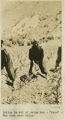
Cuzco. Similar place farther up the Anta road. Dr. Eaton pointing to the spot where a rib was found interstratified with the gravel
1911; 1912; 1915
Image
77
Cuzco. Tame vicuna in the barracks.
1911
Image
78
Cuzco. Temple of the Sun. Outside wall
1912
Image
79
Cuzco. Types of Indian women.
1912
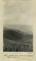
Image
80
Cuzco. Weathering in igneous mass underlying Sacsahuanan, Cuzco
1912; 1913; 1914; 1915
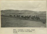
Image
81
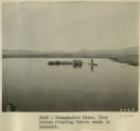
Desaguadero River. Uros Indian floating Totora reeds to Ancoaqui.
1911
Image
82
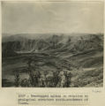
Even topped upland in relation to geological structure south-southwest of Cuzco
1911
Image
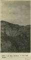
83
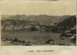
Fort Sacsuahman
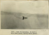
1911; 1912; 1913; 1914; 1915
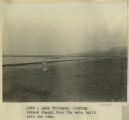
Image
84
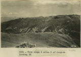
From ridge 2 miles S of Cropesa looking SE
1912
Image
85
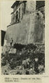
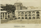
Graveyard, Cuzco.
1912; 1913; 1914; 1915
Image
86
Group at the Calca Sunday market.
1912; 1913; 1914; 1915
Image
87
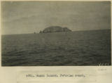
Guano Island, Peruvian coast.
1912; 1913; 1914; 1915
Image
88
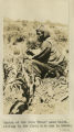
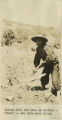
Indian at the farm 'Urco' near Calca, sitting in the field with how in hands.
1912; 1913; 1914; 1915
Image
89
Indian gathering firewood on mountain-side above Calca.
1911
Image
90
Indian gathering firewood on mountain-side above Calca.
1912
Image
91
Indian in act of using how-'Urco'-The farm near Calca.
1912; 1913; 1914; 1915
Image
92
Indigenous Quechua with hoe for farming
1912; 1913; 1914; 1915
Image
93
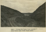
Juliaca to Cuzco R.R. Looking S from water tank above Santa Rosa.
1911; 1912; 1915
Image
94
Kettle hole north of Juancotis, Elev. 14,000 ft.
1912; 1913; 1914; 1915
Image
95
La Paz. Details of the Bad Lands.
1912; 1913; 1914; 1915
Image
96
La Raya. Abandoned moraine
1912; 1913; 1914; 1915
Image
97
Lake Parinacochas. Ox half a mile from shore, eating water grass.
1911; 1912; 1915
Image
98
Lake Titicaca. Looking toward Quaqui from the mole built into the lake
1911
Image
99
Lake Titicaca. Reed belt, alluvial fringe and tilted strata, border of Lake Titicaca near Guaqui.
1911
Image
100
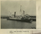
Lake Titicaca. Steamer at Guaqui.
1911
Image
76
-
100
of
154
<
1
2
3
4
5
6
7
>