Curriculum-based images for use in teaching, research, and learning.
1 - 25 of 8
| Title | Creator | Creation Date | ||
|---|---|---|---|---|
| 1 |
 |
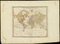
A chart of the world upon Mercator's projection : describing the tracks of Capt. Cook in the year 1768, 69, 70, 71, and in 1772, 73, 74, 75, with the new discoveries | William Faden | 1775 CE |
| 2 |
 |
A new plan of ye great town of Boston in New England in America, with the many additionall [sic] buildings, & new streets, to the year, 1769 | William Price; John Bonner | 1769 CE |
| 3 |
 |
Map: The Empire on the Eve of the French Revolution, 1789 | ||
| 4 |
 |
Map: The greatest extent of Napoleon I's First Empire, 1812 | ||
| 5 |
 |
Amerique Meridionale Publiee sous les Auspices de Monseigneur le Duc d'Orleans | Jean Baptiste Bourguignon D'Anville | 1748 CE |
| 6 |
 |
Map: Portuguese America in 1750 | 1750 CE | |
| 7 |
 |
Boston, its environs and harbour, with the rebels works raised against that town in 1775 | Thomas Hyde Page | c. 1775 CE |
| 8 |
 |
Novus Orbis sive America | Matthäus Seutter | 1735 CE |
1 - 25 of 8
