Home
Browse
Ask Us
Chat
Harmful Language Statement
Log in
Advanced Search
Year
1846
1847
1848
1849
1850
1851
1852
1853
1854
1855
1856
1857
1858
1859
1860
1861
1862
1863
1864
1865
1866
1867
1868
1869
1870
1871
1872
1873
1874
1875
1876
1877
1878
1879
1880
1881
1882
1883
1884
1885
1886
1887
1888
1889
1890
1891
1892
1893
1894
1895
1896
1897
1898
1899
1900
1901
1902
1903
1904
1905
1906
1907
1908
1909
1910
1911
1912
1913
1914
1915
1916
1917
1918
1919
1920
1921
1922
1923
1924
1925
1926
1927
1928
1929
1930
1931
1932
1933
1934
1935
1936
1937
1938
1939
1940
1941
1942
1943
1944
1945
1946
1947
1948
1949
1950
1951
1952
1953
1954
1955
1956
1957
1958
1959
1960
1961
1962
1963
1964
1965
1966
1967
1968
1969
1970
1971
1972
1973
1974
1975
1976
1977
1978
1979
1980
1981
1982
1983
1984
1985
1986
1987
1988
1989
1990
1991
1992
1993
1994
1995
1996
1997
1998
1999
2000
2001
2002
2003
2004
2005
2006
2007
2008
2009
2010
2011
2012
2013
2014
2015
2016
2017
TO
1846
1847
1848
1849
1850
1851
1852
1853
1854
1855
1856
1857
1858
1859
1860
1861
1862
1863
1864
1865
1866
1867
1868
1869
1870
1871
1872
1873
1874
1875
1876
1877
1878
1879
1880
1881
1882
1883
1884
1885
1886
1887
1888
1889
1890
1891
1892
1893
1894
1895
1896
1897
1898
1899
1900
1901
1902
1903
1904
1905
1906
1907
1908
1909
1910
1911
1912
1913
1914
1915
1916
1917
1918
1919
1920
1921
1922
1923
1924
1925
1926
1927
1928
1929
1930
1931
1932
1933
1934
1935
1936
1937
1938
1939
1940
1941
1942
1943
1944
1945
1946
1947
1948
1949
1950
1951
1952
1953
1954
1955
1956
1957
1958
1959
1960
1961
1962
1963
1964
1965
1966
1967
1968
1969
1970
1971
1972
1973
1974
1975
1976
1977
1978
1979
1980
1981
1982
1983
1984
1985
1986
1987
1988
1989
1990
1991
1992
1993
1994
1995
1996
1997
1998
1999
2000
2001
2002
2003
2004
2005
2006
2007
2008
2009
2010
2011
2012
2013
2014
2015
2016
2017
Type
Image/StillImage
527
Format
image/jpeg
398
application/pdf
126
Collection
Photo Archives
29
Regional History Center
19
Sustainability U
1
UAIDA Main Collection
63
Uintah County Regional History Center...
415
Filters:
Subject:
"Utah"
Type:
"Image/StillImage"
26
-
50
of
527
<
1
2
3
4
5
6
7
8
9
10
>
Gallery view
Number of results to display per page
10
25
50
100
200
Sort by Relevance
Sort by Title A-Z
Sort by Title Z-A
Sort by Date Ascending
Sort by Date Descending
Sort by Last Modified Ascending
Sort by Last Modified Descending
Title
Date
Type
Setname
26
Ashley National Forest Wilderness Proposal 1967 - South Slope Plan - Roadless Areas - Alternative 1
1967
Image/StillImage
ucl_maps
27
Ashley National Forest Wilderness Proposal 1967 - South Slope Plan - Roadless Areas - Alternative 2
1967
Image/StillImage
ucl_maps
28
Ashley National Forest Wilderness Proposal 1967 - South Slope Plan - Roadless Areas - Alternative 3
1967
Image/StillImage
ucl_maps
29
Ashley National Forest Wilderness Proposal 1967 - South Slope Plan - Roadless Areas - Alternative 4
1967
Image/StillImage
ucl_maps
30
Ashley National Forest, Duchesne, Flaming Gorge, Roosevelt and Vernal Ranger Districts 1982
1982
Image/StillImage
ucl_maps
31
Ashley National Forest, Roosevelt and Duchesne Ranger Districts 1971
1971
Image/StillImage
ucl_maps
32
Ashley National Forest, Roosevelt, Flaming Gorge & Vernal Ranger Distrs. 1971. UT & WY
1971
Image/StillImage
ucl_maps
33
Ashley National Forest, Utah - Salt Lake and Uinta Special Meridians
1962
Image/StillImage
ucl_maps
34
Ashley National Forest, Utah - Salt Lake and Uinta Special Meridians 1962
1962
Image/StillImage
ucl_maps
35
Ashley National Forest, Utah and Wyoming - Salt Lake, Uinta Special, and Sixth Principal Meridians 1928
1928
Image/StillImage
ucl_maps
36
Ashley National Forest, Utah and Wyoming - Salt Lake, Uinta Special, and Sixth Principal Meridians 1933
1933
Image/StillImage
ucl_maps
37
Ashley National Forest, Utah, Salt Lake and Uinta Special Meridians. 1955 - reprint of 1945 edition
1955
Image/StillImage
ucl_maps
38
Ashley Valley Survey T5S R20 East SLM, 1880s
1879; 1880; 1881; 1882; 1883; 1884; 1885; 1886; 1887; 1888; 1889
Image/StillImage
ucl_maps
39
Ashley, Utah reprint edition of Dec. 1885 map
1885
Image/StillImage
ucl_maps
40
Ashton Home Floor Plan
1989
Image/StillImage
ucl_maps
41
Basin US DOI BLM 1977
1977
Image/StillImage
ucl_maps
42
Bear Dance Circle
1930; 1931; 1932; 1933; 1934; 1935; 1936; 1937; 1938; 1939; 1940
Image/StillImage
uaida_main
43
Bear Lake US DOI BLM 1974
1974
Image/StillImage
ucl_maps
44
Beaver US DOI BLM 1977
1977
Image/StillImage
ucl_maps
45
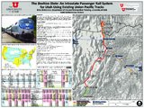
The Beehive State: an intrastate passenger rail system for Utah using existing Union Pacific tracks
2017
Image/StillImage
ir_su
46
Bennion - Feltch Home Floor Plans
1989
Image/StillImage
ucl_maps
47
Bennion - Valora Home Floor Plans
1989
Image/StillImage
ucl_maps
48
Bitter Creek, NE-18, (US DOI BLM) 1975 (revised)
1975
Image/StillImage
ucl_maps
49
Black Ridge Gilsonite Mine - Profile View, Plot Plan, Topographical Profile View - February 1971
1971
Image/StillImage
ucl_maps
50
BLM Vernal Field Office Grazing Allotments 2004
2004
Image/StillImage
ucl_maps
26
-
50
of
527
<
1
2
3
4
5
6
7
8
9
10
>