Home
Browse
Ask Us
Chat
Harmful Language Statement
Log in
Art and Art History
Advanced Search
Subject
Maps
169
Asian Art
27
Brazil
13
Buddhism
9
Buddhist Art
8
Architecture
6
Latin America
5
Ruins
5
Colonial Latin America
4
Japanese Art
3
Latin American Art
3
Asia
2
Boston Massacre
2
French History
2
French Revolution
2
History
2
Islamic Art
2
Napoleon Bonaparte
2
Napoleonic Wars
2
South America
2
Art Academy
1
Aztec Empire
1
Ceramics
1
China
1
Contemporary Asian Art
1
Dutch Brazil
1
Hindu Art
1
Hinduism
1
India
1
Korean Art
1
Middle East
1
Religious Art
1
Religious Buildings
1
World History
1
More
Filters:
Collection:
"uu_aah_art"
Subject:
"Maps"
76
-
100
of
169
<
1
2
3
4
5
6
7
>
Gallery view
Number of results to display per page
10
25
50
100
200
Sort by Relevance
Sort by Title A-Z
Sort by Title Z-A
Sort by Date Ascending
Sort by Date Descending
Sort by Last Modified Ascending
Sort by Last Modified Descending
Sort by Module Order
Title
Creator
Creation Date
76
Map: Europe during the 14th Century CE
14th Century CE
77
Map: British Empire, excluding Americas, 1921 CE
1921 CE
78
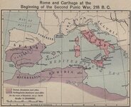
Map: Roman and Carthaginian Territories at the beginning of the Second Punic War, 218 BCE
218 BCE
79
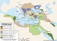
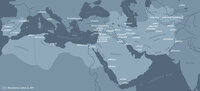
Map: Extent of Ottoman Empire, 1300-1699 CE
1300 - 1699 CE
80
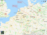
Map: Northern Europe showing Dessau and Weimar, Germany
81
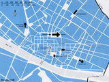
Map: Florence, Italy, 1400 CE
82
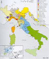
Map: Italy, c.1410 CE
83
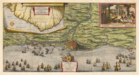
Map of the Dutch capture of the town of Olinda in Pernambuco by the Dutch West Indies Company in February 1630
1630 CE
84
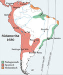
Map: South America around 1650
1650 CE
85
Map: Brazil
86
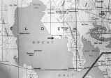
Map: Northen Great Salt Lake Area
87
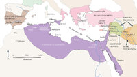
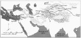
Map: Abbasid caliphate
88
Map showing Ravenna and Aachen
89
Map showing the dissolution of the former Roman Empire, c. 600
c. 600 CE
90
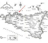
Map: Sicily
91
Map: Cairo and environs during Fatimid period
92
Map: Cairo and environs during Fatimid period
93
Map: Fatimid Caliphate Rule
94
Map: Fatimid Caliphate Rule
95
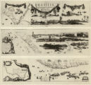
New Hydrographic and Geographic Map of Brazil, containing the Provinces of Ciriji, with Itapuama in Paranambuca, Itamaraca, Paraiba, and Potigi to the Rio Grande
Georg Marcgraf; Johan Blaeu (engraver)
1643 CE
96
Map of America
attributed to Diogo Ribeiro
c. 1532 CE
97
Map: Areas in northeast Brazil occupied by the Dutch, showing the main regions under Johan Maurits van Nassau's rule, 1637 - 1644
98
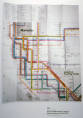
New York Metropolitan Transit Authority Subway Guide
Massimo Vignelli
1970 CE
99
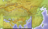
Map: The Silk Road
100
Map: Ancient Silk Routes between China and the West
76
-
100
of
169
<
1
2
3
4
5
6
7
>