| Title | Date | Type | Setname | ||
|---|---|---|---|---|---|
| 926 |
 |
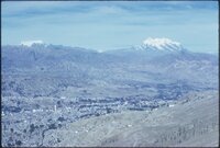
Aerial slide of Little Cottonwood Canyon | 1937; 1938; 1939; 1940; 1941; 1942; 1943; 1944; 1945; 1946; 1947; 1948; 1949; 1950; 1951; 1952; 1953; 1954; 1955; 1956; 1957; 1958; 1959; 1960; 1961; 1962; 1963; 1964; 1965; 1966; 1967; 1968; 1969 | uum_map_usa | |
| 927 |
 |
Aerial slide of Little Cottonwood Canyon | 1937; 1938; 1939; 1940; 1941; 1942; 1943; 1944; 1945; 1946; 1947; 1948; 1949; 1950; 1951; 1952; 1953; 1954; 1955; 1956; 1957; 1958; 1959; 1960; 1961; 1962; 1963; 1964; 1965; 1966; 1967; 1968; 1969 | uum_map_usa | |
| 928 |
 |
Aerial slide of Little Cottonwood Canyon | 1937; 1938; 1939; 1940; 1941; 1942; 1943; 1944; 1945; 1946; 1947; 1948; 1949; 1950; 1951; 1952; 1953; 1954; 1955; 1956; 1957; 1958; 1959; 1960; 1961; 1962; 1963; 1964; 1965; 1966; 1967; 1968; 1969 | uum_map_usa | |
| 929 |
 |
Aerial slide of Little Cottonwood Canyon | 1937; 1938; 1939; 1940; 1941; 1942; 1943; 1944; 1945; 1946; 1947; 1948; 1949; 1950; 1951; 1952; 1953; 1954; 1955; 1956; 1957; 1958; 1959; 1960; 1961; 1962; 1963; 1964; 1965; 1966; 1967; 1968; 1969 | uum_map_usa | |
| 930 |
 |
Aerial slide of Little Cottonwood Canyon | 1937; 1938; 1939; 1940; 1941; 1942; 1943; 1944; 1945; 1946; 1947; 1948; 1949; 1950; 1951; 1952; 1953; 1954; 1955; 1956; 1957; 1958; 1959; 1960; 1961; 1962; 1963; 1964; 1965; 1966; 1967; 1968; 1969 | uum_map_usa | |
| 931 |
 |
Aerial slide of Little Cottonwood Canyon | 1937; 1938; 1939; 1940; 1941; 1942; 1943; 1944; 1945; 1946; 1947; 1948; 1949; 1950; 1951; 1952; 1953; 1954; 1955; 1956; 1957; 1958; 1959; 1960; 1961; 1962; 1963; 1964; 1965; 1966; 1967; 1968; 1969 | uum_map_usa | |
| 932 |
 |
Aerial view below airport, La Paz, Bolivia | 1962 | Image/StillImage | uum_map |
| 933 |
 |
Aerial view from the plane near Lima, Peru | 1962 | Image/StillImage | uum_map |
| 934 |
 |
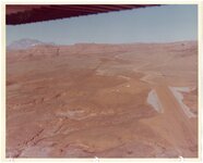
Aerial view of red rock landscape with sandstone canyon | 1962; 1963; 1964; 1965; 1966; 1967; 1968 | Image/StillImage | uum_map |
| 935 |
 |
Aerial view of a skier rounding a flag during a ski race. | 1960; 1961; 1962; 1963; 1964; 1965; 1966; 1967; 1968; 1969 | Image | uum_map_usa |
| 936 |
 |
Aerial view of a Southern Utah red rock landscape | 1962; 1963; 1964; 1965; 1966; 1967; 1968 | Image/StillImage | uum_map |
| 937 |
 |
Aerial view of a Southern Utah red rock landscape showing buttes | 1962; 1963; 1964; 1965; 1966; 1967; 1968 | Image/StillImage | uum_map |
| 938 |
 |
Aerial view of a Southern Utah red rock landscape with buildings and parked vehicles and boats | 1962; 1963; 1964; 1965; 1966; 1967; 1968 | Image/StillImage | uum_map |
| 939 |
 |
Aerial view of a Southern Utah red rock landscape with multiple mobile homes | 1962; 1963; 1964; 1965; 1966; 1967; 1968 | Image/StillImage | uum_map |
| 940 |
 |
Aerial view of a Southern Utah red rock landscape with parking area | 1962; 1963; 1964; 1965; 1966; 1967; 1968 | Image/StillImage | uum_map |
| 941 |
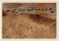 |
Aerial view of a Southern Utah red rock landscape with parking area and cars | 1962; 1963; 1964; 1965; 1966; 1967; 1968 | Image/StillImage | uum_map |
| 942 |
 |
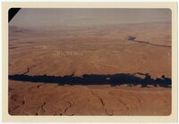
Aerial view of a Southern Utah red rock landscape with river [1] | 1962; 1963; 1964; 1965; 1966; 1967; 1968 | Image/StillImage | uum_map |
| 943 |
 |
Aerial view of a Southern Utah red rock landscape with river [2] | 1962; 1963; 1964; 1965; 1966; 1967; 1968 | Image/StillImage | uum_map |
| 944 |
 |
Aerial view of a Southern Utah red rock landscape with river [3] | 1962; 1963; 1964; 1965; 1966; 1967; 1968 | Image/StillImage | uum_map |
| 945 |
 |
Aerial view of a Southern Utah red rock landscape with several buildings and mobile homes | 1962; 1963; 1964; 1965; 1966; 1967; 1968 | Image/StillImage | uum_map |
| 946 |
 |
Aerial view of a Southern Utah red rock landscape with structures | 1962; 1963; 1964; 1965; 1966; 1967; 1968 | Image/StillImage | uum_map |
| 947 |
 |
Aerial view of a Southern Utah red rock landscape with water | 1962; 1963; 1964; 1965; 1966; 1967; 1968 | Image/StillImage | uum_map |
| 948 |
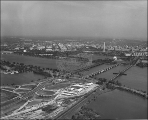 |
Aerial view of a Washington D.C. Marriott Hotel. | 1960; 1961; 1962; 1963; 1964; 1965; 1966; 1967; 1968; 1969 | uum_map | |
| 949 |
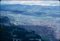 |
Aerial view of Bogota from Teleferico de Monserrate tourist cable car, Bogota, Colombia [01] | 1962 | Image/StillImage | uum_map |
| 950 |
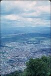 |
Aerial view of Bogota from Teleferico de Monserrate tourist cable car, Bogota, Colombia [02] | 1962 | Image/StillImage | uum_map |