|
|
Title | Date | Type | Setname |
| 1 |
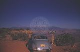 |
Automobile on road to Grand View Point in Canyonlands National Park, Utah | 1960-10-25 | Image | uum_map |
| 2 |
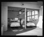 |
Automobile Service Station | 1960-10-25 | Image | dha_scp |
| 3 |
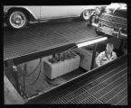 |
Automobile Service Station | 1960-10-25 | Image | dha_scp |
| 4 |
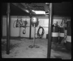 |
Automobile Service Station | 1960-10-25 | Image | dha_scp |
| 5 |
 |
Automobile Service Station | 1960-10-25 | Image | dha_scp |
| 6 |
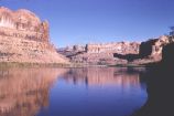 |
Colorado River at Bootlegger Canyon, downstream from Moab | 1960-10-25 | Image | uum_map |
| 7 |
 |
Colorado River at Gold Bar | 1960-10-25 | Image | uum_map |
| 8 |
 |
Colorado River canyonlands southwest of Moab [1] | 1960-10-25 | Image | uum_map |
| 9 |
 |
Colorado River canyonlands southwest of Moab [2] | 1960-10-25 | Image | uum_map |
| 10 |
 |
Colorado River canyonlands southwest of Moab [3] | 1960-10-25 | Image | uum_map |
| 11 |
 |
Colorado River canyonlands southwest of Moab [4] | 1960-10-25 | Image | uum_map |
| 12 |
 |
Colorado River canyonlands southwest of Moab [5] | 1960-10-25 | Image | uum_map |
| 13 |
 |
Colorado River canyonlands southwest of Moab [6] | 1960-10-25 | Image | uum_map |
| 14 |
 |
Colorado River canyonlands southwest of Moab [7] | 1960-10-25 | Image | uum_map |
| 15 |
 |
Colorado River canyonlands southwest of Moab [8] | 1960-10-25 | Image | uum_map |
| 16 |
 |
Corona Arch, southern Utah [1] | 1960-10-25 | Image | uum_map |
| 17 |
 |
Corona Arch, southern Utah [2] | 1960-10-25 | Image | uum_map |
| 18 |
 |
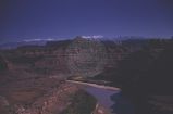
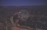
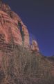
Grand View Point in Canyonlands National Park, Utah | 1960-10-25 | Image | uum_map |
| 19 |
 |
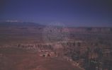
Grand View Point in Canyonlands National Park, Utah | 1960-10-25 | Image | uum_map |
| 20 |
 |
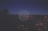
Grand View Point in Canyonlands National Park, Utah | 1960-10-25 | Image | uum_map |
| 21 |
 |
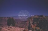
Grand View Point in Canyonlands National Park, Utah | 1960-10-25 | Image | uum_map |
| 22 |
 |
Grand View Point in Canyonlands National Park, Utah | 1960-10-25 | Image | uum_map |
| 23 |
 |
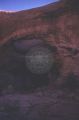
Jug Handle Arch, southern Utah | 1960-10-25 | Image | uum_map |
| 24 |
 |
Pinto Arch near Moab, Utah | 1960-10-25 | Image | uum_map |
| 25 |
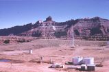 |
Potash Wells, Grand County, Utah | 1960-10-25 | Image | uum_map |