Over 70,000 photos covering a variety of topics from Marriott Library Special Collections
TO
| Title | Collection Number And Name | Photo Number | ||
|---|---|---|---|---|
| 26 |
 |
Salt Lake temple postcard | P0005 C. Lowell Lees Photograph Collection | P0005n06_12_002 |
| 27 |
 |
Demolition of unidentified building | P0005 C. Lowell Lees Photograph Collection | P0005n06_13_001 |
| 28 |
 |
Unidentified actress and actor | P0005 C. Lowell Lees Photograph Collection | P0005n06_20_001 |
| 29 |
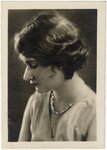 |
Lees Family [01] | P0005 C. Lowell Lees Photograph Collection | P0005n06_25_001 |
| 30 |
 |
Lees Family [02] | P0005 C. Lowell Lees Photograph Collection | P0005n06_25_002 |
| 31 |
 |
Lees Family [03] | P0005 C. Lowell Lees Photograph Collection | P0005n06_25_003 |
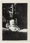
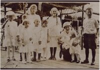
| 32 |
 |
Lees Family [05] | P0005 C. Lowell Lees Photograph Collection | P0005n06_25_005 |
| 33 |
 |
Lees Family [06] | P0005 C. Lowell Lees Photograph Collection | P0005n06_25_006 |
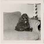
| 34 |
 |
Dog [01] | P0005 C. Lowell Lees Photograph Collection | P0005n06_25_009 |
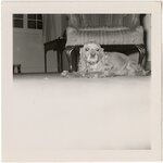
| 35 |
 |
Dog [02] | P0005 C. Lowell Lees Photograph Collection | P0005n06_25_010 |
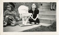
| 36 |
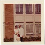 |
Lees Family [09] | P0005 C. Lowell Lees Photograph Collection | P0005n06_25_011 |
| 37 |
 |
Lees Family [11] | P0005 C. Lowell Lees Photograph Collection | P0005n06_25_014 |
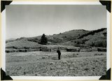
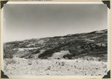
| 38 |
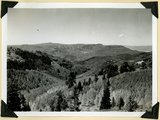 |
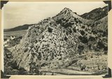
Summit Ridge. View looking south across Braffitts Canyon. Iron County, UT | P0013 Herbert E. Gregory Photograph Collection | P0013n11_167_2788 |
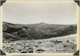
| 39 |
 |
Summit Ridge. Undissected highland 9000 feet near head of Summit Canyon, Iron County | P0013 Herbert E. Gregory Photograph Collection | P0013n11_167_2789 |
| 40 |
 |
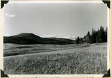
Summit Ridge. Pond supplied chiefly by melting snow. Iron County | P0013 Herbert E. Gregory Photograph Collection | P0013n11_168_2790 |
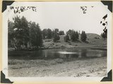
| 41 |
 |
Summit Ridge. Pond supplied chiefly by melting snow. Iron County | P0013 Herbert E. Gregory Photograph Collection | P0013n11_168_2791 |
| 42 |
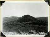 |
Sugar loaf on outlier of Markagunt Plateau on divide between Parowan and Coal Creek drainage areas. Iron County | P0013 Herbert E. Gregory Photograph Collection | P0013n11_169_2792 |
| 43 |
 |
Surface of Kolob Terrace near Pryor Knoll, Iron County | P0013 Herbert E. Gregory Photograph Collection | P0013n11_169_2793 |
| 44 |
 |
Westward tilting Moenkopi strata; Timpoweap, lower red, Virgin and Shnabkaib members. Mouth of Kanarra Canyon. Iron Co, UT | P0013 Herbert E. Gregory Photograph Collection | P0013n11_170_2794 |
| 45 |
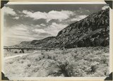 |
Hurricane Cliffs looking north across mouth of Swayne Creek. Iron County | P0013 Herbert E. Gregory Photograph Collection | P0013n11_170_2795 |
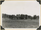
| 46 |
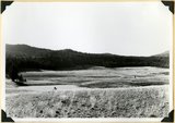 |
Sidney Valley near head of Castle Creek. Ponds and kame-like accumulation resulting from glaciation. Iron County, UT | P0013 Herbert E. Gregory Photograph Collection | P0013n11_171_2796 |
| 47 |
 |
Sidney Valley near head of Castle Creek. Ponds and kame-like accumulation resulting from glaciation. Iron County, UT | P0013 Herbert E. Gregory Photograph Collection | P0013n11_171_2797 |
| 48 |
 |
Surface of Kolob Terrace near head of Crystal Creek. Developed on Tropic shale | P0013 Herbert E. Gregory Photograph Collection | P0013n11_172_2798 |
| 49 |
 |
Panorama. Surface of Kolob Terrace near the head of Kolob Creek. Iron County, UT | P0013 Herbert E. Gregory Photograph Collection | P0013n11_172_2799 |
| 50 |
 |
Panorama. Surface of Kolob Terrace near the head of Kolob Creek. Iron County, UT | P0013 Herbert E. Gregory Photograph Collection | P0013n11_173_2800 |