Home
Browse
Ask Us
Chat
Harmful Language Statement
Log in
Photo Archives
Advanced Search
About
Over 70,000 photos covering a variety of topics from Marriott Library Special Collections
Year
1942
1943
1944
1945
TO
1942
1943
1944
1945
Type
Image
65
Format
application/pdf
35
image/jpeg
30
Collection
Photo Archives
65
Filters:
Collection Name:
"Herbert E. Gregory"
Date:
"1943"
1
-
25
of
65
<
1
2
3
>
Gallery view
Number of results to display per page
10
25
50
100
200
Sort by Relevance
Sort by Title A-Z
Sort by Title Z-A
Sort by Date Ascending
Sort by Date Descending
Sort by Last Modified Ascending
Sort by Last Modified Descending
Title
Date
Type
1
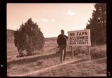
"No Japs allowed" sign, 1943
1943
Image
2
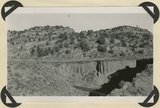
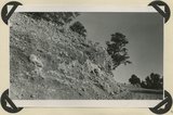
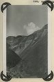
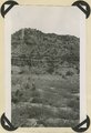
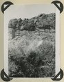
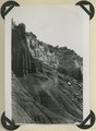
Alluvium valley fill trenched by stream since 1900. Lower Flood Canyon. Kane County, UT. 1943
1943
Image
3
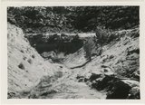
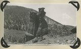
Bark Wash, Utah 1943
1943
Image
4
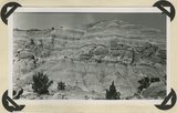
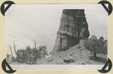
Brian Head formation capped by lava (rhyolite?): Cliff on upthrown side of Paunsaugunt fault. East fork of Sevier River near the mouth of Deer Creek. Garfield County, UT. 1943
1943
Image
5
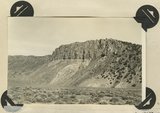
Brian Head formation in the walls of Panguitch Canyon near power house. Garfield County, UT. 1943
1943
Image
6
Burro Gap on East Fork of Sevier River above mouth of Deer Creek. Locus of Paunsaugunt fault; upthrow on east right. Garfield County, UT. 1943
1943
Image
7
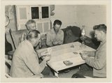
Card players, Paria Valley camp, 1943
1943
Image
8
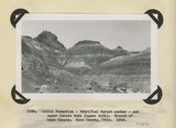
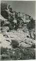
Chile formation, Petrified Forest member, and upper Chinle beds ( upper left). Branch of Road Canyon. Kane County, UT. 1943
1943
Image
9
Chinle formation 2 miles northwest abandoned village of Paria. Kane County, UT. 1943
1943
Image
10
Chinle formation, Petrified Forest member. Head of Fossil Wood Creek. Kane County, UT. 1943
1943
Image
11
Chinle formation, Petrified Forest member. Head of Fossil Wood Creek. Kane County, UT. 1943
1943
Image
12
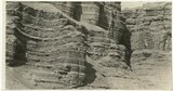
Chinle formation, upper red beds capped by remnants of Wingate sandstone. Five Pines Wash. Kane County, UT. 1943
1943
Image
13
Chinle formation, upper red beds near mouth of Box Elder Canyon. Kane County, UT. 1943
1943
Image
14
Contact of Kayenta formation (foreground) and Navajo sandstone Park Wash above the mouth of Five Pines Wash. Kane County, UT. 1943
1943
Image
15
Cretaceous shales (tropic formation). Antimony Canyon, Garfield County, UT. 1943
1943
Image
16
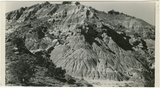
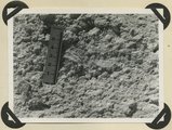
Detailed view of pumice conglomerate in the Brian Head formation, Casto Bluff, Garfield County, UT, 1943
1943
Image
17
Detailed view of pumice conglomerate in the Brian Head formation, Casto Bluff, Garfield County, UT, 1943
1943
Image
18
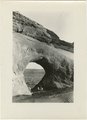
East side of Lone Rock on Wah Weap Creek
1943; 1944; 1945
Image
19
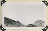
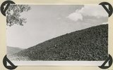
End of lava flow 6 miles long in Black Creek Valley
1943; 1944; 1945
Image
20
End of recent basalt flow at the race track, Panguitch Lake. Garfield County, UT, 1943
1943
Image
21
Entrada sandstone, regular bedded shaly phase overlain by undifferentiated Curtis and Winsor formations. Antimony Canyon, Garfield County, UT, 1943
1943
Image
22
Erosion features in Entrada sandstone. Antimony Canyon, Garfield County, UT, 1943
1943
Image
23
Erosion features in Entrada sandstone. Antimony Canyon, Garfield County, UT, 1943
1943
Image
24
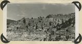
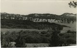
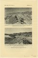
Features of the East Kaibab monocline [and] Structural relations of rocks along Utah-Arizona boundary
1943; 1944; 1945
Image
25
Glaciated surface showing (roche mountain): glade in spruce forest at top of Aquarius Plateau at altitude of 10,800 feet. Near the head of Antimony Creek, Garfield County, UT, 1943
1943
Image
1
-
25
of
65
<
1
2
3
>